Mato Grosso in the context of "List of Brazilian states by area"

Play Trivia Questions online!

or

Skip to study material about Mato Grosso in the context of "List of Brazilian states by area"

Ad spacer

⭐ Core Definition: Mato Grosso

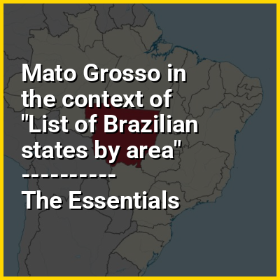
Mato Grosso (Portuguese pronunciation: [ˈmatu ˈɡɾosu] lit.'Thick Bush') is one of the states of Brazil, the third largest by area, located in the Central-West region. The state has 1.66% of the Brazilian population and is responsible for 1.9% of the Brazilian GDP. Neighboring states (from west clockwise) are: Rondônia, Amazonas, Pará, Tocantins, Goiás and Mato Grosso do Sul. It is divided into 142 municipalities and covers an area of 903,357 square kilometers, consequently the state is roughly 82.2% of the size of its southwest neighbor, the nation of Bolivia.

A state with a flat landscape that alternates between vast chapadas and plain areas, Mato Grosso contains three main ecosystems: the Cerrado, the Pantanal and the Amazon rainforest. The Chapada dos Guimarães National Park, with its caves, grottoes, tracks, and waterfalls, is one of its tourist attractions. The extreme northwest of the state has a small part of the Amazonian forest. The Xingu Indigenous Park and the Araguaia River are in Mato Grosso. Farther south, the Pantanal, the world's largest wetland, is the habitat for nearly one thousand species of animals and many aquatic birds.

↓ Menu

>>>PUT SHARE BUTTONS HERE<<<
In this Dossier

Mato Grosso in the context of Pantanal

The Pantanal (Portuguese pronunciation: [pɐ̃taˈnaw], Spanish pronunciation: [pantaˈnal]) is a natural region encompassing the world's largest tropical wetland area, and the world's largest flooded grasslands. It is located mostly within the Brazilian state of Mato Grosso do Sul, but it extends into Mato Grosso and portions of Bolivia and Paraguay. It sprawls over an area estimated at between 140,000 and 195,000 km (54,000 and 75,000 sq mi). Various subregional ecosystems exist, each with distinct hydrological, geological, and ecological characteristics; up to 12 of them have been defined.

Roughly 80% of the Pantanal floodplains are submerged during the rainy seasons, nurturing a biologically diverse collection of aquatic plants and helping to support a dense array of animal species.

↑ Return to Menu

Mato Grosso in the context of Cerrado

The Cerrado (Portuguese pronunciation: [seˈʁadu]) is a vast ecoregion of tropical savanna in central Brazil, being present in the states of Goiás, Mato Grosso do Sul, Mato Grosso, Tocantins, Maranhão, Piauí, Bahia, Minas Gerais, São Paulo, Paraná and the Federal District. The core areas of the Cerrado biome are the Brazilian highlands – the Planalto. The main habitat types of the Cerrado consist of forest savanna, wooded savanna, park savanna and gramineous-woody savanna. The Cerrado also includes savanna wetlands and gallery forests.

The second largest of Brazil's major habitat types, after the Amazonian rainforest, the Cerrado accounts for a full 21 percent of the country's land area (extending marginally into Paraguay and Bolivia). About 75% of the Cerrado’s 2 million km is privately owned.

↑ Return to Menu

Mato Grosso in the context of Paraguay River

The Paraguay River (Ysyry Paraguái in Guarani, Rio Paraguai in Portuguese, Río Paraguay in Spanish) is a major river in south-central South America, running through Brazil and Paraguay and forming parts of the Paraguay-Argentina, Brazil-Bolivia, and Brazil-Paraguay borders. It flows about 2,695 kilometres (1,675 mi) from its headwaters in the Brazilian state of Mato Grosso to its confluence with the Paraná River north of Corrientes and Resistencia.

↑ Return to Menu

Mato Grosso in the context of Mato Grosso do Sul

Mato Grosso do Sul (Portuguese pronunciation: [ˈmatu ˈɡɾosu du ˈsuw] lit.'South Thick Bush') is one of Brazil's 27 federal units, located in the southern part of the Central-West Region, bordering five Brazilian states: Mato Grosso (to the north), Goiás and Minas Gerais (northeast), São Paulo (east) and Paraná (southeast); and two South American countries: Paraguay (south and southwestern) and Bolivia (west). It is divided into 79 municipalities and covers an area of 357,145.532 square kilometers, which is about the same size as Germany. With a population of 2,839,188 inhabitants in 2021, Mato Grosso do Sul is the 21st most populous state in Brazil.

Campo Grande is the capital and largest city of Mato Grosso do Sul. The economy of the state is largely based on agriculture and cattle-raising. Crossed in the south by the Tropic of Capricorn, Mato Grosso do Sul generally has a warm, sometimes hot, and humid climate, and is crossed by numerous tributaries of the Paraná River. The state has 1.3% of the Brazilian population and is responsible for 1.5% of the Brazilian GDP. Mato Grosso do Sul is also known for its natural environment, and is a destination for domestic and international tourism. The Pantanal lowlands cover 12 municipalities and presents a variety of flora and fauna, with forests, natural sand banks, savannahs, open pasture, fields and bushes. The city Bonito, in the mountain of Bodoquena, has prehistoric caves, natural rivers, waterfalls, swimming pools and the Gruta do Lago Azul cave.

↑ Return to Menu

Mato Grosso in the context of Goiás

Goiás (Brazilian Portuguese: [ɡo(j)ˈjas] ; English: /ɡɔɪˈɑːs/, UK also /ɡɔɪˈæs/) is a Brazilian state located in the Central-West region. Goiás borders the Federal District and the states of (from north clockwise) Tocantins, Bahia, Minas Gerais, Mato Grosso do Sul and Mato Grosso. The state capital is Goiânia. With 7.2 million inhabitants, Goiás is the most populous state in the Central-West region and the 11th most populous in the country. It has the ninth largest economy among Brazilian federative units. In Brazil's geoeconomic division, Goiás belongs to the Centro-Sul (Center-South), being the northernmost state of the southern portion of Brazil. The state has 3.3% of the Brazilian population and is responsible for 2.7% of the Brazilian GDP.

The history of Goiás dates back to the beginning of the 18th century, with the arrival of pioneers from São Paulo. The Rio Vermelho region was the first to be occupied, where Vila Boa (later renamed Goiás) was founded. The development and settlement of the state took place, in a more intensified way, starting in the 1930s with the founding of the new capital, Goiânia, and especially with the construction of Brasília in the 1950s.

↑ Return to Menu

Mato Grosso in the context of Raddiella

↑ Return to Menu

Mato Grosso in the context of Pará

Pará (Brazilian Portuguese: [paˈɾa] ) is a state of Brazil, located in northern Brazil and traversed by the lower Amazon River. It borders the Brazilian states of Amapá, Maranhão, Tocantins, Mato Grosso, Amazonas and Roraima. To the northwest are the borders of Guyana and Suriname, to the northeast of Pará is the Atlantic Ocean. The capital and largest city is Belém, which is located at the Marajó bay, near the estuary of the Amazon river. The state, which is home to 4.1% of the Brazilian population, is responsible for just 2.2% of the Brazilian GDP.

Pará is the most populous state of the North Region, with a population of over 8.6 million, being the ninth-most populous state in Brazil. It is the second-largest state of Brazil in area, at 1.2 million square kilometres (460,000 sq mi), second only to Amazonas upriver. Its most famous icons are the Amazon River and the Amazon rainforest. Pará produces rubber (extracted from rubber tree groves), cassava, açaí, pineapple, cocoa, black pepper, coconut, banana, tropical hardwoods such as mahogany, and minerals such as iron ore and bauxite. A new commodity crop is soy, cultivated in the region of Santarém.

↑ Return to Menu

Mato Grosso in the context of Central-West Region, Brazil

The Central-West or Center-West Region of Brazil (Portuguese: Região Centro-Oeste do Brasil [ʁeʒiˈɐ̃w ˌsẽtɾoˈɛstʃi du bɾaˈziw]) is composed of the states of Goiás, Mato Grosso and Mato Grosso do Sul; along with the Distrito Federal (Federal District), where Brazil's national capital, Brasília, is situated. The region comprises 18.86% of the national territory, and is the least populated in Brazil.

With the move of the country's federal capital from Rio de Janeiro to Brasília in the 1960s, the construction of roads and railways to the interior of the country made access to the region easier, speeding up population growth and contributing significantly to the region's development.

↑ Return to Menu

Mato Grosso in the context of Chiquitano language

Chiquitano (also Bésɨro or Tarapecosi) is an indigenous language isolate, possibly one of the Macro-Jê languages spoken in the central region of Santa Cruz Department of eastern Bolivia and the state of Mato Grosso in Brazil.

↑ Return to Menu