Tocantins in the context of "Cerrado"

Play Trivia Questions online!

or

Skip to study material about Tocantins in the context of "Cerrado"

Ad spacer

⭐ Core Definition: Tocantins

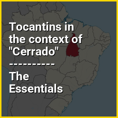
Tocantins (Brazilian Portuguese: [tokɐ̃ˈtʃĩs] ) is one of the 26 states of Brazil. It is the newest state, formed in 1988 and encompassing what had formerly been the northern two-fifths of the state of Goiás. Tocantins covers 277,620.91 square kilometres (107,190.03 sq mi) and had an estimated population of 1,496,880 in 2014. Construction of its capital, Palmas, began in 1989; most of the other cities in the state date to the Portuguese colonial period. With the exception of Araguaína, there are few other cities with a significant population in the state. The government has invested in a new capital, a major hydropower dam, railroads and related infrastructure to develop this primarily agricultural area. The state has 0.75% of the Brazilian population and is responsible for 0.5% of the Brazilian GDP.

Tocantins has attracted hundreds of thousands of new residents, primarily to Palmas. It is building on its hydropower resources. The Araguaia and Tocantins rivers drain the largest watershed that lies entirely inside Brazilian territory. The Rio Tocantins has been dammed for hydropower, creating a large reservoir that has become a center of recreation. Because it is in the central zone of the country, Tocantins has characteristics of the Amazon Basin, and also semi-open pastures, known as cerrado. The Bananal Island (Ilha do Bananal), in the southwest of the State, is the second largest fluvial island in the world. Tocantins is also home to the Araguaia National Park, the Carajás Indian reservations, and Jalapão State Park, which is about 250 kilometres (160 mi) from Palmas. There, the rivers create oases in the dry landscape, attracting many ecotourists to the region.

↓ Menu

>>>PUT SHARE BUTTONS HERE<<<

👉 Tocantins in the context of Cerrado

The Cerrado (Portuguese pronunciation: [seˈʁadu]) is a vast ecoregion of tropical savanna in central Brazil, being present in the states of Goiás, Mato Grosso do Sul, Mato Grosso, Tocantins, Maranhão, Piauí, Bahia, Minas Gerais, São Paulo, Paraná and the Federal District. The core areas of the Cerrado biome are the Brazilian highlands – the Planalto. The main habitat types of the Cerrado consist of forest savanna, wooded savanna, park savanna and gramineous-woody savanna. The Cerrado also includes savanna wetlands and gallery forests.

The second largest of Brazil's major habitat types, after the Amazonian rainforest, the Cerrado accounts for a full 21 percent of the country's land area (extending marginally into Paraguay and Bolivia). About 75% of the Cerrado’s 2 million km is privately owned.

↓ Explore More Topics
In this Dossier

Tocantins in the context of Maranhão

Maranhão (Brazilian Portuguese pronunciation: [maɾɐˈɲɐ̃w] ) is a state in Brazil. Located in the country's Northeast Region, it has a population of about 7 million and an area of 332,000 km (128,000 sq mi) and it is divided into 217 municipalities. Clockwise from north, it borders on the Atlantic Ocean for 2,243 km and the states of Piauí, Tocantins and Pará. The people of Maranhão have a distinctive accent within the common Northeastern Brazilian dialect. Maranhão is described in literary works such as Exile Song by Gonçalves Dias and Casa de Pensão by Aluísio Azevedo.

The dunes of Lençóis are an important area of environmental preservation. Also of interest is the state capital of São Luís, which is a UNESCO World Heritage Site. Another important conservation area is the Parnaíba River delta, between the states of Maranhão and Piauí, with its lagoons, desert dunes and deserted beaches or islands, such as Caju island, which shelters rare birds.

↑ Return to Menu

Tocantins in the context of Goiás

Goiás (Brazilian Portuguese: [ɡo(j)ˈjas] ; English: /ɡɔɪˈɑːs/, UK also /ɡɔɪˈæs/) is a Brazilian state located in the Central-West region. Goiás borders the Federal District and the states of (from north clockwise) Tocantins, Bahia, Minas Gerais, Mato Grosso do Sul and Mato Grosso. The state capital is Goiânia. With 7.2 million inhabitants, Goiás is the most populous state in the Central-West region and the 11th most populous in the country. It has the ninth largest economy among Brazilian federative units. In Brazil's geoeconomic division, Goiás belongs to the Centro-Sul (Center-South), being the northernmost state of the southern portion of Brazil. The state has 3.3% of the Brazilian population and is responsible for 2.7% of the Brazilian GDP.

The history of Goiás dates back to the beginning of the 18th century, with the arrival of pioneers from São Paulo. The Rio Vermelho region was the first to be occupied, where Vila Boa (later renamed Goiás) was founded. The development and settlement of the state took place, in a more intensified way, starting in the 1930s with the founding of the new capital, Goiânia, and especially with the construction of Brasília in the 1950s.

↑ Return to Menu

Tocantins in the context of Tocantins River

The Tocantins River (Portuguese: Rio Tocantins Portuguese pronunciation: [ˈʁi.u tokɐ̃ˈtʃĩs, tu-], Parkatêjê: Pyti [pɨˈti]) is a river in Brazil, the central fluvial artery of the country. In the Tupi language, its name means "toucan's beak" (Tukã for "toucan" and Ti for "beak"). It runs from south to north for about 2,450 km (1,520 mi). While sometimes included in definitions of the Amazon basin, the Tocantins is not a branch of the Amazon River, since its waters flow into the Atlantic Ocean via an eastern channel of the Amazon Delta, alongside those of the Amazon proper. It flows through four Brazilian states (Goiás, Tocantins, Maranhão, and Pará) and gives its name to one of Brazil's newest states, formed in 1988 from what was until then the northern portion of Goiás.

The Tocantins is one of the largest clearwater rivers in South America.

↑ Return to Menu

Tocantins in the context of Mato Grosso

Mato Grosso (Portuguese pronunciation: [ˈmatu ˈɡɾosu] lit.'Thick Bush') is one of the states of Brazil, the third largest by area, located in the Central-West region. The state has 1.66% of the Brazilian population and is responsible for 1.9% of the Brazilian GDP. Neighboring states (from west clockwise) are: Rondônia, Amazonas, Pará, Tocantins, Goiás and Mato Grosso do Sul. It is divided into 142 municipalities and covers an area of 903,357 square kilometers, consequently the state is roughly 82.2% of the size of its southwest neighbor, the nation of Bolivia.

A state with a flat landscape that alternates between vast chapadas and plain areas, Mato Grosso contains three main ecosystems: the Cerrado, the Pantanal and the Amazon rainforest. The Chapada dos Guimarães National Park, with its caves, grottoes, tracks, and waterfalls, is one of its tourist attractions. The extreme northwest of the state has a small part of the Amazonian forest. The Xingu Indigenous Park and the Araguaia River are in Mato Grosso. Farther south, the Pantanal, the world's largest wetland, is the habitat for nearly one thousand species of animals and many aquatic birds.

↑ Return to Menu

Tocantins in the context of Centro-Sul

Centro-Sul (Portuguese pronunciation: [ˌsẽtɾuˈsuw], South-Central) is a geographic area that encompasses the Southeastern, Southern and Central-West regions of Brazil (see Brazil Regional Division), excluding the north of Minas Gerais, most of Mato Grosso, and parts of Tocantins.

↑ Return to Menu