Cordillera Occidental, Colombia in the context of Chocó Department


Cordillera Occidental, Colombia in the context of Chocó Department

⭐ Core Definition: Cordillera Occidental, Colombia

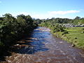
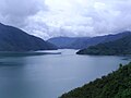
The Cordillera Occidental (English: Western Ranges) is the lowest in elevation of the three branches of the Colombian Andes. The average altitude is 2,000 m (6,600 ft) and the highest peak is Cerro Tatamá at 4,100 m (13,500 ft). The range extends from south to north dividing from the Colombian Massif in Nariño Department, passes north through Cauca, Valle del Cauca, Risaralda, Chocó, and Caldas Departments to the Paramillo Massif in Antioquia and Córdoba Departments. The cordillera is paralleled on the east by the Cauca river. From this massif the range divides further to form the Serranías de Ayapel, San Jerónimo and Abibe. Only to recede into the Caribbean plain and the Sinú River valley.

It is a direct continuation of Cordillera Occidental of Ecuador.

↓ Menu
HINT:

In this Dossier

Cordillera Occidental, Colombia in the context of Atrato River

The Atrato River (Spanish: Río Atrato) is a river of northwestern Colombia. It rises in the slopes of the Western Cordillera and flows almost due north to the Gulf of Urabá (or Gulf of Darién), where it forms a large, swampy delta. Its course crosses the Chocó Department, forming that department's border with neighboring Antioquia in two places. Its total length is about 650 km (400 mi), and it is navigable as far as Quibdó (400 km / 250 mi), the capital of the department.

In 2016, the Constitutional Court of Colombia granted the river legal rights of personhood after years of degradation of the river basin from large-scale mining and illegal logging practices, which severely impacted the traditional ways of life for Afro-Colombians and Indigenous people.

View the full Wikipedia page for Atrato River
↑ Return to Menu

Cordillera Occidental, Colombia in the context of Cauca River

The Cauca River (Spanish: Río Cauca) is a river in Colombia that lies between the Occidental and Central cordilleras. From its headwaters in southwestern Colombia near the city of Popayán, it joins the Magdalena River near Magangué in Bolívar Department, and the combined river eventually flows out into the Caribbean Sea. It has a length of 965 km (600 mi) to its junction with the Magdalena, for a total length of 1,350 km (840 mi). The river is under the supervision of the Cauca Regional Corporation and the Cauca Valley Regional Autonomous Corporation, and is navigable for 640 km (400 mi) above its junction with the Magdalena.

View the full Wikipedia page for Cauca River
↑ Return to Menu