The Darién Gap (UK: /ˈdɛəriən, ˈdær-/, US: /ˌdɛəriˈɛn, ˌdɑːr-, dɑːrˈjɛn/, Spanish: Tapón del Darién [taˈpon del daˈɾjen]) is a remote, roadless, and dangerous area of rainforest on the international border between Colombia and Panama. Stretching across southern Panama's Darién Province and the northern portion of Colombia's Chocó Department, it acts as a natural barrier between North America and South America. Consisting of a large drainage basin, dense rainforest, and mountains, it is known for its remoteness, difficult terrain, and extreme environment, with a reputation as one of the most inhospitable regions in the world. Nevertheless, as the only land bridge between North America and South America, the Darién Gap has historically served as a major route for both humans and wildlife.
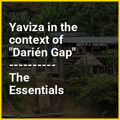
The geography of the Darién Gap is highly diverse. The Colombian side is dominated primarily by the river delta of the Atrato River, which creates a flat marshland at least 80 km (50 mi) wide. The Tanela River, which flows toward Atrato, was Hispanicized to Darién by 16th-century European conquistadors. The Serranía del Baudó mountain range extends along Colombia's Pacific coast and into Panama. The Panamanian side, in stark contrast, is a mountainous rainforest, with terrain reaching from 60 m (197 ft) in the valley floors to 1,845 m (6,053 ft) at the tallest peak, Cerro Tacarcuna, in the Serranía del Darién. The Darién Gap is inhabited mostly by the indigenous Embera-Wounaan and Guna peoples; in 1995, it had a reported population of 8,000 among five tribes. The only sizable settlement in the region is La Palma, the capital of Darién Province, with roughly 4,200 residents; other population centers include Yaviza and El Real de Santa María, both on the Panamanian side.