World map in the context of "Mappa mundi"

Play Trivia Questions online!

or

Skip to study material about World map in the context of "Mappa mundi"

Ad spacer

⭐ Core Definition: World map

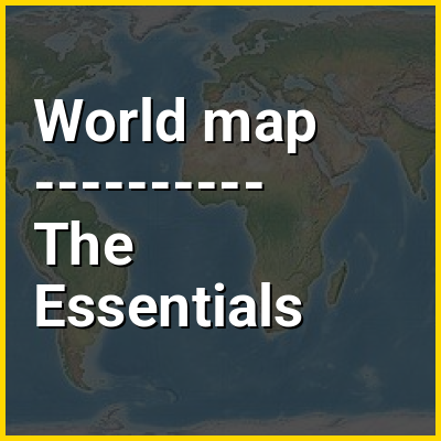
A world map is a map of most or all of the surface of Earth. World maps, because of their scale, must deal with the problem of projection. Maps rendered in two dimensions by necessity distort the display of the three-dimensional surface of the Earth. While this is true of any map, these distortions reach extremes in a world map. Many techniques have been developed to present world maps that address diverse technical and aesthetic goals.

Charting a world map requires global knowledge of the Earth, its oceans, and its continents. From prehistory through the Middle Ages, creating an accurate world map would have been impossible because less than half of Earth's coastlines and only a small fraction of its continental interiors were known to any culture. With exploration that began during the European Renaissance, knowledge of the Earth's surface accumulated rapidly, such that most of the world's coastlines had been mapped, at least roughly, by the mid-1700s and the continental interiors by the twentieth century.

↓ Menu

>>>PUT SHARE BUTTONS HERE<<<
In this Dossier

World map in the context of Ancient world map

The earliest known world maps date to classical antiquity, the oldest examples of the 6th to 5th centuries BCE still based on the flat Earth paradigm. World maps assuming a spherical Earth first appear in the Hellenistic period. The developments of Greek geography during this time, notably by Eratosthenes and Posidonius culminated in the Roman era, with Ptolemy's world map (2nd century CE), which would remain authoritative throughout the Middle Ages. Since Ptolemy, knowledge of the approximate size of the Earth allowed cartographers to estimate the extent of their geographical knowledge, and to indicate parts of the planet known to exist but not yet explored as terra incognita.

With the Age of Discovery, during the 15th to 18th centuries, world maps became increasingly accurate; exploration of Antarctica, Australia, and the interior of Africa by western mapmakers was left to the 19th and early 20th century.

↑ Return to Menu

World map in the context of Circle of latitude

A circle of latitude or line of latitude on Earth is an abstract eastwest small circle connecting all locations around Earth (ignoring elevation) at a given latitude coordinate line.

Circles of latitude are often called parallels because they are parallel to each other; that is, planes that contain any of these circles never intersect each other. A location's position along a circle of latitude is given by its longitude. Circles of latitude are unlike circles of longitude, which are all great circles with the centre of Earth in the middle, as the circles of latitude get smaller as the distance from the Equator increases. Their length can be calculated by a common sine or cosine function. For example, the 60th parallel north or south is half as long as the Equator (disregarding Earth's minor flattening by 0.335%), stemming from . On the Mercator projection or on the Gall-Peters projection, a circle of latitude is perpendicular to all meridians. On the ellipsoid or on spherical projection, all circles of latitude are rhumb lines, except the Equator.

↑ Return to Menu

World map in the context of Ecumene

In ancient Greece, the term oecumene (UK) or ecumene (US; from Ancient Greek οἰκουμένη (oikouménē) 'the inhabited world') denoted the known, inhabited, or habitable world. In Greek antiquity, it referred to the portions of the world known to Hellenic geographers, subdivided into three continents: Africa, Europe, and Asia. Under the Roman Empire, it came to refer to civilization itself, as well as the secular and religious imperial administration.

In present usage, it is most often used in the context of "ecumenical" and describes the Christian Church as a unified whole, or the unified modern world civilization. It is also used in cartography to describe a type of world map (mappa mundi) used in late antiquity and the Middle Ages.

↑ Return to Menu

World map in the context of Dymaxion map

The Dymaxion map projection, also called the Fuller projection, is a kind of polyhedral map projection of the Earth's surface onto the unfolded net of an icosahedron. The resulting map is heavily interrupted in order to reduce shape and size distortion compared to other world maps, but the interruptions are chosen to lie in the ocean.

The projection was invented by Buckminster Fuller. In 1943, Fuller proposed a projection onto a cuboctahedron, which he called the Dymaxion World, using the name Dymaxion which he also applied to several of his other inventions. In 1954, Fuller and cartographer Shoji Sadao produced an updated Dymaxion map, the Airocean World Map, based on an icosahedron with a few of the triangular faces cut to avoid breaks in landmasses.

↑ Return to Menu

World map in the context of Atlas

An atlas is a collection of maps; it is typically a bundle of maps of Earth or of a continent or region of Earth. Advances in astronomy have also resulted in atlases of the celestial sphere or of other planets.

Atlases have traditionally been bound into book form, but today, many atlases are in multimedia formats. In addition to presenting geographical features and political boundaries, many atlases often feature geopolitical, social, religious, and economic statistics. They also have information about the map and places in it.

↑ Return to Menu

World map in the context of 16th century

The 16th century begins with the Julian year 1501 (MDI) and ends with either the Julian or the Gregorian year 1600 (MDC) (depending on the reckoning used; the Gregorian calendar introduced a lapse of 10 days in October 1582). The Habsburg Spanish Empire, Portuguese Empire, Ottoman Empire, Safavid Persia, Mughal India and Ming China were the most powerful and hegemonic states.

The Renaissance in Italy and Europe saw the emergence of important artists, authors and scientists, and led to the foundation of important subjects which include accounting and political science. Copernicus proposed the heliocentric universe, which was met with strong resistance, and Tycho Brahe refuted the theory of celestial spheres through observational measurement of the 1572 appearance of a Milky Way supernova. These events directly challenged the long-held notion of an immutable universe supported by Ptolemy and Aristotle, and led to major revolutions in astronomy and science. Galileo Galilei became a champion of the new sciences, invented the first thermometer and made substantial contributions in the fields of physics and astronomy, becoming a major figure in the Scientific Revolution in Europe.

↑ Return to Menu