West Pennine Moors in the context of "Metropolitan Borough of Bolton"

Play Trivia Questions online!

or

Skip to study material about West Pennine Moors in the context of "Metropolitan Borough of Bolton"

Ad spacer

⭐ Core Definition: West Pennine Moors

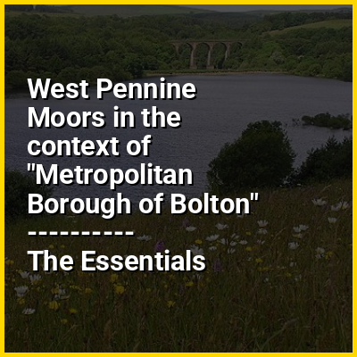
The West Pennine Moors is an area of the Pennines covering approximately 90 square miles (230 km) of moorland and reservoirs in Lancashire and Greater Manchester, England. It is a Site of Special Scientific Interest.

The West Pennine Moors are separated from the main Pennine range by the Irwell Valley to the east. The moorland includes Withnell, Anglezarke and Rivington Moors in the extreme west, Darwen and Turton Moors, Oswaldtwistle Moors and Holcombe Moors. These moors are lower in height than the main spine of the South Pennines. At 1,496 feet (456 m), the highest point is at Winter Hill. The area is of historical importance with archaeological evidence of human activity from Neolithic times. The area is close to urban areas, the dramatic backdrop to Bolton, Blackburn and Bury and neighbouring towns affording panoramic views across the Lancashire Plain and the Greater Manchester conurbation. The moorland is surrounded by the towns of Bolton, Chorley, Darwen, Horwich, Ramsbottom, Haslingden and Oswaldtwistle. Notable structures include Rivington Pike Tower, Winter Hill transmitting station, Peel Monument near Holcombe and the Jubilee Tower on Darwen Moor.

↓ Menu

>>>PUT SHARE BUTTONS HERE<<<

👉 West Pennine Moors in the context of Metropolitan Borough of Bolton

The Metropolitan Borough of Bolton (/ˈbltən/ BOHL-tən) is a metropolitan borough in Greater Manchester, England, named after its largest town, Bolton, but covering a larger area which includes Blackrod, Farnworth, Horwich, Kearsley, Westhoughton, and part of the West Pennine Moors. It had a population of 310,085 in 2024, making it the third-most populous district in Greater Manchester.

What is now the borough was created in 1974 under the Local Government Act 1972; the area was formerly part of Lancashire. It was formed from seven urban districts from the administrative county of Lancashire, the southern part of an eighth urban district, and the county borough of Bolton. The metropolitan districts of Bury, Salford and Wigan lie to the east, south and west respectively; and the unitary authority of Blackburn with Darwen and the non-metropolitan district of Chorley in Lancashire to the north and north-west.

↓ Explore More Topics
In this Dossier

West Pennine Moors in the context of Blackburn

Blackburn (/ˈblækbɜːrn/ ) is an industrial town and the administrative centre of the Blackburn with Darwen borough in Lancashire, England. The town is north of the West Pennine Moors on the southern edge of the Ribble Valley, 8 mi (13 km) east of Preston and 21 mi (34 km) north-northwest of Manchester. Blackburn is at the centre of the wider unitary authority area along with the town of Darwen. It is the second largest town (after Blackpool) in Lancashire.

At the 2011 census, Blackburn had a population of 117,963, whilst the wider borough of Blackburn with Darwen had a population of 150,030; 30.8% of the population of town were people of ethnic backgrounds other than white British.

↑ Return to Menu

West Pennine Moors in the context of Pennines

The Pennines (/ˈpɛnnz/), also known as the Pennine Chain or Pennine Hills, are an upland range mainly located in Northern England. Sometimes described as the "backbone of England" because of its length and position, the range runs from Derbyshire and Staffordshire in the north of the Midlands to Northumberland in North East England. From the Tyne Gap in the north, the range extends south through the North Pennines, Yorkshire Dales, South Pennines, and Peak District to end near the valley of the River Trent. The Border Moors and Cheviot Hills, which lie beyond the Tyne Gap, are included in some definitions of the range.

The range is divided into two by the Aire Gap, a wide pass formed by the valleys of the rivers Aire and Ribble. There are several spurs off the main Pennine range east into Greater Manchester and Lancashire, comprising the Rossendale Fells, West Pennine Moors, and Bowland Fells. The Howgill Fells and Orton Fells in Cumbria are also sometimes considered to be Pennine spurs. The Pennines are an important water catchment area, with numerous reservoirs in the head streams of the river valleys.

↑ Return to Menu

West Pennine Moors in the context of Chapeltown, Lancashire

Chapeltown is a village of the civil parish of North Turton, in the Blackburn with Darwen unitary authority, in the north west of England. It is on the B6391 road, on the southern slopes of the West Pennine Moors. The village was once the historic centre of the old Turton Urban District.

The village consists mainly of 18th- and 19th-century terraced stone cottages. The tight clustering of properties along High Street is typical of villages with medieval origins. There is a small public garden containing the old village stocks and market cross. Their timber elements have been renewed several times, but the stone bases are original.

↑ Return to Menu

West Pennine Moors in the context of Bolton

Bolton (/ˈbltən/ BOHL-tən, locally /ˈbtən/ BOH-tən) is a town in Greater Manchester in England. In the foothills of the West Pennine Moors, Bolton is between Manchester, Blackburn, Wigan, Bury and Salford. It is surrounded by several towns and villages that form the wider borough, of which Bolton is the administrative centre. The town is within the historic county boundaries of Lancashire.

A former mill town, Bolton has been a centre for textile production since the 14th century when Flemish weavers settled in the area, introducing a wool and cotton-weaving tradition. It was a 19th-century boomtown, development largely coincided with the introduction of textile manufacture during the Industrial Revolution. At its peak in 1929, its 216 cotton mills and 26 bleaching and dyeing works made it one of the largest and most productive centres of cotton spinning in the world. The British cotton industry declined sharply after the First World War and, by the 1980s, cotton manufacture had virtually ceased in the town.

↑ Return to Menu

West Pennine Moors in the context of Hoddlesden

Hoddlesden is a village in the borough of Blackburn with Darwen, in Lancashire, England. The village population at the 2011 census was 1,239. It is in the borough's East Rural ward, and is situated east of Darwen. To the north there are the parishes of Eccleshill and Yate and Pickup Bank, to the east there is Haslingden Grane, part of the West Pennine Moors, and to the south-west there is Blacksnape, a small hamlet.

Although the village is now a residential area, with its residents commuting to places such as the nearby towns of Blackburn and Darwen, in the 19th and early 20th century, local industries included weaving and coal mining.

↑ Return to Menu

West Pennine Moors in the context of Pendle Hill

Pendle Hill is in the east of Lancashire, England, near the towns of Burnley, Nelson, Colne, Brierfield, Clitheroe and Padiham. Its summit is 557 metres (1,827 ft) above mean sea level. It gives its name to the Borough of Pendle. It is an isolated hill in the Pennines, separated from the South Pennines to the east, the Bowland Fells to the northwest, and the West Pennine Moors to the south. It is included in a detached part of the Forest of Bowland Area of Outstanding Natural Beauty.

↑ Return to Menu

West Pennine Moors in the context of South Pennines

The South Pennines is a region of moorland and hill country in northern England lying towards the southern end of the Pennines. In the west it includes the Rossendale Valley and the West Pennine Moors. It is bounded by the Greater Manchester conurbation in the west and the Bowland Fells and Yorkshire Dales to the north. To the east it is fringed by the towns of West Yorkshire whilst to the south it is bounded by the Peak District. The rural South Pennine Moors constitutes both a Site of Special Scientific Interest and Special Area of Conservation.

↑ Return to Menu

West Pennine Moors in the context of Rossendale Valley

The Rossendale Valley is in the Rossendale area of Lancashire, England, between the West Pennine Moors and the main range of the Pennines. The area includes the steep-sided valleys of the River Irwell and its tributaries (between Rawtenstall and Bacup), which flow southwards into Greater Manchester. The rivers cut through the moorland of the Rossendale Hills, generally characterized by open unwooded land, despite the ancient designation of "forest".

↑ Return to Menu