Provinces of Indonesia in the context of Central Sumatra


Provinces of Indonesia in the context of Central Sumatra

Provinces of Indonesia Study page number 1 of 6

Play TriviaQuestions Online!

or

Skip to study material about Provinces of Indonesia in the context of "Central Sumatra"


⭐ Core Definition: Provinces of Indonesia

Provinces are the first-level administrative divisions of Indonesia. They were formerly called first-level provincial regions (provinsi daerah tingkat I), before the Reform era. Provinces have a local government, consisting of a governor (Gubernur) and a regional legislative body (Dewan Perwakilan Rakyat Daerah Provinsi, DPRD Provinsi). The governor and members of local representative bodies are elected by popular vote for five-year terms, but governors can only serve for two terms. Provincial governments have the authority to regulate and manage their own government affairs, subject to the limits of the central government. The average land area of all 38 provinces in Indonesia is about 49,800 km (19,200 sq mi), and they had an average population of 7,410,626 people in mid-2024.

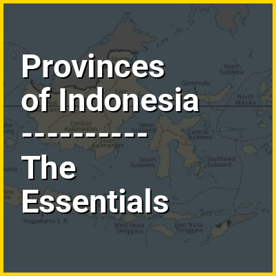
Indonesia is divided into 38 provinces, nine of which have special autonomous status. The terms for special status are "Istimewa" and "Khusus", which translate to "special", or "designated". Provinces are further divided into regencies and cities (formerly called second-level region regencies/cities, or kabupaten/kotamadya daerah tingkat II), which are in turn subdivided into districts (kecamatan). Proposals for the creation of additional provinces (by the splitting of existing ones) have been considered by the Indonesian government, but further action has been suspended since 2013 under a moratorium. However, in 2022, nine years later, Central Papua, Highland Papua, South Papua, and Southwest Papua were created and became the youngest provinces in the country. The enactment of the Law on State Capital in 2022 established a future provincial-level city, Nusantara, which would officially become the 39th province after a presidential decree on relocating the state capital is issued, and it would replace Jakarta as the nation's capital city.

↓ Menu
HINT:

In this Dossier

Provinces of Indonesia in the context of Indonesia

Indonesia, officially the Republic of Indonesia, is a country in Southeast Asia and Oceania, between the Indian and Pacific oceans. Comprising over 17,000 islands, including Sumatra, Java, Sulawesi, and parts of Borneo and New Guinea, Indonesia is the world's largest archipelagic state and the 14th-largest country by area, at 1,904,569 square kilometres (735,358 square miles). With over 280 million people, Indonesia is the world's fourth-most-populous country and the most populous Muslim-majority country. Java, the world's most populous island, is home to more than half of the country's population.

Indonesia operates as a presidential republic with an elected legislature and consists of 38 provinces, nine of which have special autonomous status. Jakarta, the largest city, is the world's second-most-populous urban area. Indonesia shares land borders with Papua New Guinea, Timor-Leste, and East Malaysia, as well as maritime borders with Singapore, Peninsular Malaysia, Vietnam, Thailand, the Philippines, Australia, Palau, and India. Despite its large population and densely populated regions, Indonesia has vast areas of wilderness that support one of the world's highest levels of biodiversity.

View the full Wikipedia page for Indonesia
↑ Return to Menu

Provinces of Indonesia in the context of Jakarta

Jakarta, officially the Special Capital Region of Jakarta, is the capital and largest city of Indonesia and an autonomous region at the provincial level. Lying on the northwest coast of Java, the world's most populous island, Jakarta is the largest metropole in Southeast Asia and serves as the Headquarters of ASEAN. The Special Region has a status equivalent to that of a province and is bordered by the province of West Java to the south and east and Banten to the west. Its coastline faces the Java Sea to the north, and it shares a maritime border with Lampung to the west. Jakarta's metropolitan area has an estimated population of 41.9 million as of 2025, making it the largest urban area in Indonesia and the world; in addition of being ASEAN's second largest economy after Singapore.

Jakarta is the economic, cultural, and political centre of Indonesia. Although Jakarta extends over only 661.23 km (255.30 sq mi) and thus has the smallest area of any Indonesian province, its metropolitan area covers 7,076.31 km (2,732.18 sq mi), which includes the satellite cities of Bogor, Depok, Tangerang, South Tangerang, and Bekasi. Jakarta ranks first among the Indonesian provinces in the human development index. Jakarta's business and employment opportunities, along with its ability to offer a potentially higher standard of living compared to other parts of the country, have attracted migrants from across the Indonesian archipelago, making it a melting pot of numerous cultures.

View the full Wikipedia page for Jakarta
↑ Return to Menu

Provinces of Indonesia in the context of Riau Islands

The Riau Islands (Indonesian: Kepulauan Riau; Jawi: كڤولاوان رياو) is a province of Indonesia consisting of a group of islands located in the western part of the country. It was established in 2002 after being separated from the neighboring Riau Province. The capital of the province is Tanjung Pinang, while the largest city is Batam. It shares a maritime border with Riau and Jambi to the west, Bangka Belitung Islands to the south, Singapore to the northeast, Malaysia and West Kalimantan to the east, and Vietnam and Cambodia to the north. It comprises a total of 2,408 islands (1,798 having names) scattered between Sumatra, Malay Peninsula, and Borneo including the Riau Archipelago. Situated on one of the world's busiest shipping lanes along the Malacca Strait and the Natuna Sea (South China Sea), the province shares water borders with neighboring countries such as Singapore, Malaysia, and Brunei. The Riau Islands also have relatively large potential mineral resources and energy, as well as marine resources.

The Riau Islands have played a significant role in the maritime history and civilization of the Nusantara region. Between the 7th and 13th centuries, the area was influenced by the powerful Srivijaya Empire, a major maritime kingdom that controlled trade routes along the Malacca Strait. Evidence of Srivijaya's influence in the Riau Islands can be seen from the discovery of the Pasir Panjang Inscription [id] in Karimun Regency, which shows the existence of religious practices through Buddha's footprints, indicating early settlement and the spread of Buddhism long before the arrival of Islam.

View the full Wikipedia page for Riau Islands
↑ Return to Menu

Provinces of Indonesia in the context of Central Java

Central Java (Indonesian: Jawa Tengah, Javanese: ꦗꦮꦶꦩꦢꦾ, romanized: Jawi Tengah) is a province of Indonesia, located in the middle of the island of Java. Its administrative capital is Semarang. It is bordered by West Java in the west, the Indian Ocean and the Special Region of Yogyakarta in the south, East Java in the east, and the Java Sea in the north. It has a total area of 33,750.37 km, with a population of 36,516,035 at the 2020 Census making it the third-most populous province in both Java and Indonesia after West Java and East Java. The official population estimate in mid-2024 was 37,892,280 (comprising 19,037,740 males and 18,854,540 females). The province also includes a number of offshore islands, including the island of Nusakambangan in the south (close to the border of West Java), and the Karimun Jawa Islands in the Java Sea.

Central Java is also a cultural concept that includes the Yogyakarta Special Region, in turn including the city of Yogyakarta; however, administratively that city and its surrounding regencies have formed a separate special region (equivalent to a province) since the country's independence, and is administered separately. Although known as the "heart" of Javanese culture, there are several other non-Javanese ethnic groups, such as the Sundanese on the border with West Java. Chinese Indonesians, Arab Indonesians, and Indian Indonesians are also scattered throughout the province.

View the full Wikipedia page for Central Java
↑ Return to Menu

Provinces of Indonesia in the context of Javanese people

The Javanese (Javanese: ꦮꦺꦴꦁꦗꦮ, romanized: Wong Jåwå (in the ngoko register), ꦠꦶꦪꦁꦗꦮꦶ, Tiyang Jawi (in the krama register); Indonesian: Orang Jawa) are an Austronesian ethnic group native to the central and eastern part of Java island, which covers most of the administrative areas of the provinces of Central Java, East Java, and Special Region of Yogyakarta. With more than 100 million people, Javanese people are the largest ethnic group in both Indonesia and in Southeast Asia as a whole. Their native language is Javanese, it is the largest of the Austronesian languages in number of native speakers and also the largest regional language in Southeast Asia. As the largest ethnic group in the region, the Javanese have historically dominated the social, political, and cultural landscape of both Indonesia and Southeast Asia.

There are significant numbers of Javanese diaspora outside of central and eastern Java regions, including the other provinces of Indonesia, as well as other countries such as Suriname, Singapore, Malaysia, Egypt, Saudi Arabia, South Africa, Sri Lanka, Yemen and the Netherlands. The Javanese ethnic group has many sub-groups (based on native Javanese community on the island of Java) that can be distinguished based on their characteristics, customs, traditions, dialects, or even their respective ways of life. These include Banyumasan, Cirebonese, Mataram, Osing, and Tenggerese. The majority of the Javanese people identify themselves as Sunni Muslims, with a small minority identifying as Christians and Hindus. With a large global population, the Javanese are considered significant as they are the largest Muslim ethnic group in the Far East and the fifth largest in the world after the Arabs, Bengalis, Punjabis, and Turks.

View the full Wikipedia page for Javanese people
↑ Return to Menu

Provinces of Indonesia in the context of East Java

East Java (Indonesian: Jawa Timur, Javanese: ꦙꦮꦶꦮꦺꦠꦤ꧀, romanized: Jawi Wétan, Madurese: Jhâbâ Tèmor) is a province of Indonesia located in the easternmost third of Java island. It has a land border only with the province of Central Java to the west; the Java Sea and the Indian Ocean border its northern and southern coasts, respectively, while the narrow Bali Strait to the east separates Java from Bali by around 2.29 kilometres (1.42 mi). Located in eastern Java, the province also includes the island of Madura (which is connected to Java by the longest bridge in Indonesia, the Suramadu Bridge), as well as the Kangean islands and other smaller island groups located further east (in the northern Bali Sea) and the Masalembu archipelago to the north. Its capital is Surabaya, the second largest city in Indonesia, a major industrial center and also a major business center. Banyuwangi is the largest regency in East Java and the largest on the island of Java.

The province covers a land area of 48,036.84 square kilometres (18,547.13 sq mi), and according to the 2010 Census, there were 37,476,757 people residing there, making it Indonesia's second-most-populous province; the 2020 Census showed an increase to 40,665,696 people, while the official estimate for mid 2024 was 41,914,499 (comprising 20,848,660 males and 20,965,880 females). Almost a quarter of the population lives inside the Greater Surabaya metropolitan area. East Java is inhabited by many different ethnic groups, such as the Javanese, Madurese and Chinese. Most of the people in East Java adhere to Islam, forming around 94% of the total population. Other religions are also practiced, such as Christianity, Buddhism and Confucianism which are mostly practised by Tionghoa people and immigrants from Eastern Indonesia and North Sumatra, and also Hinduism which are practised by the Tenggerese people in the Bromo Tengger Semeru National Park and the Balinese people inhabiting the easternmost part of the province bordering Bali as well as the dominant minority Indian Indonesians in Surabaya city.

View the full Wikipedia page for East Java
↑ Return to Menu

Provinces of Indonesia in the context of Bali

Bali (English: /ˈbɑːli/ ; Indonesian: ['bali]; Balinese: ᬩᬮᬶ) is a province of Indonesia and the westernmost of the Lesser Sunda Islands. East of Java and west of Lombok, the province includes the island of Bali and a few smaller offshore islands, notably Nusa Penida, Nusa Lembongan, and Nusa Ceningan to the southeast. The provincial capital, Denpasar, is the most populous city in the Lesser Sunda Islands and the second-largest, after Makassar, in Eastern Indonesia. The Denpasar metropolitan area is the extended metropolitan area around Denpasar. The upland town of Ubud in Greater Denpasar is considered Bali's cultural centre. The province is Indonesia's main tourist destination, with a significant rise in tourism since the 1980s, and has become the country's area of overtourism. Tourism-related business makes up 80% of the Bali economy.

Bali is the only Hindu-majority province in Indonesia, with 86.40% of the population adhering to Balinese Hinduism. It is renowned for its highly developed arts, including traditional and modern dance, sculpture, painting, leather, metalworking, and music. The Indonesian International Film Festival is held every year in Bali. Other international events that have been held in Bali include Miss World 2013, the 2018 Annual Meetings of the International Monetary Fund and the World Bank Group, and the 2022 G20 summit. In March 2017, Tripadvisor named Bali as the world's top destination in its Traveler's Choice award, which it earned once again in January 2021.

View the full Wikipedia page for Bali
↑ Return to Menu

Provinces of Indonesia in the context of Timor

Timor (Indonesian: Pulau Timor; Portuguese: Ilha de Timor; Tetum: Illa Timór) is an island at the southern end of Maritime Southeast Asia, in the north of the Timor Sea. The island is divided between the sovereign states of Timor-Leste in the eastern part and Indonesia in the western part. The Indonesian part, known as West Timor, constitutes part of the province of East Nusa Tenggara. Within West Timor lies an exclave of Timor-Leste called Oecusse District. The island covers an area of 30,777 square kilometres (11,883 square miles). The name is a variant of timur, Malay for "east"; it is so called because it lies at the eastern end of the Lesser Sunda Islands. Mainland Australia is less than 500 km away, separated by the Timor Sea.

View the full Wikipedia page for Timor
↑ Return to Menu

Provinces of Indonesia in the context of Halmahera

Halmahera, formerly known as Jilolo, Gilolo, or Jailolo, is the largest island in the Maluku Islands. It is part of the North Maluku province of Indonesia, and Sofifi, the capital of the province, is located on the west coast of the island.

Halmahera has a land area of 17,780 km (6,860 sq mi). It is the largest island of Indonesia outside the five main islands. It had a population of 162,728 in 1995; by 2010, it had increased to 449,938 for the island itself (excluding the tip which is considered part of the Joronga Islands, but including Gebe and Ju islands) and 667,161 for the island group (including all of South Halmahera and Tidore, but not Ternate). Approximately half of the island's inhabitants are Muslim and half are Christian.

View the full Wikipedia page for Halmahera
↑ Return to Menu

Provinces of Indonesia in the context of Bangka Belitung Islands

The Bangka Belitung Islands (Indonesian: Kepulauan Bangka Belitung) is a province of Indonesia. Situated off the southeastern coast of Sumatra, the province comprises two main land masses — the islands of Bangka and Belitung — and numerous smaller islands. Bangka Belitung is bordered by the Bangka Strait to the west, the Natuna Sea to the north, the Java Sea is to the south and the Karimata Strait to the east; the two principal islands are separated by the Gaspar Strait, within which lie lesser islands such as Lepar, Pongok (or Liak) and Mendanau.

The province's capital and largest city is Pangkalpinang. The province shares maritime borders with South Sumatra to the west, Riau Islands to the north, Banten, the Special Capital Region of Jakarta, West Java, and Central Java to the south, and West Kalimantan to the east. Bangka Belitung covers a land area of 16,690.13 km (6,444.10 sq mi) and had a population of 1,455,678 according to the 2020 census; the official estimate as at mid 2024 was 1,531,530 (comprising 786,010 males and 745,520 females).

View the full Wikipedia page for Bangka Belitung Islands
↑ Return to Menu

Provinces of Indonesia in the context of West Java

West Java (Indonesian: Jawa Barat, Sundanese: ᮏᮝ ᮊᮥᮜᮧᮔ᮪, romanized: Jawa Kulon) is an Indonesian province on the western part of the island of Java, with its provincial capital in Bandung and its largest city is Bekasi. West Java is bordered by the province of Banten and the country's capital region of Jakarta to the west, the Java Sea to the north, the province of Central Java to the east and the Indian Ocean to the south. With Banten, this province is the native homeland of the Sundanese people, the second-largest ethnic group in Indonesia.

West Java was one of the first eight provinces of Indonesia formed following the country's independence proclamation and was later legally re-established on 14 July 1950. In 1960, the city of Jakarta was split off from West Java as a 'special capital region' (Daerah Khusus Ibukota), with a status equivalent to that of a province, while in 2000 the western parts of the province were in turn split away to form a separate Banten province.

View the full Wikipedia page for West Java
↑ Return to Menu

Provinces of Indonesia in the context of Banten

Banten (Sundanese: ᮘᮔ᮪ᮒᮨᮔ᮪, romanized: banten, Pegon: بنتن) is the westernmost province on the island of Java, Indonesia. Its capital city is Serang and its largest city is Tangerang. The province borders West Java and the Special Capital Region of Jakarta on the east, the Java Sea on the north, the Indian Ocean on the south, and the Sunda Strait (which separates Java from the neighbouring island of Sumatra) on the west and shares a maritime border with Lampung to the west. The province covers an area of 9,352.77 km (3,611.12 sq mi). It had a population of over 11.9 million in the 2020 census, up from about 10.6 million in 2010. The estimated mid-2024 population was 12,431,390, still increasing by about 106,000 people per year. Formerly part of the province of West Java, Banten was split off to become a separate province on 17 October 2000.

The northern half (particularly the eastern areas near Jakarta and the Java Sea coast) has recently experienced rapid rises in population and urbanization, and the southern half (especially the region facing the Indian Ocean) has a more traditional character but an equally fast-rising population.

View the full Wikipedia page for Banten
↑ Return to Menu

Provinces of Indonesia in the context of Lampung

Lampung (English: /ˈlæmpʌŋ/; Indonesian: [ˈlampʊŋ]), officially the Province of Lampung (Indonesian: Provinsi Lampung; Indonesian pronunciation: [proˌfinsi ˈlampʊŋ]), is a province of Indonesia. It is located on the southern tip of the island of Sumatra. It has a short border with the province of Bengkulu to the northwest, and a longer border with the province of South Sumatra to the north, as well as a maritime border with the provinces of Banten and Jakarta to the east. It is the home of the Lampung people, who speak their own language and possess their own written script. Its capital city is Bandar Lampung.

The province covers a land area of 33,570.26 km and had a population of 7,608,405 at the 2010 census, 9,007,848 at the 2020 census, and 9,419,580 (comprising 4,809,540 males and 4,610,040 females) according to the official estimates for mid-2024, with three-quarters of that being descendants of Javanese, Sundanese and Balinese migrants from Java and Bali islands. These migrants came from more densely populated islands in search of available land, as well as being part of the national government's Indonesian transmigration program, of which Lampung was one of the earliest and most significant transmigration destinations. The provincial population continues to rise by over 100,000 per year.

View the full Wikipedia page for Lampung
↑ Return to Menu

Provinces of Indonesia in the context of List of Indonesian provinces by Human Development Index

This is a list of Indonesian provinces by Human Development Index as of 2025. The data are regularly published every year by Statistics Indonesia. Below also contains list of cities and regencies that has classification of very high HDI as of 2025, as well as historical data of HDI of Indonesian provinces.

View the full Wikipedia page for List of Indonesian provinces by Human Development Index
↑ Return to Menu

Provinces of Indonesia in the context of Riau

Riau (Jawi: رياو‎) is a province of Indonesia. It is located on the central eastern coast of the island of Sumatra, and extends from the eastern slopes of the Barisan Mountains to the Malacca Strait, including several large islands situated within the Strait. The province shares land borders with North Sumatra to the northwest, West Sumatra to the west, and Jambi to the south, and a maritime border with the Riau Islands and the country of Malaysia to the east. It is the second-largest province in the island of Sumatra after South Sumatra with a total land area of 93,356.32 km², and an estimated population of 7,007,353 in 2024. The province comprises ten regencies and two cities, with Pekanbaru serving as the capital and largest city.

Historically, Riau has been a part of various monarchies before the arrival of European colonial powers. Muara Takus, a Buddhist temple complex believed to be a remnant of the Buddhist empire of Srivijaya c. 11th-12th century, is situated in Kampar Regency in Riau province. Following the spread of Islam in the 14th century, the region was then under control of Malay sultanates of Siak Sri Indrapura, Indragiri, and Johor. The sultanates later became protectorate of the Dutch and were reduced to puppet states of the Dutch East Indies. After the establishment of Indonesia in 1945, Riau belonged to the republic's provinces of Sumatra (1945–1948) and Central Sumatra (1948–1957). On 10 August 1957, the province of Riau was inaugurated and it included the Riau Islands until 2004.

View the full Wikipedia page for Riau
↑ Return to Menu

Provinces of Indonesia in the context of Tanjung Pinang

Tanjungpinang, also colloquially written as Tanjung Pinang, is the capital city of the Indonesian province of Riau Islands. It covers a land area of 144.56 km, mainly in the southern part of Bintan Island, as well as other smaller islands such as Dompak Island and Penyengat Island. With a population of 227,663 at the 2020 Census, it is the second largest city of the province, after Batam; the official estimate as at mid 2023 was 234,840 (comprising 118,600 males and 116,250 females). Tanjungpinang is a historic city of the Malay culture, having served as the capital of both Johor Sultanate and Riau-Lingga Sultanate.

Tanjungpinang – whose name is taken from the position of a beach tree that juts into the sea – occupies a strategic location on the south of Bintan Island, guarding the mouth of the Bintan River. Tanjungpinang has ferry and speedboat connections to Batam, Singapore (40 km away), and Johor Bahru. The city is also served by Raja Haji Fisabilillah International Airport, located about 7 km east of the city center.

View the full Wikipedia page for Tanjung Pinang
↑ Return to Menu

Provinces of Indonesia in the context of Jambi

Jambi is a province of Indonesia. It is located on the east coast of central Sumatra and stretches to the Barisan Mountains in the west. Its capital and largest city is also called Jambi. It is bordered by the provinces of Riau to the north, West Sumatra to the west, Bengkulu to the southwest, South Sumatra to the south, and shares a maritime border with the Riau Islands to the east and the Pacific Ocean to the east. The province has a land area of 49,026.58 km, and a sea area of 3,274.95 km. Its area is comparable to the European country of Slovakia or Smolensk Oblast. It had a population of 3,092,265 according to the 2010 census and 3,548,228 according to the 2020 census; the official estimate of population as of mid-2024 was 3,745,746 (comprising 1,893,490 males and 1,830,790 females).

View the full Wikipedia page for Jambi
↑ Return to Menu

Provinces of Indonesia in the context of West Kalimantan

West Kalimantan (Indonesian: Kalimantan Barat) is a province of Indonesia. It is one of five Indonesian provinces comprising Kalimantan, the Indonesian part of the island of Borneo. Its capital and largest city is Pontianak. It is bordered by East Kalimantan and Central Kalimantan to the east, the Malaysian state of Sarawak to the north, and the Bangka Belitung Islands to the west and the Java Sea to the south. The province has an area of 147,037 km, and had a population of 4,395,983 at the 2010 Census and 5,414,390 at the 2020 Census; the official estimate as at mid 2023 was 5,623,328 (comprising 2,887,209 males and 2,736,119 females), and was projected to rise to 5,695,500 at mid 2024. Ethnic groups include the Dayak, Malay, Chinese, Javanese, Bugis, and Madurese. The borders of West Kalimantan roughly trace the mountain ranges surrounding the vast watershed of the Kapuas River, which drains most of the province. The province shares land borders with Central Kalimantan to the southeast, East Kalimantan to the east, and the Malaysian state of Sarawak to the north.

West Kalimantan is nicknamed "The Province of a Thousand Rivers". The nickname references the geography of the province, which features hundreds of rivers of varying size, most of which are navigable. Several major rivers are still the main route for freight to the hinterland, despite road infrastructure now reaching most districts.

View the full Wikipedia page for West Kalimantan
↑ Return to Menu

Provinces of Indonesia in the context of Oecusse

Oecusse, also known as Oecusse-Ambeno (Portuguese: Oé-Cusse Ambeno; Tetum: Oecussi Ambeno) and formerly just Ambeno, is an exclave, municipality (formerly a district) and the only Special Administrative Region (SAR) of Timor-Leste.

Located on the north coast of the western portion of Timor, Oecusse is separated from the rest of Timor-Leste by West Timor, Indonesia, which is part of the province of East Nusa Tenggara. West Timor surrounds Oecusse on all sides except the north, where the exclave faces the Savu Sea.

View the full Wikipedia page for Oecusse
↑ Return to Menu