Mason–Dixon line in the context of "Culture of the Southern United States"

Play Trivia Questions online!

or

Skip to study material about Mason–Dixon line in the context of "Culture of the Southern United States"

Ad spacer

⭐ Core Definition: Mason–Dixon line

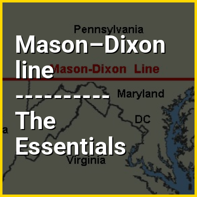
The Mason–Dixon line, sometimes referred to as Mason and Dixon's Line, is a demarcation line separating four U.S. states: Pennsylvania, Maryland, Delaware and West Virginia. It was surveyed between 1763 and 1767 by English surveyors and astronomers Charles Mason and Jeremiah Dixon as part of the resolution to Cresap's War, a border conflict involving Maryland, Pennsylvania, and Delaware (then a part of Pennsylvania) in the colonial United States.

The largest portion of the Mason–Dixon line, along the southern Pennsylvanian border, later became informally known as the boundary between the Southern slave states and Northern free states. This usage came to prominence during the debate around the Missouri Compromise of 1820, when drawing boundaries between slave and free territory, and resurfaced during the American Civil War, with border states also coming into play. The Confederate States of America claimed the Virginian (now West Virginia) portion of the line as part of its northern border, although it never exercised meaningful control that far north – especially after West Virginia separated from Virginia and joined the Union as a separate state in 1863. It is still used today in the figurative sense of a line that separates the Northeast and South regionally, politically, and socially (see Dixie).

↓ Menu

>>>PUT SHARE BUTTONS HERE<<<

👉 Mason–Dixon line in the context of Culture of the Southern United States

The culture of the Southern United States, Southern culture, or Southern heritage, is a subculture of the United States. From its many cultural influences, the South developed its own unique customs, dialects, arts, literature, cuisine, dance, and music. The combination of its unique history and the fact that many Southerners maintain—and even nurture—an identity separate from the rest of the country has led to it being one of the most studied and written-about regions of the United States.

From the 17th century until the mid-19th century, the central role of agriculture and slavery during the colonial period and antebellum era economies made society stratified according to land ownership. This landed gentry made culture in the early Southern United States differ from areas north of the Mason–Dixon line and west of the Appalachians. The upland areas of the South were characterized by yeoman farmers who worked on their small landed property with few or no slaves, while the lower-lying elevations and Deep South was a society of more plantations worked by African slave labor. Events such as the First Great Awakening (1730s–1750s) would strengthen Protestantism in the South and United States as a whole. Communities would often develop strong attachment to their churches as the primary community institution.

↓ Explore More Topics
In this Dossier

Mason–Dixon line in the context of Union (American Civil War)

The Union is a term used to refer to the central government and loyal states of the United States during the American Civil War. Its military forces and civilian population resisted the purported secession of the slave states that formed the Confederate States of America following the 1860 election of Abraham Lincoln as president of the United States. Lincoln's administration asserted the permanency of the federal government and the continuity of the United States Constitution, and it refused to recognize the Confederate government.

Nineteenth-century Americans commonly used the term Union to mean either the federal government of the United States or the unity of the states within the federal constitutional framework. The Union can also refer to the people or territory of the states that remained loyal to the national government during the war. The loyal U.S states located mostly above the Mason–Dixon line were also known as the North, although four southern border states and the future state of West Virginia remained loyal to the Union, and Black Southerners and many Southern Unionists opposed secession and supported the Union war effort.

↑ Return to Menu

Mason–Dixon line in the context of Southern United States

The Southern United States (sometimes Dixie, also referred to as the Southern States, the American South, the Southland, Dixieland, or simply the South) is one of the four census regions defined by the United States Census Bureau. It is between the Atlantic Ocean and the Western United States, with the Midwestern and Northeastern United States to its north and the Gulf of Mexico and Mexico to its south.

Historically, the South was defined as all states south of the 18th-century Mason–Dixon line, the Ohio River, and the 36°30′ parallel. Within the South are different subregions such as the Southeast, South Central, Upper South, and Deep South. Maryland, Delaware, Washington, D.C., and Northern Virginia have become more culturally, economically, and politically aligned in certain aspects with the Northeastern United States and are sometimes identified as part of the Northeast or Mid-Atlantic. The U.S. Census Bureau continues to define all four places as formally being in the South. To account for cultural variations across the region, some scholars have proposed definitions of the South that do not coincide neatly with state boundaries. The South does not precisely correspond to the entire geographic south of the United States, but primarily includes the south-central and southeastern states. For example, California, which is geographically in the southwestern part of the country, is not considered part of the South; however, the geographically southeastern state of Georgia is.

↑ Return to Menu

Mason–Dixon line in the context of Southeastern United States

The Southeastern United States, also known as the American Southeast or simply the Southeast, is a geographical region of the United States located in the eastern portion of the Southern United States and the southern portion of the Eastern United States. The region includes a core of states that reaches north to Maryland and West Virginia, bordering the Ohio River and Mason–Dixon line, and stretches west to Arkansas and Louisiana.

↑ Return to Menu

Mason–Dixon line in the context of Dixie

Dixie, also known as Dixieland or Dixie's Land, is a nickname for all or part of the Southern United States. While there is no official definition of this region (and the included areas have shifted over the years), or the extent of the area it covers, most definitions include the U.S. states below the Mason–Dixon line that seceded and comprised the Confederate States of America, almost always including the Deep South. The term became popularized throughout the United States by songs that nostalgically referred to the American South.

↑ Return to Menu

Mason–Dixon line in the context of Garrett County, Maryland

Garrett County (/ɡɛrɪt/) is the westernmost county of the U.S. state of Maryland, completely within the Appalachian Mountains. As of the 2020 United States census, the population was 28,806, making it the third-least populous county in Maryland. Its county seat is Oakland. The county was named for John Work Garrett (1820–1884), president of the Baltimore and Ohio Railroad. Created from Allegany County in 1872, it was the last county to be formed in the state. The county is part of the Western Maryland region of the state. Garrett County is bordered by four West Virginia counties and to the north the Maryland–Pennsylvania boundary known as the Mason–Dixon line. The eastern border with Allegany County was defined by the Bauer Report, submitted to Governor Lloyd Lowndes, Jr. on November 9, 1898. The Potomac River and State of West Virginia lie to the south and west.

Garrett County lies in the Allegheny Mountains, which here form the western flank of the Appalachian Mountain Range. Hoye-Crest, a summit along Backbone Mountain, is the highest point in Maryland at an elevation of 3,360 feet (1,020 m).

↑ Return to Menu

Mason–Dixon line in the context of Western Maryland

Western Maryland, also known as the Maryland panhandle or Mountain Maryland, is the portion of the U.S. state of Maryland that typically consists of Washington, Allegany, and Garrett counties. The region is bounded by the Mason-Dixon line (Pennsylvania) to the north, the Potomac River and West Virginia to the south, and Preston County, West Virginia to the west. At one point, at the town of Hancock, the northern and southern boundaries are separated by just 1.8 miles (2.9 km), the narrowest stretch in the state.

Western Maryland is more rural than the Washington-Baltimore area, where most of the state's population lives, and is noted for its mountainous terrain. The area is in the central Appalachians. Washington, Allegany, and Garrett counties are part of the Appalachian Regional Commission. The most populous community in Western Maryland is Hagerstown, located in Washington County, the most populous county in the region. Major highways in Western Maryland include Interstate Highways I-70, I-81 and I-68; U.S. Highways U.S. 11, U.S. 40, U.S. 40 ALT, U.S. 219 and U.S. 50; and several state highways.

↑ Return to Menu

Mason–Dixon line in the context of Charles Mason

Charles Mason (25 April 1728 – 25 October 1786) was an English surveyor and astronomer who best known for surveying the Mason–Dixon line with Jeremiah Dixon from 1763 to 1767. The line came to mark the borders between Maryland, Pennsylvania and Delaware.

↑ Return to Menu

Mason–Dixon line in the context of Jeremiah Dixon

Jeremiah Dixon (27 July 1733 – 22 January 1779) was an English surveyor and astronomer best known for surveying the Mason–Dixon line with Charles Mason from 1763 to 1767. The line came to mark the borders between Maryland, Pennsylvania and Delaware.

↑ Return to Menu