Lukmanier Pass in the context of "Lake Sontga Maria"

Play Trivia Questions online!

or

Skip to study material about Lukmanier Pass in the context of "Lake Sontga Maria"


⭐ Core Definition: Lukmanier Pass

Lukmanier Pass (Italian: Passo del Lucomagno, Romansh: Cuolm Lucmagn) is a pass in the Swiss Alps.

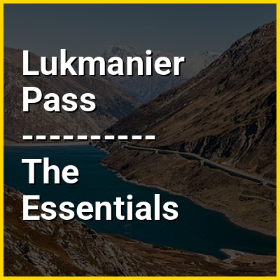
The road from Disentis/Mustér in the canton of Graubünden leads through the Val Medel across the pass to the Blenio Valley and Biasca in the canton of Ticino. North of the pass, the road runs along the east shore of Lake Sontga Maria. The highest elevation reached by the road is 1973 m, in the 2 km long Lukmanier tunnel running along the lake. However, the pass is marked at the southern exit from the tunnel, on the site of the Lukmanier Hospice, at an elevation of 1915 m.

↓ Menu

👉 Lukmanier Pass in the context of Lake Sontga Maria

Lai da Sontga Maria (Italian: Lago di Santa Maria) is a lake, located north of the Lukmanier Pass in Switzerland. It lies almost entirely in the municipality of Medel (canton of Graubünden), a tiny fraction of the south-west part of the lake belonging to the municipalities of Quinto and Blenio (canton of Ticino). The reservoir has a surface area is 1.77 km (0.68 sq mi). The arch dam Santa Maria, which is to the north of the lake, was completed in 1968. The main road of the Lukmanier Pass runs along the eastern shore of the lake.

The lake lies at a height of 1,908 metres above sea level and is surrounded by mountains over 3,000 metres on both sides. The highest peak overlooking Lai da Sontga Maria is the Scopi (3,190 m), on the east side. On the west side are Piz Gannaretsch (3,040 m) and Piz Rondadura (3,016 m). On the south side (in Ticino), the lake is overlooked by Pizzo dell'Uomo (2,663 m). The lake is drained by the Rein da Medel, a tributary of the Anterior Rhine.

↓ Explore More Topics
In this Dossier

Lukmanier Pass in the context of Saint-Gotthard Massif

The Gotthard Massif or Saint-Gotthard Massif (German: Gotthardmassiv or Sankt-Gotthard-Massiv; Italian: Massiccio del San Gottardo; Romansh: Massiv dal Gottard) is a mountain range in the Alps in Switzerland, located at the border of four cantons: Valais, Ticino, Uri and Graubünden. It is delimited by the Nufenen Pass on the west, by the Furka Pass and the Oberalp Pass on the north and by the Lukmanier Pass on the east. The eponymous Gotthard Pass, lying at the heart of the massif, is the main route from north to south (excluding tunnels).

The region of the Gotthard lies at the heart of the Swiss Alps, often referred to as the "water tower of Europe". Three major rivers take their source in the Gotthard Massif: the Reuss, Rhine and Ticino. A fourth river, the Rhône, takes its source in very close proximity of the massif, just north of the Furka Pass. A trekking itinerary, the Vier-Quellen-Weg ("four springs trail"), crosses the Gotthard Massif.

↑ Return to Menu