Liaodong Bay in the context of "Shanhai Pass"

Play Trivia Questions online!

or

Skip to study material about Liaodong Bay in the context of "Shanhai Pass"

Ad spacer

⭐ Core Definition: Liaodong Bay

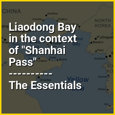
Liaodong Bay is largest and longest of the three main bays of the Bohai Sea, the innermost gulf of the Yellow Sea. The other two bays are Laizhou Bay to the south and Bohai Bay to the southwest.

Although named after the Liaodong Peninsula (which forms its eastern shore), the bay is located directly south of the Liaoxi region, almost entirely west of the Liao River. It is bounded by the coastline of cities from southern Liaoning province (Dalian, Yingkou, Panjin, Jinzhou and Huludao) and eastern Hebei province (Qinhuangdao and Tangshan), between the Laotieshan Cape at Dalian's Lüshunkou District in the east, and the Daqing River estuary (which is an old southern mouth of Luan River) at Tangshan's Laoting County in the west. The bay is a source of ecological importance and exhibits rich biodiversity.

↓ Menu

>>>PUT SHARE BUTTONS HERE<<<

👉 Liaodong Bay in the context of Shanhai Pass

The Shanhai Pass (simplified Chinese: 山海关; traditional Chinese: 山海關; pinyin: Shānhǎi Guān; lit. 'Mountain Sea Pass') is a major fortified gateway at the eastern end of the Great Wall of China and one of its most crucial fortifications, as the pass commands the narrowest choke point in the strategic Liaoxi Corridor, an elongated coastal plain between the Yan Mountains foothills and the Bohai Sea, which is the only easily traversable landway between North and Northeast China. It is located in present-day Shanhaiguan District, Qinhuangdao, Hebei province, on the east bank of the Shi River, with defensive walls stretching from the Yan Mountains all the way to the shores of the Liaodong Bay.

Throughout Chinese history, garrisons around the pass served as frontline defensive outposts against raids and incursions into the North China Plain by various non-Sinitic ethnic groups from the Northeast (also known as Manchuria since the 19th century), including the Dongyi, Donghu (Xianbei and Wuhuan), Khitan and Jurchen (Manchus). The current Shanhai Pass was built during the early Ming dynasty as the easternmost fortification of the Ming Great Wall, and was extensively reinforced after Yongle Emperor moved the capital from Nanjing to Beijing following the Jingnan campaign, making it the most important defensive barrier in all of China, as it shielded the heartland region around the imperial capital. The pass' strategic location dictated that without mounting a costly direct siege, the only way an invading army can get past the pass' defense was to circumvent it around the north through a few treacherously narrow mountain passes deep within the Yan Mountains, which would make it very difficult to maintain supply lines and thus any sizeable invasions. This defensive significance therefore earned the pass the famous nickname "Greatest Pass Under Heaven" (天下第一关).

↓ Explore More Topics
In this Dossier

Liaodong Bay in the context of Dalian

Dalian (/dɑːˈljɛn/ dah-LYEN) is a major sub-provincial port city in Liaoning province, People's Republic of China, and is Liaoning's second largest city (after the provincial capital Shenyang) and the third-most populous city of Northeast China (after Shenyang and Harbin). Located on the southern tip of the Liaodong peninsula, it is the southernmost city in both Liaoning and the entire Northeast. Dalian borders the prefectural cities of Yingkou and Anshan to the north and Dandong to the northeast, and also shares maritime boundaries with Qinhuangdao and Huludao across the Liaodong Bay to the west and northwest, Yantai and Weihai on the Shandong peninsula across the Bohai Strait to the south, and North Korea across the Korea Bay to the east.

As of the 2020 census, its total population was 7,450,785 inhabitants of whom 5,106,719 lived in the built-up (or metro) area made of 6 out of 7 urban districts, Pulandian District not being conurbated yet.

↑ Return to Menu

Liaodong Bay in the context of Northeast China Plain

The Northeast China Plain (simplified Chinese: 东北平原; traditional Chinese: 東北平原; pinyin: Dōngběi Píngyuán), also known as Songliao Plain, Manchurian Plain, or Northeast Plain, is located in Northeast China. It lies between the Greater and Lesser Khingan and Changbai mountains, ending at the coast at Liaodong Bay in the Bohai Sea. Covering 350,000 km, it is China's largest plain, with an elevation of lower than 200 meters, and less than 100 meters to the southwest. The Songhua, Nen, and Liao Rivers run through the plain.

The Northeast Plain includes Songnen Plain in the north, Liaohe Plain in the south, and Sanjiang Plain in the northeast. The Songnen Plain was formed by the Songhua and alluvial soils from the Nen. The Liaohe Plain, located in the hilly areas near Changchun, was created by the separation of watersheds of the Songhua and Liao, which are collectively known as the Liaohe Plain. The Sanjiang Plain, at the confluence of the Songhua, Amur, and Ussuri Rivers, was originally a swamp known as the "Great Northern Wilderness", becoming a food-producing area after reclamation. The original wetland area of the Sanjiang Plain has been greatly reduced.

↑ Return to Menu

Liaodong Bay in the context of Daliao River

The Daliao River (simplified Chinese: 大辽河; traditional Chinese: 大遼河; pinyin: Dàliáohé, "Great Liao River") is a major river system in eastern Liaoning province of Northeast China, and formerly the main distributary of the lower Liao River until 1958. The Daliao River proper is formed from the confluence of three rivers at the border between Anshan's Haicheng city and Panjin's Panshan County, after where it runs a length of 94 kilometres (58 mi) covering a catchment area of 1,926 square kilometres (744 sq mi), before coursing in meanders southwest and draining into the Liaodong Bay just west of Yingkou.

The principal river of southern Northeast China, the Liao River, historically bifurcates into two distributaries near the Liujianfang Hydrological Station (六间房水文站) at Xinkaihe Town (新开河镇) of Anshan's Tai'an County, forming the Liao River Delta. The eastern distributary, called the Wailiao River, was originally the larger one and the main body of lower Liao River. It travelled southwards to pick up two large tributaries the Hun River and Taizi River, at a confluence locally referred as the "Trident River" (三岔河). After the three rivers merged, the resultant large river then adopted the new name as Daliao River.

↑ Return to Menu

Liaodong Bay in the context of Yingkou

Yingkou (Chinese: 营口; pinyin: Yíngkǒu) is a coastal prefecture-level city of central southern Liaoning province, People's Republic of China, on the northeastern shore of Liaodong Bay. It is the third-smallest prefecture level city in Liaoning with a total area of 5,502 square kilometres (2,124 sq mi), and the ninth most populous with a population of 2,328,582 as of the 2020 census, of whom 1,228,198 lived in the built-up (or metro) area made of three urban districts (Zhanqian, Xishi and Laobian) and one county-level city (Dashiqiao). It borders the sub-provincial city of Dalian to the south, the prefectural cities of Anshan to the north and east and Panjin to the northwest, and also shares maritime boundaries with Jinzhou and Huludao across the Liaodong Bay to its west.

Located on the east bank of the Daliao River mouth, Yingkou is an important port city, with the Port of Yingkou being the second-largest container port in the Bohai Sea (after the Port of Tianjin) and Northeast China (after the Port of Dalian), the tenth-largest nationwide, and the 25th-busiest worldwide. Yingkou is classified as a Medium-Port Metropolis.

↑ Return to Menu

Liaodong Bay in the context of Huludao

Huludao (Chinese: 葫芦岛; pinyin: Húludǎo), formerly known as Jinxi (锦西) until 1994, is a coastal prefecture-level city in southwestern Liaoning province, People's Republic of China. Its name literally means "Gourd Island", referring to the fiddle-shaped contour of the peninsula ("half-island" in Chinese), which resembles a bottle gourd, at the city's Longgang District. It has a total area of 10,582 km (4,086 sq mi) and as of the 2020 census a population of 2,434,194 of whom 1,252,660 inhabitants lived in the built-up (or metro) area made of the 2 urban districts and Xingcheng City largely being conurbated.

Located on the northwestern shore of the Liaodong Bay, Huludao is one of the three principal cities (along with Jinzhou and Hebei province's Qinhuangdao) in the Liaoxi Corridor, and is Northeast China's gateway through the Shanhai Pass into North China. It borders Jinzhou to the northeast, Chaoyang to the north, and Qinhuangdao to the southwest, as well as sharing maritime boundaries with Yingkou and Dalian to the east and southeast across the bay.

↑ Return to Menu

Liaodong Bay in the context of Laizhou Bay

Laizhou Bay (simplified Chinese: 莱州湾; traditional Chinese: 萊州灣; pinyin: Láizhōu Wān) is a bay on the southern shore of the Bohai Sea (also known as the Bohai Gulf, or just Bo Hai, which is a large and relatively shallow westward extension of the northern Yellow Sea), bounded by the northwestern coastline of the Shandong Peninsula west of the Port of Longkou and the eastern coastline of Dongying south of the Yellow River estuary. It is named after the county-level city of Laizhou to its east, and is the smallest of the three main bays of the Bohai Sea (the other two being the Liaodong Bay to the north, and the Bohai Bay to the west).

↑ Return to Menu