Kawhia Harbour in the context of "Ngāti Toa"

Play Trivia Questions online!

or

Skip to study material about Kawhia Harbour in the context of "Ngāti Toa"

Ad spacer

⭐ Core Definition: Kawhia Harbour

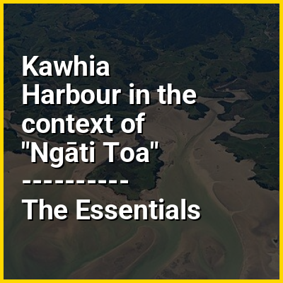
Kawhia Harbour (Māori: Kāwhia) is one of three large natural inlets in the Tasman Sea coast of the Waikato region of New Zealand's North Island. It is located to the south of Raglan Harbour, Ruapuke and Aotea Harbour, 40 kilometres southwest of Hamilton. Kawhia is part of the Ōtorohanga District and is in the King Country. It has a high-tide area of 68 km (26 mi) and a low-tide area of 18 km (6.9 mi). Te Motu Island is located in the harbour.

The settlement of Kawhia is located on the northern coast of the inlet, and was an important port in early colonial New Zealand. The area of Kawhia comprises 16 to 20 hectares (40 to 50 acres) and is the town block that was owned by the New Zealand Government. The government bought it from the Europeans in 1880 "not from the original Māori owners, but from a European who claimed ownership in payment of money owed by another European".

↓ Menu

>>>PUT SHARE BUTTONS HERE<<<

👉 Kawhia Harbour in the context of Ngāti Toa

Ngāti Toa, also called Ngāti Toarangatira or Ngāti Toa Rangatira, is a Māori iwi (tribe) based in the southern North Island and the northern South Island of New Zealand. Ngāti Toa remains a small iwi with a population of about 9,000. The iwi is centred around Porirua, Plimmerton, Kāpiti, Blenheim and Arapaoa Island. It has four marae: Takapūwāhia and Hongoeka in Porirua City, and Whakatū and Wairau in the South Island. Ngāti Toa's governing body has the name Te Rūnanga o Toa Rangatira.

The iwi traces its descent from the eponymous ancestor Toarangatira. Ngāti Toa lived in the Kāwhia region of the North Island until the 1820s, when forced out by conflict with other Tainui iwi, led by Pōtatau Te Wherowhero (c. 1785 – 1860), who later became the first Māori King (r. 1858–1860). Ngāti Toa, Ngāti Rārua and Ngāti Koata, led by Te Rauparaha (c. 1765 – 1849), escaped south and invaded Taranaki and the Wellington regions together with three north Taranaki iwi, Te Āti Awa, Ngāti Tama and Ngāti Mutunga. Together they fought and conquered the people of Wellington, Ngāti Ira, who practically ceased to exist as an independent iwi.After the 1820s, the region conquered by Ngāti Toa extended from Miria-te-kakara at Rangitikei to Wellington, and across Cook Strait to Wairau and Nelson.

↓ Explore More Topics
In this Dossier

Kawhia Harbour in the context of King Country

The King Country (Māori: Te Rohe Pōtae or Rohe Pōtae o Maniapoto) is a region of the western North Island of New Zealand. It extends approximately from Kawhia Harbour and the town of Ōtorohanga in the north to the upper reaches of the Whanganui River in the south, and from the Hauhungaroa and Rangitoto Ranges in the east to near the Tasman Sea in the west. It comprises hill country, large parts of which are forested.

The region, albeit loosely defined, is very significant in New Zealand's history. The term "King Country" dates from the New Zealand Wars of the 1860s, when colonial forces invaded the Waikato and forces of the Māori King Movement withdrew south of what was called the aukati, or boundary, a line of alongside the Puniu River near Kihikihi. Land behind the aukati remained native territory, with Europeans warned they crossed it under threat of death.

↑ Return to Menu