Kapıdağ Peninsula in the context of "Cyzicus"

Play Trivia Questions online!

or

Skip to study material about Kapıdağ Peninsula in the context of "Cyzicus"

Ad spacer

⭐ Core Definition: Kapıdağ Peninsula

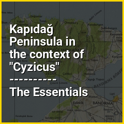
Kapıdağ Peninsula (Turkish: Kapıdağ Yarımadası) is a tied island in northwestern Anatolia extending into the Sea of Marmara in Balıkesir Province, Turkey. The peninsula forms the Gulf of Bandırma on its east and the Gulf of Erdek on its west.

Kapıdağ was the classical island of ancient Greek Arctonnesus, but was joined to the mainland by a narrow isthmus in historic times either by an earthquake or (according to legend) by Alexander the Great. It was also known as the Peninsula of Cyzicus after its chief town.

↓ Menu

>>>PUT SHARE BUTTONS HERE<<<

👉 Kapıdağ Peninsula in the context of Cyzicus

Cyzicus (/ˈsɪzɪkəs/ SIZ-ik-əs; Ancient Greek: Κύζικος, romanizedKúzikos; Ottoman Turkish: آیدینجق, romanizedAydıncıḳ) was an ancient Greek town in Mysia in Anatolia in the current Balıkesir Province of Turkey. It was located on the shoreward side of the present Kapıdağ Peninsula (the classical Arctonnesus), a tombolo which is said to have originally been an island in the Sea of Marmara only to be connected to the mainland in historic times either by artificial means or an earthquake.

The site of Cyzicus, located on the Erdek and Bandırma roads, is protected by Turkey's Ministry of Culture.

↓ Explore More Topics
In this Dossier

Kapıdağ Peninsula in the context of Biga Peninsula

Biga Peninsula (Turkish: Biga Yarımadası) is a peninsula in Turkey, in the northwest part of Anatolia. It is also known by its ancient name Troad (Troas).

The peninsula is bounded by the Dardanelles Strait and the southwest coast of the Marmara Sea to the north, Aegean Sea to the west and the Edremit gulf to the South. The eastern border of the peninsula is Gönen creek close to Kapıdağ Peninsula. Cape Baba at 39°28′46″N 26°03′49″E / 39.47944°N 26.06361°E / 39.47944; 26.06361 is the westernmost point of Anatolia The main mountain of the peninsula is Kaz Mountain (Mount Ida of the antiquity). Among the seven rivers or creeks, Karamenderes River (Scamander of the antiquity) and Biga River (Granikos of the antiquity) are the longest. Karamenderes discharges to Dardanelles Strait and Biga River discharges to the Marmara Sea.

↑ Return to Menu

Kapıdağ Peninsula in the context of Erdek

Erdek is a municipality and district of Balıkesir Province, Turkey. Its area is 307 km, and its population is 32,021 (2024). Located on the Kapıdağ Peninsula, on the north coast of the Gulf of Erdek at the south of the Sea of Marmara, Erdek is a popular domestic holiday destination with several hotels dating back to the 1960s. The surrounding area has a rugged geology and topography with evergreen wooded areas and large olive groves. It is dominated by Mt Dindymus (782m). Erdek district also included the islands of Koyun and Paşalimanı.

In the summer ferries travel from Erdek to Avşa Adası, one of the Marmara Islands in the Sea of Marmara. The harbour overlooks tiny Zeytinlik island where there is a research station devoted to olives.

↑ Return to Menu

Kapıdağ Peninsula in the context of Gulf of Erdek

Erdek Gulf is a gulf of Marmara Sea, Turkey. It is administratively a part of Balıkesir Province.In fact, the gulf is named after Erdek, an ilçe (district) of the Balıkesir Province which is situated at the north coast of the gulf .The midpoint of the gulf is at about 40°22′N 27°40′E / 40.367°N 27.667°E / 40.367; 27.667. Kapıdağ Peninsula, Paşalimanı Island and Avşa Island are to the north, Belkıs Tombolo (connecting Kapıdağ Peninsula to the Anatolia mainland) is to the east, Karabiga ilçe is to the west and the Marmara coast of Anatolia is to the south. The maximum depth of the gulf is 47 metres (154 ft).

There are ferry services in the gulf. One service is to Barbaros in the Thracen side of Turkey, close to Tekirdağ. There are also ferry services to the nearby islands such as Marmara Island (Saraylar terminal), Avşa Island and the Paşalimanı Island.

↑ Return to Menu