Anegada Passage in the context of Charlotte Amalie Harbor


Anegada Passage in the context of Charlotte Amalie Harbor

⭐ Core Definition: Anegada Passage

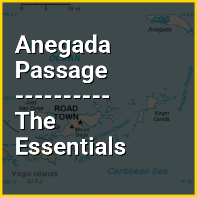
The Anegada Passage /ˌænəˈɡɑːdə/, also known as the Anegada Trough, is a strait in the Caribbean that separates the British Virgin Islands and the British ruled Sombrero Island of Anguilla, and connects the Caribbean and the Atlantic Ocean. It is 2300 m deep. Because the threshold depths are 1800 and 1600 m, Atlantic deep water from 1600 m level may flow into the deep areas in the Caribbean Sea.

The Anegada Passage is a key shipping lane for the Panama Canal. Often called the "Oh-my-god-a Passage", it is considered a difficult passage for sailors because of the winds, waves, and swells.

↓ Menu
HINT:

👉 Anegada Passage in the context of Charlotte Amalie Harbor

Charlotte Amalie Harbor is a major maritime hub located in the subdistrict of Charlotte Amalie, the modern day capital of the U.S. Virgin Islands, on the southern coast of St. Thomas. Renowned for its deep-water anchorage and strategic location in the Caribbean, the harbor plays a crucial role in regional tourism, trade, and transportation and military strategy. The harbor is the deepest natural harbor connected to the Anegada Passage (7,550 feet [2,300m]) and the Virgin Islands Basin (area between St. Thomas-St. John and St. Croix districts). The Anegada Passage and Virgin Islands Basin form the deepest channel leading into the Caribbean Basin from the Atlantic Ocean. Because the Charlotte Amalie harbor is the deepest natural connected to this channel, it made Charlotte Amalie a natural choice as a maritime hub and free port. As a free port, Charlotte Amalie has long served as a center for commerce, allowing duty-free trade that attracts businesses and visitors alike.

↓ Explore More Topics
In this Dossier

Anegada Passage in the context of Virgin Islands

The Virgin Islands (Spanish: Islas Vírgenes) is an archipelago between the North Atlantic Ocean and northeastern Caribbean Sea, located to the immediate east of the main island of Puerto Rico. It generally forms part of the Leeward Islands of the Lesser Antilles in the West Indies of the Caribbean region.

Geologically separated from the Lesser Antilles by the Anegada Passage and from the Greater Antilles by the Mona passage, all the islands except for Saint Croix lie on the same carbonate platform and insular shelf, known as the Puerto Rico Bank, and same tectonic plate, known as the Puerto Rico–Virgin Islands microplate.

View the full Wikipedia page for Virgin Islands
↑ Return to Menu

Anegada Passage in the context of Spanish Virgin Islands

The Spanish Virgin Islands (Spanish: Islas Vírgenes Españolas), formerly called the Passage Islands (Spanish: Islas del Pasaje), commonly known as the Puerto Rican Virgin Islands (Spanish: Islas Vírgenes Puertorriqueñas), consist of the islands of Vieques and Culebra, which are administratively part of the archipelago of Puerto Rico as municipalities. Located between the main island of Puerto Rico and the U.S. Virgin Islands in the northeastern Caribbean, the islands are geographically part of the archipelago of the Virgin Islands in the Leeward Islands of the Lesser Antilles.

Geologically separated from the Greater Antilles island of Hispaniola by the Mona Passage and from the Lesser Antilles island arc by the Anegada Passage, the main island of Puerto Rico, the Spanish Virgin Islands of Vieques and Culebra, the British Virgin Islands, and the U.S. Virgin Islands except for the southernmost island of Saint Croix, all lie on the same carbonate platform and insular shelf, the Puerto Rico Bank, between the North Atlantic Ocean and the Caribbean Sea. The archipelagos of Puerto Rico and the Virgin Islands except for Saint Croix also lie on the same tectonic plate, the Puerto Rico–Virgin Islands microplate.

View the full Wikipedia page for Spanish Virgin Islands
↑ Return to Menu