Steinkjer Municipality in the context of Bartnes, Trøndelag


Steinkjer Municipality in the context of Bartnes, Trøndelag

⭐ Core Definition: Steinkjer Municipality

Steinkjer 
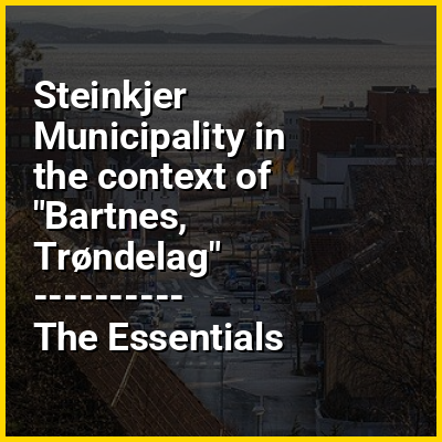
(Norwegian) or Stïentje (Southern Sami) is a municipality in Trøndelag county, Norway. It is part of the Innherad region. The administrative centre of the municipality is the town of Steinkjer which is located on the inner part of the Trondheimsfjord. The town is also the administrative centre for Trøndelag county. Other populated areas in Steinkjer include the villages of Bartnes, Beitstad, Binde, Byafossen, Follafoss, Følling, Gaulstad, Henning, Hyllbrua, Kvam, Lerkehaug, Malm, Mære, Sela, Skei, Sparbu, Stod, Sunnan, Vassaunet, Vellamelen, and Verrastranda.

The 2,122-square-kilometre (819 sq mi) municipality is the 31st largest by area out of the 357 municipalities in Norway. Steinkjer Municipality is the 54th most populous municipality in Norway with a population of 24,032. The municipality's population density is 11.3 inhabitants per square kilometre (29/sq mi) and its population has decreased by 0.4% over the previous 10-year period.

↓ Menu
HINT:

In this Dossier

Steinkjer Municipality in the context of Trondheimsfjord

The Trondheim Fjord or Trondheimsfjorden (pronounced [ˈtrɔ̂nː(h)æɪmsˌfjuːɳ]), an inlet of the Norwegian Sea, is Norway's third-longest fjord at 130 kilometres (81 mi) long. It is located in the west-central part of the country in Trøndelag county, and it stretches from Ørland Municipality in the west to Steinkjer Municipality in the north, passing the city of Trondheim on its way. Its maximum depth is 617 metres (2,024 ft), in the channel between Orkland Municipality and Indre Fosen Municipality.

The largest islands in the fjord are Ytterøya and Tautra; the small island of Munkholmen is located near the harbor of Trondheim; and there are several islands at the entrance of the fjord. The narrow Skarnsundet is crossed by the Skarnsund Bridge. The part of the fjord to the north of the strait is referred to as the Beitstadfjorden. The main part of the Trondheimsfjord is ice-free all year; only Verrasundet, a long and narrow fjord branch in the northern part of the fjord, might be ice covered in winter. The Beitstadfjorden might also freeze over in winter, but only for a few weeks.

View the full Wikipedia page for Trondheimsfjord
↑ Return to Menu

Steinkjer Municipality in the context of Nord-Trøndelag

Nord-Trøndelag (Urban East Norwegian: [ˈnûːˌʈrœndəlɑːɡ] ; "North Trøndelag") was a county constituting the northern part of the present-day Trøndelag county in Norway. It bordered the old Sør-Trøndelag ("South Trøndelag") county as well as the county of Nordland. To the west is the Norwegian Sea (Atlantic Ocean), and to the east is Jämtland in Sweden. The county was established in 1804 when the old Trondhjems amt was divided into two: Nordre Trondhjems amt and Søndre Trondhjems amt. In 2016, the two county councils voted to merge (back) into a single county on 1 January 2018.

As of 1 January 2014, the county had 135,142 inhabitants, making it the country's fourth-least populated county. The largest municipalities are Stjørdal, Steinkjer (the county seat), Levanger, Namsos, and Verdal, all with between 24,000 and 12,000 inhabitants. The economy is primarily centered on services, although there are significant industries in agriculture, fisheries, hydroelectricity and forestry. It has the lowest gross domestic product per capita of any county in the country.

View the full Wikipedia page for Nord-Trøndelag
↑ Return to Menu

Steinkjer Municipality in the context of Steinkjer (town)

Steinkjer (Norwegian), /ˈstæi̯nçæːɾ/ or Stïentje (Southern Sami), /ˈstɨe̯ntʃe/ is the administrative centre of Steinkjer Municipality and Trøndelag county in Norway. The town is located at the northeastern end of the inner-most part of the Trondheimsfjorden, at the mouth of the river Steinkjerelva. In the eastern part of the town, the river of Figgja also flows into the fjord. The town is split in two by the river Steinkjerelva, creating the two traditional neighborhoods of Nordsia and Sørsia. Both the European route E6 highway and the Nordlandsbanen railway line run through the town, the latter serving the city at Steinkjer Station. Steinkjer Church and Egge Church are both located in the town.

Prior to 1 January 2018, the town was also the administrative centre of Nord-Trøndelag county, and since that day it has been the seat of the newly created Trøndelag county. This means the Trøndelag County Municipality is based here as is the County Governor, the representative of the King and Government of Norway in Trøndelag county.

View the full Wikipedia page for Steinkjer (town)
↑ Return to Menu

Steinkjer Municipality in the context of Beitstadfjorden

Beitstadfjorden (Urban East Norwegian: [ˈbæ̂ɪtstɑˌfjuːɳ]) is the innermost arm of the Trondheimsfjord in Trøndelag county, Norway. It is located in Steinkjer Municipality, Inderøy Municipality, and a small part extends into Indre Fosen Municipality. The fjord has a length of 28 kilometres (17 mi) from southwest to northeast, and a width of about 6 to 8 kilometres (3.7 to 5.0 mi).

The fjord begins at the Skarnsund strait in the south and extends northeast to the city of Steinkjer. On the far western part of the fjord, the Verrasundet strait extends south to the village of Verrabotn in Indre Fosen Municipality, while in the north the Beitstad strait stretches northward past the villages of Malm, Beitstad, and Vellamelen. In Inderøy Municipality, the villages of Kjerknesvågen and Breivika are located along the shoreline. Follafoss is located along the north side of the fjord.

View the full Wikipedia page for Beitstadfjorden
↑ Return to Menu

Steinkjer Municipality in the context of Verrasundet

Verrasundet is a fjord in Trøndelag county, Norway. The 22-kilometre (14 mi) long fjord branches off of the northern part of the vast Trondheimsfjorden in Indre Fosen Municipality, Steinkjer Municipality, and Inderøy Municipality. It extends from Beitstadfjorden to the village of Verrabotn. The fjord is a maximum of 2 kilometres (1.2 mi) wide, but at Trongsundet, the fjord is barely 200 metres (660 ft) wide.

View the full Wikipedia page for Verrasundet
↑ Return to Menu