South East Queensland in the context of "Brisbane, Australia"

Play Trivia Questions online!

or

Skip to study material about South East Queensland in the context of "Brisbane, Australia"


⭐ Core Definition: South East Queensland

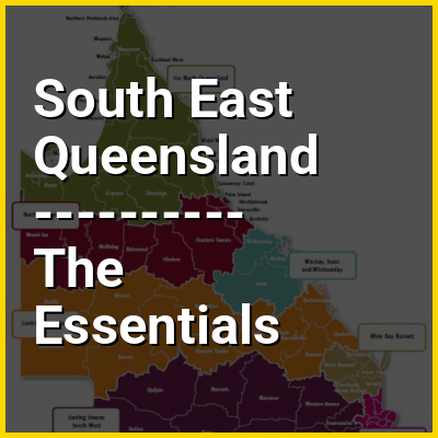
South East Queensland (SEQ) is a bio-geographical, metropolitan and statistical region of the state of Queensland in Australia, with a population of approximately 4.0 million people out of the state's population of 5.5 million. The area covered by South East Queensland varies, depending on the definition of the region, though it tends to include Queensland's three largest cities: the capital city Brisbane; the Gold Coast; and the Sunshine Coast. Its most common use is for political purposes, and covers 35,248 square kilometres (13,609 sq mi) and incorporates 11 local government areas, extending 240 kilometres (150 mi) from Noosa in the north to the Gold Coast and New South Wales border in the south (some sources include Tweed Heads, New South Wales which is contiguous as a conurbation with Brisbane/Gold Coast), and 140 kilometres (87 mi) west to Toowoomba (which is simultaneously considered part of the Darling Downs region). It is the third largest urban area in Australia by population.

South East Queensland was the first part of Queensland to be settled and explored by Europeans. Settlements initially arose in the Brisbane and Ipswich areas with activity by European immigrants spreading in all directions from there. Various industries such as timber cutting and agriculture quickly developed at locations around the region from the 1840s onwards. Transport links have been shaped by the range of terrain found in South East Queensland.

↓ Menu

In this Dossier

South East Queensland in the context of Brisbane

Brisbane (/ˈbrɪzbən/ BRIZ-bən; Turrbal/Yagara: Meanjin, Meaanjin, Maganjin or Magandjin) is the capital and largest city of the state of Queensland and the third-most populous city in Australia, with a population of approximately 2.8 million. Brisbane lies at the centre of South East Queensland and is located roughly in the midpoint of Australia's eastern coastline. It is an urban agglomeration with a population of over 4 million. The central business district is situated within a peninsula of the Brisbane River about 15 km (9 mi) from its mouth at Moreton Bay. Greater Brisbane sprawls over the hilly floodplain of the Brisbane River Valley between Pacific Ocean and the Taylor and D'Aguilar mountain ranges, encompassing several local government areas, most centrally the City of Brisbane, the most populous local government area in Australia. The demonym of Brisbane is Brisbanite or Brisbaner.

The Moreton Bay penal settlement was founded in 1824 at Redcliffe as a place for secondary offenders from the Sydney colony, but in May 1825 moved to North Quay on the banks of the Brisbane River, so named for the Governor of New South Wales Sir Thomas Brisbane. German Lutherans established the first free settlement of Zion Hill at Nundah in 1838, and in 1859 Brisbane was chosen as Queensland's capital when the state separated from New South Wales. During World War II, the Allied command in the South West Pacific was based in the city, along with the headquarters for General Douglas MacArthur of the United States Army.

↑ Return to Menu

South East Queensland in the context of Queensland

Queensland (locally /ˈkwnzlænd/ KWEENZ-land, commonly abbreviated as QLD) is a state in northeastern Australia, the second-largest and third-most populous state in Australia. It is bordered by the Northern Territory, South Australia and New South Wales to the west, south-west and south, respectively. To the east, Queensland is bordered by the Coral Sea and the Pacific Ocean; to the state's north is the Torres Strait, separating the Australian mainland from Papua New Guinea, and the Gulf of Carpentaria to the north-west. With an area of 1,723,030 square kilometres (665,270 sq mi), Queensland is the world's sixth-largest subdivision of any country on earth; it is larger than all but 16 countries. Due to its size, Queensland's geographical features and climates are diverse, and include tropical rainforests, rivers, coral reefs, mountain ranges and white sandy beaches in its tropical and sub-tropical coastal regions, as well as deserts and savanna in the semi-arid and desert climatic regions of its interior.

Queensland has a population of over 5.5 million, concentrated in South East Queensland, where nearly three in four reside. The capital and largest city in the state is Brisbane, Australia's third-largest city and comprising fully half of the state's population. Ten of Australia's thirty largest cities are located in Queensland, the largest outside Brisbane being the Gold Coast, the Sunshine Coast, Townsville, Cairns, Ipswich, and Toowoomba. 24.2% of the state's population were born overseas. The state has the highest inter-state net migration in Australia.

↑ Return to Menu

South East Queensland in the context of Brisbane River

The Brisbane River (Turrbal: Maiwar) is the longest river in South East Queensland, Australia. It flows through the city of Brisbane, before emptying into Moreton Bay on the Coral Sea. John Oxley, the first European to explore the river, named it after the Governor of New South Wales, Sir Thomas Brisbane in 1823. The penal colony of Moreton Bay later adopted the same name, eventually becoming the present city of Brisbane. The river is a tidal estuary and the water is brackish from its mouth through the majority of the Brisbane metropolitan area westward to the Mount Crosby Weir. The river is wide and navigable throughout the Brisbane metropolitan area. It is affectionately known by locals as the "Brown Snake", on account of its silty waters and long, winding course.

The river travels 344 km (214 mi) from Mount Stanley. The river is dammed by the Wivenhoe Dam, forming Lake Wivenhoe, the main water supply for Brisbane. The waterway is a habitat for the rare Queensland lungfish, Brisbane River cod (extinct), and bull sharks.

↑ Return to Menu

South East Queensland in the context of Sunshine Coast, Queensland

The Sunshine Coast is a peri-urban region in South East Queensland, Australia. In 1967, it was defined as "the area contained in the [former] Shires of Landsborough, Maroochy and Noosa, but excluding Bribie Island". Located 100 km (62 mi) north of the centre of Brisbane in South East Queensland, on the Coral Sea coastline, its urban area spans approximately 60 km (37 mi) of coastline and hinterland from Pelican Waters to Tewantin.

The area has several coastal hubs at Caloundra, Kawana Waters, Maroochydore and Noosa Heads. Nambour and Maleny have developed as primary commercial centres for the hinterland.

↑ Return to Menu

South East Queensland in the context of Ipswich, Queensland

Ipswich (/ˈɪpswɪ/ ) is an urban centre within the City of Ipswich in South East Queensland, Australia. Situated on the Bremer River, it is approximately 40 km (25 mi) west of the Brisbane central business district. Ipswich is renowned for its architectural, natural and cultural heritage, and the city preserves and operates from many of its historical buildings, with more than 6000 heritage-listed sites and over 500 parks. Ipswich was founded in 1827 as a mining settlement, and soon developed into a major commercial and population centre. The suburb of the same name serves as the city's central business district. In the 2021 census, the population of the urban area of Ipswich was 115,913 people.

↑ Return to Menu

South East Queensland in the context of Toowoomba

Toowoomba (/təˈwʊmbə/ tə-WUUM-bə), nicknamed 'The Garden City' and 'T-Bar', is a city on the border of the South East Queensland and Darling Downs regions of Queensland, Australia. It is located 132 km (82 mi) west of Queensland's capital, Brisbane. The urban population of Toowoomba as of the 2021 census was 142,163, having grown at an average annual rate of 1.45% over the previous two decades. Toowoomba is the second-most-populous inland city in Australia after the nation's capital, Canberra. It is also the second-largest regional centre in Queensland and is often referred to as the capital of the Darling Downs, or the 4th biggest city in South East Queensland after Brisbane, Gold Coast and the Sunshine Coast. The city serves as the council seat of the Toowoomba Region.

Toowoomba, one of Australia's oldest inland cities, was founded in 1849 on the lands of the Giabal and Jarowair people. The city's central streets were named after the history of the House of Stuart. The city became the viceregal summer retreat of Queensland's governors. The city witnessed several significant events during Australia's Victorian period, including the War of Southern Queensland and Battle of One Tree Hill. During the Federation period, Toowoomba emerged as a major artistic and cultural centre with the establishment of the Austral Society.

↑ Return to Menu

South East Queensland in the context of Currumbin Ecovillage

The Ecovillage at Currumbin is an innovative residential community at 639 Currumbin Creek Road, Currumbin Valley, Queensland, Australia. It showcases best practices in residential ecologically sustainable development. The ecovillage project has been developed on degraded farmland on the exurban fringe of City of Gold Coast, a major resort city on Queensland’s South East Queensland coast. The developer, Land Matters Currumbin Valley, has rehabilitated the site and is protecting its environmental integrity and biodiversity by preserving 50 percent of the site as an environmental reserve.

It is on a 300-acre (1.2 km) site comprising 80% bushland, plus open spaces and 141 home sites. The ecovillage is master planned with many homes architecturally designed. It was established by Chris Walton and his wife Kerry Shepherd. Currumbin Ecovillage lacks adequate public transport. Residents are car-reliant.

↑ Return to Menu

South East Queensland in the context of Moreton Island

Moreton Island (Mulgumpin) is an island on the eastern side of Moreton Bay on the coast of South East Queensland, Australia. The Coral Sea lies on the east coast of the island. Moreton Island lies 58 kilometres (36 mi) northeast of the Queensland capital, Brisbane. 98% of the island is contained within a national park and a popular destination for day trippers, four wheel driving, camping, recreational angling and whale watching and a 75-minute ferry ride from Brisbane. It is the third largest sand island in the world. Together with K'gari, Moreton Island forms the largest sand structure in the world. It was the traditional country of the Ngugi before settlement.

The island is within the City of Brisbane and is gazetted into four localities, the small townships of Bulwer (on the north-west coast), Cowan Cowan (on the west coast) and Kooringal (on the south-west coast) with the bulk of the island being the locality of Moreton Island. The private Tangalooma Island Resort is also within the locality of Moreton Island. All residential areas are located on the western coast of the island facing Moreton Bay.

↑ Return to Menu