Santa Ynez Mountains in the context of Gaviota Coast


Santa Ynez Mountains in the context of Gaviota Coast

⭐ Core Definition: Santa Ynez Mountains

The Santa Ynez Mountains are a portion of the Transverse Ranges, part of the Pacific Coast Ranges of the west coast of North America. It is the westernmost range in the Transverse Ranges.

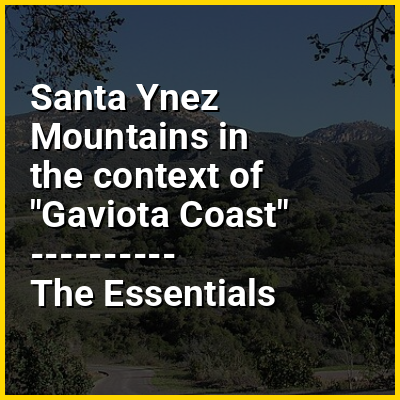
The range is a large fault block of Cenozoic age created by the movements of the Santa Ynez Fault. A very narrow range, the Santa Ynez Mountains rise quickly on its north side and drops off equally dramatically along the range's south face along the Gaviota Coast. The Santa Ynez Mountains begin as a series of volcanic hills near Point Arguello, and gradually transitions eastward into a single, well-defined ridge extending from Gaviota Peak to Matilija Creek. The range is approximately contiguous with the Topatopa Mountains beyond to the east, which terminates abruptly at Sespe Creek.

↓ Menu
HINT:

In this Dossier

Santa Ynez Mountains in the context of Santa Barbara, California

Santa Barbara (Spanish: Santa Bárbara, meaning 'Saint Barbara') is a coastal city in Santa Barbara County, California, of which it is also the county seat. Situated on a south-facing section of coastline, the longest such section on the West Coast of the United States excepting Alaska, the city lies between the steeply rising Santa Ynez Mountains and the Pacific Ocean. Santa Barbara's climate is often described as Mediterranean, and the city has been dubbed "The American Riviera". According to the 2020 U.S. census, the city's population was 88,665.

In addition to being a popular tourist and resort destination, the city has a diverse economy that includes a large service sector, education, technology, health care, finance, agriculture, manufacturing, and local government. In 2004, the service sector accounted for 35% of local employment. In 2024, the biggest employer in Santa Barbara County was government, followed by private education and healthcare, then leisure and hospitality. Together, these accounted for 50.5% of all employment.

View the full Wikipedia page for Santa Barbara, California
↑ Return to Menu

Santa Ynez Mountains in the context of Chaparral

Chaparral (/ˌʃæpəˈræl, ˌæp-/ SHAP-ə-RAL, CHAP-) is a shrubland plant community found primarily in California, southern Oregon, and northern Baja California, part of the California floristic province. It is shaped by a Mediterranean climate (mild wet winters and hot dry summers) and infrequent, high-intensity crown fires. Many chaparral shrubs have hard sclerophyllous evergreen leaves, as contrasted with the associated soft-leaved, drought-deciduous, scrub community of coastal sage scrub, found often on drier, southern-facing slopes.

Three other closely related chaparral shrubland systems occur in southern Arizona, western Texas, and along the eastern side of central Mexico's mountain chains, all having summer rains in contrast to the Mediterranean climate of other chaparral formations.

View the full Wikipedia page for Chaparral
↑ Return to Menu

Santa Ynez Mountains in the context of Point Conception

34°26′53″N 120°28′17″W / 34.448113°N 120.471439°W / 34.448113; -120.471439

Point Conception (Chumash: Humqaq; Spanish: Punta Concepción) is a headland along the Gaviota Coast in southwestern Santa Barbara County, California, United States. It is the point where the Santa Barbara Channel meets the Pacific Ocean, and as the corner between the mostly north-south trending portion of coast to the north and the east-west trending part of the coast near Santa Barbara, it makes a natural division between Southern and Central California, and is commonly used as such in regional weather forecasts. Point Conception Light is at its tip and the Jack and Laura Dangermond Preserve covers some of the surrounding land.

View the full Wikipedia page for Point Conception
↑ Return to Menu