An erg (also sand sea or dune sea, or sand sheet if it lacks dunes) is a broad, flat area of desert covered with wind-swept sand with little or no vegetative cover. The word is derived from the Arabic word ʿirq (عرق), meaning 'dune field'. Strictly speaking, an erg is defined as a desert area that contains more than 125 km (48 sq mi) of aeolian or wind-blown sand and where sand covers more than 20% of the surface. Smaller areas are known as "dune fields". The largest hot desert in the world, the Sahara, covers 9 million square kilometres (3.5×10 sq mi) and contains several ergs, such as the Chech Erg and the Issaouane Erg in Algeria. Approximately 85% of all the Earth's mobile sand is found in ergs that are greater than 32,000 km (12,355 sq mi), the largest being the Rub' al Khali, the Empty Quarter of the Arabian Peninsula. Ergs are also found on other celestial bodies, such as Venus, Mars, and Saturn's moon Titan.
- ⭐ Core Definition: Sand sea
- Sand sea in the context of Tengger mountain range
- Sand sea in the context of Namib Desert
Sand sea in the context of Tengger mountain range
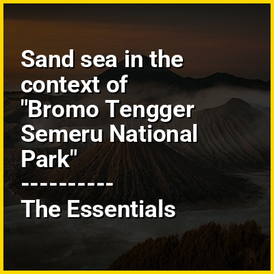
Bromo Tengger Semeru National Park (Indonesian: Taman Nasional Bromo Tengger Semeru; abbreviated as TNBTS) is a national park located in East Java, Indonesia, to the east of Malang, to the west of Lumajang, to the south of Pasuruan and Probolinggo, and to the southeast of Surabaya, the capital of East Java. It is the only conservation area in Indonesia that has a sand sea, the Tengger Sand Sea (Indonesian: Laut Pasir Tengger), across which is the caldera of an ancient volcano (Tengger) from which four new volcanic cones have emerged. This unique feature covers a total area of 5,250 hectares at an altitude of about 2,100 meters (6,900 ft). The massif also contains the highest mountain in Java, Mount Semeru (3,676 meters (12,060 ft)), four lakes (including, the isolated Ranu Tompe), and 50 rivers. It is named after the Tenggerese people. The explosion of the volcano that created the caldera, happened ca. 45.000 years ago, in an event similar to the Krakatau eruption.
The Tengger Sand Sea has been protected since 1919. The Bromo Tengger Semeru National Park was declared a national park in 1982.
View the full Wikipedia page for Tengger mountain rangeSand sea in the context of Namib Desert
The Namib (/ˈnɑːmɪb/, NAH-mib; Portuguese: Namibe) is a coastal desert in Southern Africa. According to the broadest definition, the Namib stretches for more than 2,000 kilometres (1,200 mi) along the Atlantic coasts of Angola, Namibia, and northwest South Africa, extending southward from the Carunjamba River in Angola, through Namibia and to the Olifants River in Western Cape, South Africa. The Namib's northernmost portion, which extends 450 kilometres (280 mi) from the Angola-Namibia border, is known as Moçâmedes Desert, while its southern portion approaches the neighboring Kalahari Desert. From the Atlantic coast eastward, the Namib gradually ascends in elevation, reaching up to 200 kilometres (120 mi) inland to the foot of the Great Escarpment. Annual precipitation ranges from 2 millimetres (0.079 in) in the aridest regions to 200 millimetres (7.9 in) at the escarpment, making the Namib the only true desert in southern Africa. Having endured arid or semi-arid conditions for roughly 55–80 million years, the Namib may be the oldest desert in the world and contains some of the world's driest regions, with only western South America's Atacama Desert to challenge it for age and aridity benchmarks. Most of Namibia's share of the Namib Desert is protected under the environmental protection included in the constitution of the country.
The desert geology consists of sand seas near the coast, while gravel plains and scattered mountain outcrops occur further inland. The sand dunes, some of which are 300 metres (980 ft) high and span 32 kilometres (20 mi) long, are the second-largest in the world after the Badain Jaran Desert dunes in China. Temperatures along the coast are stable and generally range between 9–20 °C (48–68 °F) annually, while temperatures further inland are variable—summer daytime temperatures can exceed 45 °C (113 °F) while nights can be freezing. Fogs that originate offshore from the collision of the cold Benguela Current and warm air from the Hadley cell create a fog belt that frequently envelops parts of the desert. Coastal regions can experience more than 180 days of thick fog a year. While this has proved a major hazard to ships—more than a thousand wrecks litter the Skeleton Coast—it is a vital source of moisture for desert life.
View the full Wikipedia page for Namib Desert