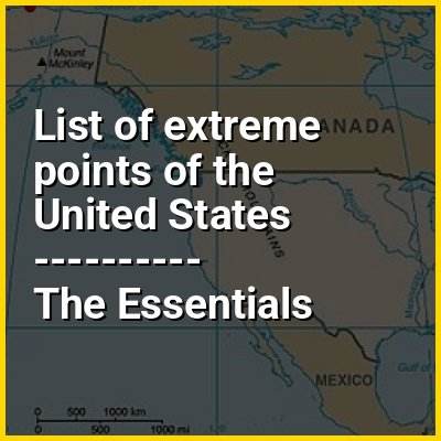
This is a list of points in the United States that are farther north, south, east or west than any other location in the country. Also included are extreme points in elevation, extreme distances and other points of peculiar geographic interest.
HINT:
In this Dossier
- ⭐ Core Definition: List of extreme points of the United States
- List of extreme points of the United States in the context of Guam
- List of extreme points of the United States in the context of Amundsen–Scott South Pole Station
- List of extreme points of the United States in the context of Point Udall (U.S. Virgin Islands)
- List of extreme points of the United States in the context of Corvallis, Oregon
- List of extreme points of the United States in the context of Utqiagvik, Alaska
List of extreme points of the United States in the context of Guam
Guam (/ˈɡwɑːm/ GWAHM; Chamorro: Guåhan [ˈɡʷɑhɑn]) is an island that is an organized, unincorporated territory of the United States in the Micronesia subregion of the western Pacific Ocean. Guam's capital is Hagåtña, and the most populous village is Dededo. It is the westernmost point and territory of the United States, as measured from the geographic center of the U.S. In Oceania, Guam is the largest and southernmost of the Mariana Islands and the largest island in Micronesia. In 2022, its population was 168,801. Chamorros are its largest ethnic group, but a minority on the multiethnic island. The territory spans 210 square miles (540 km; 130,000 acres) and has a population density of 775 per square mile (299/km).
Indigenous Guamanians are the Chamorro, who are related to the Austronesian peoples of the Malay Archipelago, the Philippines, Taiwan, and Polynesia. Unlike most of its neighbors, the Chamorro language is not classified as a Micronesian or Polynesian language. Like Palauan, it possibly constitutes an independent branch of the Malayo-Polynesian language family. The Chamorro people settled Guam and the Mariana islands approximately 3,500 years ago. Portuguese explorer Ferdinand Magellan, while in the service of Spain, was the first European to visit and claim the island in March 1521. Guam was fully colonized by Spain in 1668. Between the 17th and 19th centuries, Guam was an important stopover for Spanish Manila galleons. During the Spanish–American War, the United States captured Guam in June 1898. Under the 1898 Treaty of Paris, Spain ceded Guam to the U.S. effective April 11, 1899.
View the full Wikipedia page for GuamList of extreme points of the United States in the context of Amundsen–Scott South Pole Station
The Amundsen–Scott South Pole Station is a United States scientific research station at the South Pole of the Earth. It is the southernmost point under the jurisdiction (not sovereignty) of the United States. The station is located on the high plateau of Antarctica at 9,301 feet (2,835 m) above sea level. It is administered by the Office of Polar Programs of the National Science Foundation, specifically the United States Antarctic Program (USAP). It is named in honor of Norwegian Roald Amundsen and Briton Robert F. Scott, leaders of the competing first and second expeditions to reach the pole, in the summer of 1911–1912.
The original Amundsen–Scott Station was built by Navy Seabees for the federal government of the United States during November 1956, as part of its commitment to the scientific goals of the International Geophysical Year, an effort lasting from January 1957 to June 1958 to study, among other things, the geophysics of the polar regions of Earth.
View the full Wikipedia page for Amundsen–Scott South Pole StationList of extreme points of the United States in the context of Point Udall (U.S. Virgin Islands)
Point Udall is at the east end of St. Croix in the U.S. Virgin Islands. It is the easternmost point (by travel, not longitude) of the United States including insular areas. It was named in 1969 for Stewart Udall, United States Secretary of the Interior under Presidents John F. Kennedy and Lyndon Johnson.
A sundial known as the Millennium Monument was built above Point Udall for the New Year's celebration in 2000 — it marks the azimuth of the first U.S. sunrise of that year. From the monument an informal trail of moderate difficulty leads down to the point, which is composed primarily of uplifted and rotated volcanic and sedimentary rocks of Upper Cretaceous origin.
View the full Wikipedia page for Point Udall (U.S. Virgin Islands)List of extreme points of the United States in the context of Corvallis, Oregon
Corvallis (/kɔːrˈvælɪs/ kor-VAL-iss) is a city in and the county seat of Benton County in central western Oregon, United States. It is the principal city of the Corvallis, Oregon Metropolitan Statistical Area, which encompasses all of Benton County. As of the 2023 Census Population Estimates, the population was 61,087, making it the 9th most populous city in Oregon. This includes the 38,000 Oregon State University students attending classes in Corvallis, over 5,250 of whom live in one of 16 residence halls on the main campus. Corvallis is the location of Oregon State University's 420-acre (170 ha) main campus, Samaritan Health Services, a top 10 largest non-profit employer in the state, an 84-acre (34 ha) Good Samaritan Regional Medical Center campus, and a 2,200,000-square-foot (200,000 m), 197-acre (80 ha) Hewlett Packard research and development campus. Corvallis is a part of the Silicon Forest. Corvallis is the westernmost city in the contiguous 48 states with a population larger than 50,000.
Corvallis is the largest principal city of the Albany-Corvallis-Lebanon CSA, a Combined Statistical Area that includes the Corvallis metropolitan area (Benton County) and the Albany-Lebanon micropolitan area (Linn County), which had a combined population of 229,209 at the 2023 U.S. Census Estimates.
View the full Wikipedia page for Corvallis, OregonList of extreme points of the United States in the context of Utqiagvik, Alaska
Utqiaġvik (/ˌʊtkiˈɑːɡvɪk/ UUT-kee-AHG-vik; Inupiaq: Utqiaġvik, IPA: [utqe.ɑʁvik]), formerly known as Barrow (/ˈbæroʊ/ BARR-oh), is the borough seat and largest city of the North Slope Borough in the U.S. state of Alaska. Located north of the Arctic Circle, it is one of the northernmost cities and towns in the world and the northernmost in the United States, with nearby Point Barrow as the country's northernmost point.
Utqiaġvik's population was 4,927 at the 2020 census, an increase from 4,212 in 2010. It is the 12th-most populated city in Alaska.
View the full Wikipedia page for Utqiagvik, Alaska