Lehigh Canal in the context of Industrial Revolution in the United States


Lehigh Canal in the context of Industrial Revolution in the United States

⭐ Core Definition: Lehigh Canal

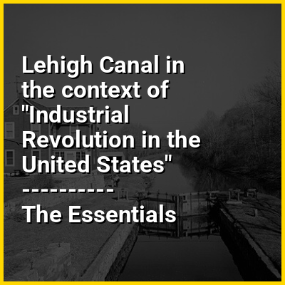
The Lehigh Canal is a navigable canal that begins at the mouth of Nesquehoning Creek on the Lehigh River in the Lehigh Valley and Northeastern regions of Pennsylvania. It was built in two sections over a span of 20 years beginning in 1818. The lower section spanned the distance between Easton and present-day Jim Thorpe. In Easton, the canal met the Pennsylvania Canal's Delaware Division and Morris Canals, which allowed anthracite coal and other goods to be transported further up the U.S. East Coast. At its greatest extent, the Lehigh Canal was 72 miles (116 km) long.

Although the canal was used to transport a variety of products, its most significant cargo was anthracite coal, the highest quality energy source then available in the United States, and pig iron, a vital input product used in manufacturing steel. Both proved cornerstones of the Lehigh Valley's ascent as a central hub of the American Industrial Revolution, and their mining and transportation defined the rugged blue collar character of the Lehigh Valley towns that surrounded the canal.

↓ Menu
HINT:

In this Dossier

Lehigh Canal in the context of Land-grant

A land grant is a gift of real estate—land or its use privileges—made by a government or other authority as an incentive, means of enabling works, or as a reward for services to an individual, especially in return for military service. Grants of land are also awarded to individuals and companies as incentives to develop unused land in relatively unpopulated countries; the process of awarding land grants are not limited to the countries named below. The United States historically gave out numerous land grants as homesteads to individuals desiring to make a farm. The American Industrial Revolution was guided by many supportive acts of legislatures (for example, the Main Line of Public Works legislation of 1863) promoting commerce or transportation infrastructure development by private companies, such as the Cumberland Road turnpike, the Lehigh Canal, the Schuylkill Canal and the many railroads that tied the young United States together.

View the full Wikipedia page for Land-grant
↑ Return to Menu

Lehigh Canal in the context of Bristol, Pennsylvania

Bristol is a borough in Bucks County, Pennsylvania, United States. It is located 23 miles (37 km) northeast of Center City in Philadelphia opposite Burlington, New Jersey, on the Delaware River.

Bristol was settled in 1681 and first incorporated in 1720. After 1834, it became very important to the development of the American Industrial Revolution as the terminus city of the Delaware Canal, providing greater Philadelphia with the day's high quality anthracite coal from the Lehigh Canal via Easton. The canal and a short trip on the Delaware River also gave the town access to the mineral resources available in Connecticut, New Jersey, and New York via each of the Morris Canal, the Delaware and Hudson Canal, and the Delaware and Raritan Canal, and connected the community to those markets and trade from New York City.

View the full Wikipedia page for Bristol, Pennsylvania
↑ Return to Menu

Lehigh Canal in the context of U.S. Route 209 in New York

U.S. Route 209 (US 209) is a 211.74-mile (340.76 km) long U.S. Highway in the states of Pennsylvania and New York. Although the route is a spur of US 9, US 209 never intersects US 9, coming within five miles of the route and making the short connection via New York State Route 199 (NY 199). The southern terminus of the route is at Pennsylvania Route 147 (PA 147) in Millersburg, Pennsylvania. The northern terminus is at US 9W north of Kingston in Ulster, New York, where the road continues east as NY 199.

In Pennsylvania, the highway travels through the length of the Delaware Water Gap National Recreation Area, along the southern part of the Poconos in Monroe and Carbon counties through Jim Thorpe and along parts of the defunct historic Lehigh Canal and Lehigh Valley Railroad then over the divide near Nesquehoning into the Schuylkill Valley along Panther Creek. For part of its route in New York, US 209 runs alongside the defunct Delaware and Hudson Canal, which ran from Port Jervis to Kingston, in each case, following the old land road connections connecting the anthracite coal fields of Northeastern Pennsylvania with the industries and heating customers in New York City.

View the full Wikipedia page for U.S. Route 209 in New York
↑ Return to Menu