Lake Pontchartrain in the context of St. Tammany Parish, Louisiana


Lake Pontchartrain in the context of St. Tammany Parish, Louisiana

⭐ Core Definition: Lake Pontchartrain

Lake Pontchartrain (/ˈpɒnətrn/ PON-chə-trayn; French: Lac Pontchartrain) is an estuary located in southeastern Louisiana in the United States. It covers an area of 630 square miles (1,600 km) with an average depth of 12 to 14 feet (3.7 to 4.3 m). Some shipping channels are kept deeper through dredging. It is roughly oval in shape, about 40 miles (64 km) from west to east and 24 miles (39 km) from south to north. As an estuary, its “Lake” title is a misnomer, but only a slight one, as its passage to the open sea is narrow.

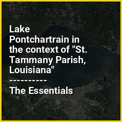
In descending order of area, the estuary is located in parts of six Louisiana parishes: St. Tammany, Orleans, Jefferson, St. John the Baptist, St. Charles, and Tangipahoa. The water boundaries were defined in 1979 (see list of parishes in Louisiana).

↓ Menu
HINT:

In this Dossier

Lake Pontchartrain in the context of Lake Pontchartrain Causeway

The Lake Pontchartrain Causeway (French: Chaussée du lac Pontchartrain), also known simply as The Causeway, is a fixed link composed of two parallel bridges crossing Lake Pontchartrain in southeastern Louisiana, United States. The longer of the two bridges is 23.83 miles (38.35 km) long. The southern terminus of the causeway is in Metairie, Louisiana, and the northern terminus is in Mandeville, Louisiana. Both are in the New Orleans metropolitan area.

The Lake Pontchartrain Causeway holds the Guinness World Record for longest continuous span over water in the world. It previously was listed as longest bridge over water in the world; in 2011, in response to the opening of the Qingdao Jiaozhou Bay Bridge in China, Guinness World Records created two categories for bridges over water: Lake Pontchartrain Causeway then became the longest bridge over water (continuous), while the Jiaozhou Bay Bridge became the longest bridge over water (aggregate).

View the full Wikipedia page for Lake Pontchartrain Causeway
↑ Return to Menu

Lake Pontchartrain in the context of Slidell, Louisiana

Slidell /slˈdɛl/ is a city on the northeast shore of Lake Pontchartrain in St. Tammany Parish, Louisiana, United States. The population was 28,781 at the 2020 census, making it the sixteenth-most populous city in Louisiana. It is part of the New OrleansMetairieKenner metropolitan statistical area.

View the full Wikipedia page for Slidell, Louisiana
↑ Return to Menu

Lake Pontchartrain in the context of Bayou St. John

Bayou St. John (French: Bayou Saint-Jean) is a bayou within the city of New Orleans, Louisiana.

The Bayou as a natural feature drained the swampy land of a good portion of what was to become New Orleans, into Lake Pontchartrain. In its natural state, it extended much farther than today; 18th- and early 19th-century maps show it had tributaries or branches (at least seasonally) reaching into what are now the Broadmoor neighborhood, the New Orleans Central Business District just back from St. Charles Avenue above Lee Circle, the Carrollton neighborhood, the Treme neighborhood, and a branch connecting to Bayou Gentilly.

View the full Wikipedia page for Bayou St. John
↑ Return to Menu

Lake Pontchartrain in the context of Mandeville, Louisiana

Mandeville is a city in St. Tammany Parish, Louisiana, United States. As of the 2020 United States census, its population was 13,192. Mandeville is located on the north shore of Lake Pontchartrain, south of Interstate 12. It is located directly across the lake from the city of New Orleans and its southshore suburbs. Mandeville is part of the New Orleans-Metairie metropolitan statistical area.

View the full Wikipedia page for Mandeville, Louisiana
↑ Return to Menu

Lake Pontchartrain in the context of U.S. Route 51 in Louisiana

U.S. Highway 51 (US 51) is a part of the United States Numbered Highway System that spans 1,277 miles (2,055 km) from LaPlace, Louisiana to a point north of Hurley, Wisconsin. Within the state of Louisiana, the highway travels 69.12 miles (111.24 km) from the national southern terminus at US 61 in LaPlace to the Mississippi state line north of Kentwood.

After heading north through LaPlace to a junction with Interstate 10 (I-10) west of New Orleans, the highway joins I-55 on a 22-mile-long (35 km) twin-span viaduct across the Manchac Swamp. The bridge, which passes between Lakes Pontchartrain and Maurepas, is the second-longest bridge over water in the United States and serves as a vital hurricane evacuation route for the New Orleans metropolitan area.

View the full Wikipedia page for U.S. Route 51 in Louisiana
↑ Return to Menu