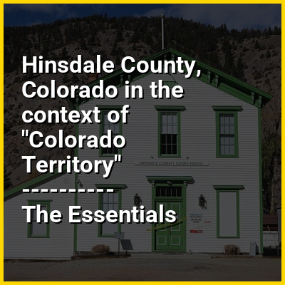
Hinsdale County is a county located in the U.S. state of Colorado. As of the 2020 census, the population was 788, making it the second least-populous county in Colorado. With a population density of only 0.71 inhabitants per square mile (0.27/km), it is also the least-densely populated county in Colorado. The county seat and only incorporated municipality in the county is Lake City. The county is named for George A. Hinsdale, a prominent pioneer and former Lieut. Governor of Colorado Territory.
HINT:
In this Dossier
- ⭐ Core Definition: Hinsdale County, Colorado
- Hinsdale County, Colorado in the context of Lake City, Colorado
- Hinsdale County, Colorado in the context of List of counties in Colorado
- Hinsdale County, Colorado in the context of Rio Grande National Forest
- Hinsdale County, Colorado in the context of Mineral County, Colorado
- Hinsdale County, Colorado in the context of Lake Fork Gunnison River
- Hinsdale County, Colorado in the context of Uncompahgre Peak
Hinsdale County, Colorado in the context of Lake City, Colorado
Lake City is a statutory town that is the county seat of, the most populous community in, and the only incorporated municipality in Hinsdale County, Colorado, United States. The population was 432 at the 2020 census. It is located in the San Juan Mountains in a valley formed by the convergence of Henson Creek and the headwaters of the Lake Fork of the Gunnison River about seven miles (11 km) east of Uncompahgre Peak, a Colorado fourteener.Lake City is named after nearby Lake San Cristobal.This area lies at the southern end of the Colorado Mineral Belt and when rich mineral deposits were discovered the native population was pushed from their tribal lands and the town of Lake City was incorporated in 1873.
View the full Wikipedia page for Lake City, ColoradoHinsdale County, Colorado in the context of List of counties in Colorado
The U.S. State of Colorado is divided into 64 counties. Two of these, the City and County of Denver, which serves as the state capital, and the City and County of Broomfield, have consolidated city and county governments. In addition to Denver and Broomfield, Pitkin County and Weld County operate as home rule counties with their own county charters. The other 60 counties operate under state regulations per Dillon's Rule. Counties are important units of government in Colorado since there are no civil townships or other minor civil divisions.
The United States Census Bureau estimates that El Paso County remains the most populous county in Colorado with a population estimate of 752,772, as of July 1, 2024, while Hinsdale County with a population of 747 is now the least populous. Five of the 64 Colorado counties now have more than 500,000 residents, while 12 counties have fewer than 5,000 residents.
View the full Wikipedia page for List of counties in ColoradoHinsdale County, Colorado in the context of Rio Grande National Forest
Rio Grande National Forest is a 1.86 million-acre (7,530 km) U.S. national forest located in southwestern Colorado. The forest encompasses the San Luis Valley, which is the world's largest agricultural alpine valley, as well as one of the world's largest high deserts located around mountains. The Rio Grande rises in the forest, and the Continental Divide runs along most of its western border. The forest lies in parts of nine counties. In descending order of land area within the forest they are Saguache, Mineral, Conejos, Rio Grande, Hinsdale, San Juan, Alamosa, Archuleta, and Custer counties. Forest headquarters are currently located in Del Norte, Colorado. There are local ranger district offices in Del Norte, La Jara, and Saguache.
View the full Wikipedia page for Rio Grande National ForestHinsdale County, Colorado in the context of Mineral County, Colorado
Mineral County is a county located in the U.S. state of Colorado. As of the 2020 census, the population was 865, making it the third-least populous county in Colorado, behind San Juan County and Hinsdale County. The county seat and only incorporated municipality in the county is Creede. The county was named for the many valuable minerals found in the mountains and streams of the area.
View the full Wikipedia page for Mineral County, ColoradoHinsdale County, Colorado in the context of Lake Fork Gunnison River
Lake Fork Gunnison River (or Lake Fork) is a 64.7-mile-long (104.1 km) tributary of the Gunnison River in Colorado. The river's source is Sloan Lake near Handies Peak in the San Juan Mountains of Hinsdale County. Lake Fork flows through Lake San Cristobal and Lake City before a confluence with the Gunnison River in Blue Mesa Reservoir.
View the full Wikipedia page for Lake Fork Gunnison RiverHinsdale County, Colorado in the context of Uncompahgre Peak
Uncompahgre Peak (/ənkəmˈpɑːɡreɪ/ ) is the sixth highest summit of the Rocky Mountains of North America and the U.S. state of Colorado. The prominent 14,316-foot (4363.46 m) fourteener is the highest summit of the San Juan Mountains and the highest point in the drainage basin of the Colorado River and the Gulf of California. It is located in the Uncompahgre Wilderness in the northern San Juans, in northern Hinsdale County approximately 7 miles (11 km) west of the town of Lake City.
Uncompahgre Peak has a broad summit plateau, rising about 1,500 ft (500 m) above the broad surrounding alpine basins. The south, east and west sides are not particularly steep, but the north face has a 700 ft (210 m) cliff. Like all peaks in the San Juan Mountains, Uncompahgre is of volcanic origin, but is not a volcano. The rock is of poor quality for climbing, precluding an ascent of the north face.
View the full Wikipedia page for Uncompahgre Peak