Hetao in the context of Bayannur


Hetao in the context of Bayannur

⭐ Core Definition: Hetao

Hetao (Chinese: 河套; pinyin: Hétào; lit. 'river loop') is a C-shaped region in northwestern China consisting of a collection of flood plains stretching from the banks of the northern half of the Ordos Loop, a large northerly rectangular bend of the Yellow River, that forms the river's entire middle section. The region makes up the northern margin of the Ordos Basin, bounded in the west by the Helan Mountains, the north by the Yin Mountains, the east by the northern portion of Lüliang Mountains, and the south by the Ordos Desert and the Loess Plateau (separated by the course of the Ming Great Wall).

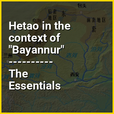
The Hetao region is divided into two main sections — the "West Loop" (Chinese: 西套; pinyin: Xītào) in Ningxia, and the "East Loop" (Chinese: 东套; pinyin: Dōngtào) in Inner Mongolia. The west section includes the alluvial Yinchuan Plain (Chinese: 银川平原, a.k.a. Ningxia Plain) around Shizuishan, Yinchuan, and Wuzhong, and the Weining Plain (Chinese: 卫宁平原) around Zhongwei. The east section is further divided into two parts — the western "Back Loop" (Chinese: 后套; pinyin: Hòutào), which includes the Bayannur Plain (Chinese: 巴彦淖尔平原) around Bayannur and Wuhai; and the eastern "Front Loop" Chinese: 前套; pinyin: Qiántào), which includes the Tumochuan Plain (Chinese: 土默川平原) around Baotou and Hohhot.

↓ Menu
HINT:

In this Dossier

Hetao in the context of Qin's campaign against the Xiongnu

In 215 BC, Qin Shi Huang ordered General Meng Tian to set out against the Xiongnu tribes in the Ordos region, and establish a frontier region at the loop of the Yellow River. Believing that the Xiongnu were a possible threat as they had repeatedly raided Chinese lands before, the emperor launched a preemptive strike against the Xiongnu with the intention to expand his empire.

View the full Wikipedia page for Qin's campaign against the Xiongnu
↑ Return to Menu

Hetao in the context of Ordos Desert

The Ordos Desert (simplified Chinese: ; traditional Chinese: 鄂爾多斯沙漠; pinyin: È'ěrduōsī Shāmò) is a desert/steppe region in Northwest China, administered under the prefecture of Ordos City in the Inner Mongolian Autonomous Region (centered ca. 39°N 109°E / 39°N 109°E / 39; 109). It extends over an area of approximately 90,650 km (35,000 sq mi), and comprises two sub-deserts: China's 7th-largest desert, the Kubuqi Desert, in the north; and China's 8th-largest desert, the Mu Us Desert, in the south. Wedged between the arable Hetao region to the north and the Loess Plateau to the south, the soil of the Ordos Desert is mostly a mixture of dry clay and sand, and as a result is poorly suited for agriculture.

View the full Wikipedia page for Ordos Desert
↑ Return to Menu

Hetao in the context of Kubuqi Desert

The Kubuqi Desert (simplified Chinese: 库布齐沙漠; traditional Chinese: 庫布齊沙漠; pinyin: Kùbùqí Shāmò), also known via its Mongolian name as the Hobq Desert, is a desert within the Ordos Basin in northwestern China, under the administration of the Inner Mongolian Ordos City. Located between the Hetao plains and the Loess Plateau, it is part of the Ordos Desert along with the neighboring Mu Us Desert to its south, and is the seventh-largest desert in China with an area of 18,600 km (7,200 sq mi).

View the full Wikipedia page for Kubuqi Desert
↑ Return to Menu