Hayward Fault Zone in the context of Richmond, California


Hayward Fault Zone in the context of Richmond, California

⭐ Core Definition: Hayward Fault Zone

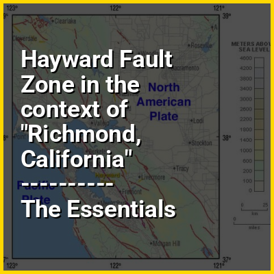
The Hayward Fault Zone is a right-lateral strike-slip geologic fault zone capable of generating destructive earthquakes. The fault was first named in the Lawson Report of the 1906 San Francisco Earthquake in recognition of its involvement in the earthquake of 1868. This fault is about 74 mi (119 km) long, situated mainly along the western base of the hills on the east side of San Francisco Bay. It runs through densely populated areas, including Richmond, El Cerrito, Berkeley, Oakland, San Leandro, Castro Valley, Hayward, Union City, Fremont, and San Jose.

The Hayward Fault is parallel to the San Andreas Fault, which lies offshore and through the San Francisco Peninsula. To the east of the Hayward Fault lies the Calaveras Fault. In 2007, the Hayward Fault was discovered to have merged with the Calaveras Fault east of San Jose at a depth of 4.0 mi (6.4 km), with the potential of creating earthquakes much larger than previously anticipated. Some geologists have suggested that the Southern Calaveras should be renamed as the Southern Hayward.

↓ Menu
HINT:

In this Dossier

Hayward Fault Zone in the context of Aseismic creep

In geology, aseismic creep or fault creep is measurable surface displacement along a fault in the absence of notable earthquakes. Aseismic creep may also occur as "after-slip" days to years after an earthquake. Notable examples of aseismic slip include faults in California (e.g. Calaveras Fault, Hayward Fault, and San Andreas Fault).

View the full Wikipedia page for Aseismic creep
↑ Return to Menu

Hayward Fault Zone in the context of Santa Clara Valley

The Santa Clara Valley (Spanish: Valle de Santa Clara) is a geologic trough in Northern California that extends 90 miles (140 km) south–southeast from San Francisco to Hollister. The longitudinal valley is bordered on the west by the Santa Cruz Mountains and on the east by the Diablo Range; the two coastal ranges meet south of Hollister. The San Francisco Bay borders the valley to the north, and fills much of the northern third of the valley. The valley floor is an alluvial plain that formed in the graben (tectonic depression) between the San Andreas Fault to the west and the Hayward and Calaveras faults to the east.Within the valley and surrounding the bay on three sides are the urban communities of San Mateo County, Santa Clara County, and Alameda County, while the narrow southern reaches of the valley extend into rural San Benito County to Hollister. In practical terms, the central portion of the Santa Clara Valley is often considered by itself, contained entirely within Santa Clara County.

The valley, named after the Spanish Mission Santa Clara, was for a time known as the Valley of Heart's Delight for its high concentration of orchards, flowering trees, and plants. Until the 1960s it was the largest fruit-producing and packing region in the world, with 39 canneries. The growing high-tech industry in the 1960s transformed the area from farmland to densely populated cities, and it became referred to as Silicon Valley.

View the full Wikipedia page for Santa Clara Valley
↑ Return to Menu

Hayward Fault Zone in the context of 1868 Hayward earthquake

The 1868 Hayward earthquake occurred in the San Francisco Bay Area, California, United States on October 21. With an estimated moment magnitude of 6.3–6.7 and a maximum Mercalli intensity of IX (Violent), it was the most recent large earthquake to occur on the Hayward Fault Zone. It caused significant damage and a number of deaths throughout the region, and was known as the "Great San Francisco earthquake" prior to the 1906 San Francisco earthquake and fire.

View the full Wikipedia page for 1868 Hayward earthquake
↑ Return to Menu