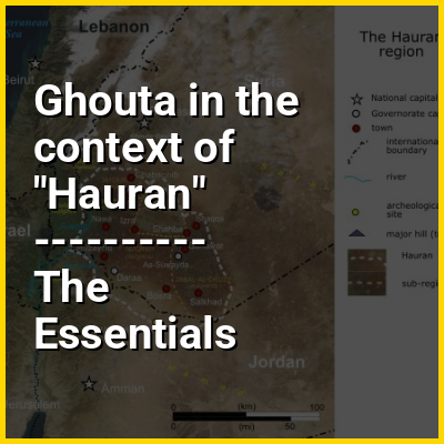
Ghouta in the context of "Hauran"

Play Trivia Questions online!

or

Skip to study material about Ghouta in the context of "Hauran"


In this Dossier

Ghouta in the context of Auranitis

The Hauran (Arabic: حَوْرَان, romanizedḤawrān; also spelled Hawran or Houran) is a region that spans parts of southern Syria and northern Jordan. It is bound in the north by the Ghouta oasis, to the northeast by the al-Safa field, to the east and south by the Harrat al-Sham and to the west by the Golan Heights. Traditionally, the Hauran consists of three subregions: the Nuqrah and Jaydur plains, the Jabal al-Druze massif, and the Lajat volcanic field. The population of the Hauran is largely Arab, but religiously heterogeneous; most inhabitants of the plains are Sunni Muslims belonging to large agrarian clans, while Druze form the majority in the eponymous Jabal al-Druze and a significant Greek Orthodox and Greek Catholic minority inhabit the western foothills of Jabal al-Druze. The region's largest towns are Daraa, al-Ramtha, and al-Suwayda.

From the mid-1st century BC, the region was governed by the Roman Empire's Herodian and Nabatean client kings until it was formally annexed by the empire in the 2nd century AD. The Hauran prospered under Roman rule (106–395 AD) and its villages functioned as largely self-governing units, some of which developed into imperial cities. The region continued to prosper in the Byzantine era (395–634), during which different Arab tribes ruled the Hauran on Byzantium's behalf, including the Salihids (5th century) and Ghassanids (6th century) until the Muslim conquest in the mid-630s. For much of the Islamic era until Ottoman rule (1517–1917), the Hauran was divided into the districts of al-Bathaniyya and Ḥawrān, which corresponded to the Classical Batanea and Auranitis. Medieval Muslim geographers variously described these districts as prosperous, well-watered and well-populated.

↑ Return to Menu

Ghouta in the context of Douma, Syria

Douma (Arabic: دُومَا, romanizedDūmā) is a city in Syria. Its centre is about 10 km (6 mi) northeast of the centre of Damascus. Being the capital of Rif Dimashq Governorate, the city is also the administrative centre of Douma District. Douma is a major city of the region known as Ghouta, for the peri-urban settlements to the east and south of Damascus.

↑ Return to Menu

Ghouta in the context of Siege of Damascus (1148)

The siege of Damascus took place between 24 and 28 July 1148, during the Second Crusade. It ended in a crusader defeat and led to the disintegration of the crusade. The two main Christian forces that marched to the Holy Land in response to Pope Eugene III and Bernard of Clairvaux's call for the Second Crusade were led by Kings Louis VII of France and Conrad III of Germany. Both faced disastrous marches across Anatolia in the months that followed, with most of their armies being destroyed. The original focus of the crusade was Edessa (Urfa), but in Jerusalem, the preferred target of King Baldwin III and the Knights Templar was Damascus. At the Council of Acre, magnates from France, Germany, and the Kingdom of Jerusalem decided to divert the crusade to Damascus.

The crusaders decided to attack Damascus from the west, where orchards of Ghouta would provide them with a constant food supply. Having arrived outside the walls of the city, they immediately put it to siege, using wood from the orchards. On 27 July, the crusaders decided to move to the plain on the eastern side of the city, which was less heavily fortified but had much less food and water. Afterwards, the local crusader lords refused to carry on with the siege, and the three kings had no choice but to abandon the city. The entire crusader army retreated back to Jerusalem by 28 July.

↑ Return to Menu