Eganville, Ontario in the context of Renfrew County


Eganville, Ontario in the context of Renfrew County

⭐ Core Definition: Eganville, Ontario

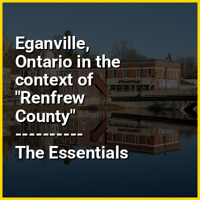
Eganville is an unincorporated community within a deep limestone valley carved at the Fifth Chute of the Bonnechere River in Renfrew County, Ontario, Canada. Eganville lies within the Township of Bonnechere Valley.

Eganville is known as the Ordovician Fossil Capital of Canada. There are many fossils to be found in this area from approximately 500 million years ago (in a time before dinosaurs) including coral, crinoids, trilobites, cephalopods, gastropods, pelecypods, stromatolites, and brachiopods. The Bonnechere Valley is also a gateway to some of north-eastern Ontario's best-known tourist destinations, including the nearby Bonnechere Caves. The caves are located under a hill of limestone, said by geologists to have been the bottom of a tropical sea 500 million years ago. The Bonnechere Museum, through a partnership with the Bonnechere Caves, offers fossil hunts four times in a summer season where people can practice finding fossils and even take one home if they find a good one. Eganville is also home to a Geo-Heritage Walking Trail located along the Bonnechere River which features a fossil pit, a visit to an old quarry, a trench, wild plants, and scenic lookouts.

↓ Menu
HINT:

In this Dossier

Eganville, Ontario in the context of Ontario Highway 60

King's Highway 60, commonly referred to as Highway 60, is a provincially maintained highway in the Canadian province of Ontario. The 255.8-kilometre (158.9 mi) highway serves as the primary corridor through Algonquin Provincial Park, where it is dedicated as the Frank McDougall Parkway. East of Algonquin Park, the route serves east–west traffic in the highlands of central Ontario. It begins at Highway 11 in Huntsville and ends at Highway 17 near Renfrew.

Highway 60 was designated in 1937 between Huntsville and Lake Dore, near where it met Highway 41. During the 1940s, the route shared a common termini with Highway 41 at Golden Lake. When Highway 41 was extended north to Pembroke in 1957, Highway 60 was routed along it between Golden Lake and Eganville. It was extended east to Highway 17 in downtown Renfrew circa 1961. It was extended further east when Highway 17 was rerouted around Renfrew in 1977, establishing the current route.

View the full Wikipedia page for Ontario Highway 60
↑ Return to Menu

Eganville, Ontario in the context of Ontario Highway 41

King's Highway 41, commonly referred to as Highway 41, is a provincially maintained highway in the Canadian province of Ontario. The 159.6-kilometre (99.2 mi) highway travels in a predominantly north–south direction across eastern Ontario, from Highway 7 in Kaladar to Highway 148 in Pembroke. The majority of this distance crosses through a rugged forested region known as Mazinaw Country. However, the route enters the agricultural Ottawa Valley near Dacre. A significant portion of Highway 41 follows the historic Addington Colonization Road, built in 1854.

Highway 41 was first assumed in 1935, though ironically the initial route is no longer part of the highway. It was extended north to meet the eastern terminus of Highway 60 at Golden Lake in 1937. The following year, a southern discontinuous section of the highway was established north from Picton in Prince Edward County. A series of changes in 1957 extended Highway 60 east to Renfrew and Highway 41 north to Pembroke; this established a concurrency of the two highways through Eganville, which remains to this day.

View the full Wikipedia page for Ontario Highway 41
↑ Return to Menu