East Stour, Kent in the context of Ashford Green Corridor


East Stour, Kent in the context of Ashford Green Corridor

⭐ Core Definition: East Stour, Kent

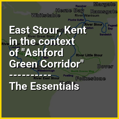
The River East Stour is one of the tributaries of the Great Stour in Kent. The East Stour, 10.3 miles (16.5 km) long,) rises on the Greensand ridge at Postling north of Hythe as a number of small streams. It then flows under the M20 motorway to continue in a westward direction: the river meanders across the Low Weald plain, passing Mersham on the way. The East Stour's confluence with the Great Stour is on both sides of Pledge's Mill at the foot of East Hill, Ashford.

The South Willesborough Dykes are on the banks of the East Stour in Willesborough, Ashford and helps form part of the Ashford Green Corridor.

↓ Menu
HINT:

In this Dossier

East Stour, Kent in the context of River Stour, Kent

The River Stour (/ˈstaʊər/, rhymes with "hour") is a river in Kent, England that flows into the North Sea at Pegwell Bay. Above Plucks Gutter, where the Little Stour joins it, the river is normally known as the Great Stour. The upper section of the river, above its confluence with the East Stour at Ashford is sometimes known as the Upper Great Stour or West Stour. In the tidal lower reaches, the artificial Stonar Cut short cuts a large loop in the natural river.

The Stour has Kent's second largest catchment area (the River Medway having the largest). The lower part of the river is tidal; its original mouth was on the Wantsum Channel, an important sea route in medieval times. The river has three major tributaries, and many minor ones. For much of its length, it flows in a generally south-west to north-east direction.

View the full Wikipedia page for River Stour, Kent
↑ Return to Menu