Dyfi hills in the context of Afon Dulas


Dyfi hills in the context of Afon Dulas

⭐ Core Definition: Dyfi hills

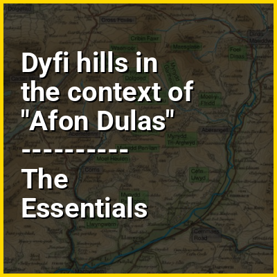
The Dyfi hills (sometimes anglicised to Dovey hills) are a range situated in the southernmost area of Snowdonia, bounded by the River Dyfi on the east and south sides, by the Afon Dulas on the west and the Afon Cerist to the north. They lie to the west of the Aran Fawddwy range, north-east of the Tarren y Gesail range and are a subgroup of the Cadair Idris group.

The highest peaks of the Dyfi hills are Maesglase (2,218 feet (676 m)), Waun-oer (2,200 feet (670 m)) and Cribin Fawr (2,162 feet (659 m)) which lie at the north of the range. Further south the peaks are lower and the hills more gently rounded.

↓ Menu
HINT:

In this Dossier

Dyfi hills in the context of Snowdonia

Snowdonia, or Eryri (Welsh: [ɛrəri] ), is a mountainous region and national park in North Wales. It contains all 15 mountains in Wales over 3000 feet high, including the country's highest, Snowdon (Yr Wyddfa), which is 1,085 metres (3,560 ft) tall. These peaks are all part of the Snowdon, Glyderau, and Carneddau ranges in the north of the region. The lower Moelwynion and Moel Hebog ranges lie immediately to the south.

The national park has an area of 823 square miles (2,130 km) (the fourth-largest in the UK), and covers most of central and southern Gwynedd and the western part of Conwy County Borough. This is much larger than the area traditionally considered Snowdonia, and in addition to the five ranges above includes the Rhinogydd, Cadair Idris, and Aran ranges and the Dyfi Hills. It also includes most of the coast between Porthmadog and Aberdyfi. The park was the first of the three national parks of Wales to be designated, in October 1951, and the third in the UK after the Peak District and Lake District, which were established in April and May 1951 respectively. The park received 3.89 million visitors in 2015.

View the full Wikipedia page for Snowdonia
↑ Return to Menu

Dyfi hills in the context of Waun-oer

Waun-oer is a mountain in Snowdonia, North Wales, situated approximately four miles to the south-west of Aran Fawddwy. It is one of the peaks in the Dyfi hills, a subgroup of the Cadair Idris group. It is a top of Maesglase and the summit consists of a trig point that crowns an uneven grassy plateau. It is connected to Cribin Fawr to the east and Mynydd Ceiswyn to the south. To the north lies Cadair Idris, while Tarren y Gesail lies to the west.

View the full Wikipedia page for Waun-oer
↑ Return to Menu

Dyfi hills in the context of Mynydd Dolgoed

Mynydd Dolgoed or Craig Portas is a mountain in southern Snowdonia, Wales. It is a long ridge running from a low summit between the valleys of the Afon Angell and the Nant Ceiswyn, north east to the cliff of Craig Portas above Dinas Mawddwy. The next mountain in the ridge to south-east is Mynydd Hendre-ddu, while to the south lie Mynydd Llwydiarth and Mynydd Cymerau.

It is one of the Dyfi hills.

View the full Wikipedia page for Mynydd Dolgoed
↑ Return to Menu

Dyfi hills in the context of Cribin Fawr

Cribin Fawr is a mountain in Snowdonia, North Wales, situated approximately four miles to the south-west of Aran Fawddwy. It is one of the peaks in the Dyfi hills, a subgroup of the Cadair Idris group. It is a top of Maesglase, connected to its parent peak by the Craig Portas ridge. The top of Cribin Fawr is a large open plateau of peat bog. To the west is Waun-oer, to the north Cadair Idris, to the south Maesglase and Glasgwm to the east.

View the full Wikipedia page for Cribin Fawr
↑ Return to Menu