Counties of Northern Ireland in the context of "Derry"

Play Trivia Questions online!

or

Skip to study material about Counties of Northern Ireland in the context of "Derry"

Ad spacer

⭐ Core Definition: Counties of Northern Ireland

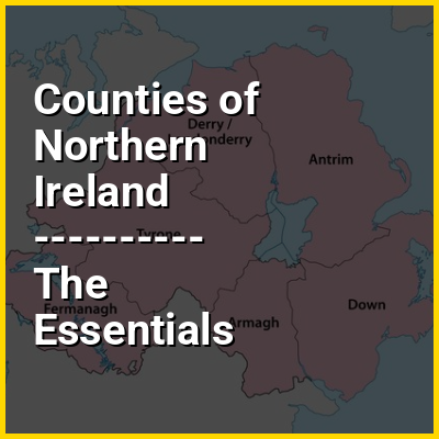
Northern Ireland is divided into six counties, namely Antrim, Armagh, Down, Fermanagh, Londonderry and Tyrone. Six largely rural administrative counties based on these were among the eight primary local government areas of Northern Ireland from its 1921 creation until 1973. The other two local government areas were the urban county boroughs of Derry (geographically part of the County of Londonderry) and Belfast (geographically split between the counties of Antrim and Down).

The six counties date from the Kingdom of Ireland; five were created between 1570 and 1591 in the Tudor conquest of Ireland, while county Londonderry dates from 1613 and the Plantation of Ulster. The total number of counties in the island of Ireland is 32, with Northern Ireland and the Republic of Ireland often respectively called "the Six Counties" and "the Twenty-Six Counties", especially by Irish nationalists opposed to the partition of Ireland. The 1898–1973 administrative counties were subdivided into county districts. The two-tier county/district system was replaced with a single-tier of "districts", numbering 26 in 1973 and rationalised into 11 in 2015. The areas corresponding to the six counties and two county boroughs remain in use for some administrative purposes, and the six historic counties retain a popular identity.

↓ Menu

>>>PUT SHARE BUTTONS HERE<<<
In this Dossier

Counties of Northern Ireland in the context of Northern Ireland

Northern Ireland is a part of the United Kingdom in the north-east of the island of Ireland. It has been variously described as a country, province or region. Northern Ireland shares an open border to the south and west with the Republic of Ireland. At the 2021 census, its population was 1,903,175, making up around 3% of the UK's population and 27% of the population on the island of Ireland. The Northern Ireland Assembly, established by the Northern Ireland Act 1998, holds responsibility for a range of devolved policy matters, while other areas are reserved for the UK Government. The government of Northern Ireland cooperates with the government of Ireland in several areas under the terms of the Good Friday Agreement. The Republic of Ireland also has a consultative role on non-devolved governmental matters through the British–Irish Governmental Conference (BIIG).

Northern Ireland was created in 1921, when Ireland was partitioned by the Government of Ireland Act 1920, creating a devolved government for the six northeastern counties. As was intended by unionists and their supporters in Westminster, Northern Ireland had a unionist majority, who wanted to remain in the United Kingdom; they were generally the Protestant descendants of colonists from Britain. Meanwhile, the majority in Southern Ireland (which became the Irish Free State in 1922), and a significant minority in Northern Ireland, were Irish nationalists (generally Catholics) who wanted a united independent Ireland. Today, the former generally see themselves as British and the latter generally see themselves as Irish, while a Northern Irish or Ulster identity is claimed by a significant minority from all backgrounds.

↑ Return to Menu

Counties of Northern Ireland in the context of Counties of Ireland

The counties of Ireland (Irish: Contaetha na hÉireann) are historic administrative divisions of the island. They began as Norman structures, and as the powers exercised by the Cambro-Norman barons and the Old English nobility waned over time, new offices of political control were established at a county level. The number of counties varied depending on the time period, however thirty-two is the traditionally accepted and used number.

In 1921, upon the partition of Ireland, six of the traditional counties became part of Northern Ireland. In Northern Ireland, counties ceased to be used for local government in 1973. Districts are instead used. In the Republic of Ireland, some counties have been split, resulting in the creation of new counties: there are currently 26 counties, 3 cities and 2 cities and counties that demarcate areas of local government in the Republic.

↑ Return to Menu

Counties of Northern Ireland in the context of County Antrim

County Antrim (named after the town of Antrim, from Irish Aontroim, meaning 'lone ridge') is one of the six counties of Northern Ireland, located within the historic province of Ulster. Adjoined to the north-east shore of Lough Neagh, the county covers an area of 3,086 square kilometres (1,192 sq mi) and has a population of 651,321, as of the 2021 census. County Antrim has a population density of 211 people per square kilometre or 546 people per square mile. It is also one of the thirty-two traditional counties of Ireland.

The Glens of Antrim offer isolated rugged landscapes, the Giant's Causeway is a unique landscape and a UNESCO World Heritage Site, Bushmills produces whiskey, and Portrush is a popular seaside resort and nightlife area. The majority of Belfast, the capital city of Northern Ireland, is in County Antrim, with the remainder being in County Down.

↑ Return to Menu

Counties of Northern Ireland in the context of County Armagh

County Armagh (Irish: Contae Ard Mhacha [ˌaːɾˠd̪ˠ ˈwaxə]) is one of the six counties of Northern Ireland and one of the traditional thirty-two counties of Ireland. It is located in the province of Ulster and adjoins the southern shore of Lough Neagh. It borders the Northern Irish counties of Tyrone to the west and Down to the east. The county borders Louth and Monaghan to the south and southwest, which are in the Republic of Ireland. It is named after its county town, Armagh, which derives from the Irish Ard Mhacha, meaning "Macha's height". Macha was a sovereignty goddess in Irish mythology and is said to have been buried on a wooded hill around which the town of Armagh grew. County Armagh is colloquially known as the "Orchard County" because of its many apple orchards.

The county covers an area of 1,327 km (512 sq mi), making it the smallest of Northern Ireland's six counties by size and the sixth-smallest county on the island of Ireland. With a population of 194,394 as of the 2021 census, it is the fourth-most populous county in both Northern Ireland and Ulster. It is the 10th most populous of Ireland's 32 traditional counties, as well as the fifth-most densely populated. In addition to the city of Armagh and the western portion of the city of Newry, notable towns in the county include Lurgan, Portadown and Craigavon.

↑ Return to Menu

Counties of Northern Ireland in the context of County Down

County Down (Irish: Contae an Dúin) is one of the six counties of Northern Ireland, one of the nine counties of Ulster and one of the traditional thirty-two counties of Ireland. It covers an area of 961 sq mi (2,490 km) and has a population of 552,261. It borders County Antrim to the north, the Irish Sea to the east, County Armagh to the west, and County Louth across Carlingford Lough to the southwest.

In the east of the county is Strangford Lough and the Ards Peninsula. The largest settlement is Bangor, a city on the northeast coast. Three other large towns and cities are on its border: Newry lies on the western border with County Armagh. Lisburn and Belfast lie on the northern border with County Antrim. Down contains the southernmost point of Northern Ireland (Cranfield Point) and the easternmost point of Ireland (Burr Point).

↑ Return to Menu

Counties of Northern Ireland in the context of County Fermanagh

County Fermanagh (/fərˈmænə/, fər-MAN; from Irish Fir Manach / Fear Manach, meaning 'men of Manach') is one of the thirty-two counties of Ireland, one of the nine counties of Ulster and one of the six counties of Northern Ireland.

The county covers an area of 1,691 km (653 sq mi) and had a population of 63,585 as of 2021. Enniskillen is the county town and largest in both size and population.

↑ Return to Menu

Counties of Northern Ireland in the context of County Londonderry

County Londonderry (Ulster-Scots: Coontie Lunnonderrie), also known as County Derry (Irish: Contae Dhoire), is one of the six counties of Northern Ireland, one of the thirty-two counties of Ireland and one of the nine counties of Ulster. Before the partition of Ireland, it was one of the counties of the Kingdom of Ireland from 1613 onward and then of the United Kingdom after the Acts of Union 1800. Adjoining the north-west shore of Lough Neagh, the county covers an area of 2,118 km (818 sq mi) and today has a population of about 252,231.

Since 1972, the counties in Northern Ireland, including Londonderry, have no longer been used by the state as part of the local administration. Following further reforms in 2015, the area is now governed under three different districts: Derry and Strabane, Causeway Coast and Glens and Mid-Ulster. Despite no longer being used for local government and administrative purposes, it is sometimes used in a cultural context in All-Ireland sporting and cultural events (i.e. Derry GAA).

↑ Return to Menu

Counties of Northern Ireland in the context of County Tyrone

County Tyrone (/tɪˈrn/; from Irish Tír Eoghain, meaning 'land of Eoghan' [tʲiːɾʲ ˈoːnʲ]) is one of the six counties of Northern Ireland, one of the nine counties of Ulster and one of the thirty-two traditional counties of Ireland. Its county town is Omagh.

Adjoined to the south-west shore of Lough Neagh, the county covers an area of 1,261 square miles (3,266 km), making it the largest of Northern Ireland's six counties by size, and the second largest county in Ulster after Donegal. With a population of 188,383 as of the 2021 census, Tyrone is the 5th most populous county in both Northern Ireland and Ulster, and the 11th most populous county on the island of Ireland. The county derives its name and general geographic location from Tír Eoghain, a Gaelic kingdom under the O'Neill dynasty which existed until the 17th century.

↑ Return to Menu