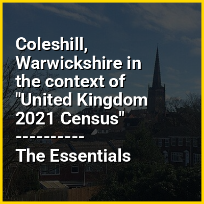
Coleshill (/ˈkoʊzɪl/ KOH-zil) is a market town and civil parish in the North Warwickshire district of Warwickshire, England, taking its name from the River Cole, on which it stands. It had a population of 6,900 in the 2021 Census, and is situated 11 miles (18 km) east of Birmingham, 8.5 miles (13.7 km) southeast of Sutton Coldfield, 11 miles (18 km) south of Tamworth, 13 miles (21 km) northwest of Coventry by road and 12.5 miles (20 km) west of Nuneaton. It borders the suburban parish village of Kingshurst in the Metropolitan Borough of Solihull to the west. It is also home to the 505-year-old Coleshill School seated next to the dual carriageway.
HINT:
In this Dossier
- ⭐ Core Definition: Coleshill, Warwickshire
- Coleshill, Warwickshire in the context of Birmingham metropolitan area
- Coleshill, Warwickshire in the context of River Blythe
- Coleshill, Warwickshire in the context of North Warwickshire
- Coleshill, Warwickshire in the context of Chelmsley Wood
Coleshill, Warwickshire in the context of Birmingham metropolitan area
The Birmingham Metropolitan Area is an urban agglomeration located in the West Midlands region of England with a population of around 4.3 million people, making it the second largest metropolitan area in the United Kingdom. It comprises the three cities (Birmingham, Coventry, Wolverhampton) and four metropolitan boroughs (Dudley, Sandwell, Solihull, Walsall) which make up the Metropolitan county of the West Midlands, along with its commuter zones, which extend into the neighbouring district authorities of Bromsgrove and Redditch in Worcestershire; Cannock Chase, Lichfield, South Staffordshire and Tamworth in Staffordshire; and all five district authorities of Warwickshire, including the towns of Bedworth, Coleshill, Nuneaton, Royal Leamington Spa, and Warwick itself.
A number of sizeable settlements fall outside the morphological boundaries of the Birmingham Metropolitan Area but still form part of its economic and infrastructural hinterland. Amongst these, the cathedral city of Lichfield, the towns of Cannock, Hednesford and Rugeley in Staffordshire, Rugby and Stratford-upon-Avon in Warwickshire, and Kidderminster in the Wyre Forest District of Worcestershire.
View the full Wikipedia page for Birmingham metropolitan areaColeshill, Warwickshire in the context of River Blythe
The River Blythe flows through the English Midlands from central Warwickshire, through the Borough of Solihull and on to Coleshill in north Warwickshire. It runs along the Meriden Gap in the Midlands Plateau, is fed by the River Cole and is a tributary of the River Tame beside the West Midland Bird Club's Ladywalk reserve. This then joins the River Trent, whose waters reach the North Sea via the Humber Estuary.
The river rises at various sources near Earlswood Lakes, but the principal tributary is listed as Spring Brook (52°21′03″N 1°50′37″W / 52.350915°N 1.843601°W; grid reference SP107725). From here it winds north east, skirting Cheswick Green, towards Solihull. Here it passes through a local wildlife park, Malvern and Brueton Park and Nature Reserve, where it briefly splits/outpours for approximately 250 metres to form Brueton Park Lake. From here it meanders east, past several old country houses—Old Berry Hall, Ravenshaw Hall and Eastcote Hall—before turning sharply south towards Barston, which is encircled within a large meander of the river. At Temple Balsall the Cuttle Brook feeds the river, which now arcs north, and again close by Barston. Past Hampton in Arden the river is fed by Shadow Brook, at Diddington Hall. Travelling further north it passes to the east of Coleshill, and is fed by the River Cole, only a few hundred yards before it itself feeds into the River Tame (52°31′20″N 1°41′18″W / 52.522317°N 1.688242°W; grid reference SP212916), at Ladywalk Nature Reserve.
View the full Wikipedia page for River BlytheColeshill, Warwickshire in the context of North Warwickshire
North Warwickshire is a local government district with borough status in Warwickshire, England. The borough includes the two towns of Atherstone (where the council is based) and Coleshill, and the large villages of Hartshill, Kingsbury, Mancetter, Polesworth and Water Orton along with smaller villages and surrounding rural areas.
The area historically had a large coal mining industry, but the last coal mine in the area, Daw Mill at Arley, closed in 2013. The borough's landscape is primarily of the mildly undulating agricultural variety, with the North Warwickshire plateau rising to 177 m (581 ft) above sea-level at Bentley Common, 2.5 miles southwest of Atherstone. The most significant bodies of water within North Warwickshire are Kingsbury Water Park, Shustoke Reservoir, the River Blythe and the mid-section of the Coventry Canal.
View the full Wikipedia page for North WarwickshireColeshill, Warwickshire in the context of Chelmsley Wood
Chelmsley Wood, sometimes called just Chelmsley, is a town and civil parish in the Metropolitan Borough of Solihull, West Midlands, England, with a population of 12,453. It is located near Birmingham Airport and the National Exhibition Centre. It lies about eight miles east of Birmingham city centre and 5 miles to the north of Solihull. The town is also close to both Coleshill and Water Orton in Warwickshire, the county the area was historically part of.
In 1966 Birmingham City Council compulsorily purchased the ancient woodland and built the 15,590 dwelling council estate to rehouse families on its council house waiting list. With the rise in unemployment in the 1970s parts of the estate suffered from deprivation and anti-social behaviour. The area established a town council.
View the full Wikipedia page for Chelmsley Wood