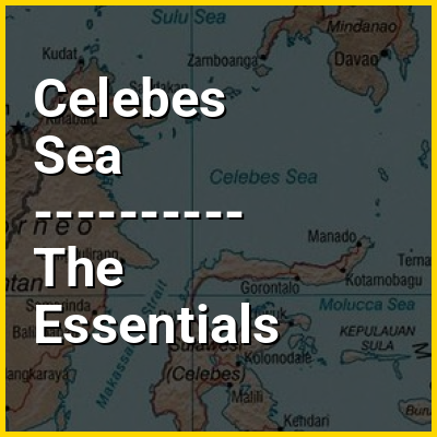
Celebes Sea in the context of "Tawau"

Play Trivia Questions online!

or

Skip to study material about Celebes Sea in the context of "Tawau"


⭐ Core Definition: Celebes Sea

The Celebes Sea (/ˈsɛlɪbz, səˈlbiz/ SEL-ib-eez, sə-LEE-beez; Filipino: Dagat Selebes) or Sulawesi Sea (Malay: Laut Sulawesi; Indonesian: Laut Sulawesi; pronounced [ˌlaʊt̪̚ sulaˈwesi]) of the western Pacific Ocean is bordered on the north by the Sulu Archipelago and Sulu Sea and Mindanao Island of the Philippines, on the east by the Sangihe Islands chain, on the south by Sulawesi's Minahasa Peninsula, and the west by northern Kalimantan in Indonesia. It extends 605 km (376 mi) north-south by 780 km (485 mi) east-west and has a total surface area of 472,000 km (182,000 sq mi), to a maximum depth of 6,220 metres (20,406 ft). South of the Cape Mangkalihat, the sea opens southwest through the Makassar Strait into the Java Sea.

The Celebes Sea is a piece of an ancient ocean basin that formed 42 million years ago in a locale removed from any landmass. By 20 million years ago, the earth's crust movement had moved the basin close enough to the Indonesian and Philippine volcanoes to receive emitted debris. By 10 million years ago the Celebes Sea was inundated with continental debris, including coal, which was shed from a growing young mountain on Borneo and the basin had docked against Eurasia.

↓ Menu

In this Dossier

Celebes Sea in the context of Philippines

The Philippines, officially known as the Republic of the Philippines, is an archipelagic country in Southeast Asia. Located in the western Pacific Ocean, it consists of 7,641 islands, with a total area of roughly 300,000 square kilometers, which are broadly categorized in three main geographical divisions from north to south: Luzon, Visayas, and Mindanao. With a population of over 112 million, it is the world's fourteenth-most-populous country.

The Philippines is bounded by the South China Sea to the west, the Philippine Sea to the east, and the Celebes Sea to the south. It shares maritime borders with Taiwan to the north, Japan and the Korean Peninsula to the northeast, Palau to the east and southeast, Indonesia to the south, Malaysia to the southwest, Vietnam to the west, and China to the northwest. It has diverse ethnicities and a rich culture. Manila is the country's capital, and its most populated city is Quezon City. Both are within Metro Manila.

↑ Return to Menu

Celebes Sea in the context of Sulu Sea

The Sulu Sea (Filipino: Dagat Sulu; Tausug: Dagat sin Sūg; Malay: Laut Sulu; Spanish: Mar de Joló) is a body of water in the southwestern area of the Philippines, separated from the South China Sea in the northwest by Palawan and from the Celebes Sea in the southeast by the Sulu Archipelago. Borneo is found to the southwest and Visayas to the northeast.

The Sulu Sea contains a number of islands. The Cuyo Islands and the Cagayan Islands are part of the province of Palawan whereas Mapun and the Turtle Islands are part of the province of Tawi-Tawi. Sulu Sea is also where the Tubbataha Reef National Marine Park, one of the World Heritage Sites is located.

↑ Return to Menu

Celebes Sea in the context of Sulu archipelago

The Sulu Archipelago (Tausug: Kapū'-pūan sin Sūg; Sulat Sūg: كَفُوْءْفُوْأَنْ سِنْ سُوْݢْ‎; Filipino: Kapuluan ng Sulu) is a chain of islands in the Pacific Ocean, in the southwestern Philippines. The archipelago forms the northern limit of the Celebes Sea and southern limit of the Sulu Sea. The Sulu Archipelago islands are within the Mindanao island group, consisting of the Philippines provinces of Basilan, Sulu, and Tawi-Tawi; hence the archipelago is sometimes referred to as Basulta, derived from the first syllables of the three provinces.

The archipelago is not, as is often supposed, the remains of a land bridge between Borneo and the Philippines. Rather, it is the exposed edge of small submarine ridges produced by tectonic tilting of the sea bottom. Basilan, Jolo, Tawi-Tawi and other islands in the group are extinct volcanic cones rising from the southernmost ridge. Tawi-Tawi, the southernmost island of the group, has a serpentine basement-complex core with a limestone covering. This island chain is an important migration route for birds.

↑ Return to Menu

Celebes Sea in the context of East Kalimantan

East Kalimantan (Indonesian: Kalimantan Timur) is a province of Indonesia. Its territory comprises the eastern portion of Borneo/Kalimantan. It had a population of about 3.03 million at the 2010 census (within the present boundary), and 3.766 million at the 2020 census; the official estimate as at mid 2024 was 4,092,984. Its capital is the city of Samarinda, the most populous city on the entire island of Borneo.

East Kalimantan has a total area of 127,346.92 square kilometres (49,168.92 sq mi) and is the third least densely populated province in Kalimantan (after North Kalimantan and Central Kalimantan). The majority of the region shares a maritime border to the east with West Sulawesi and Central Sulawesi; its Cape Mangkalihat separates the Makassar Strait from the Celebes Sea. Its former northernmost region was split off on 25 October 2012 and is now the separate province of North Kalimantan; meanwhile it still shares land border to the west with West Kalimantan and Central Kalimantan; to its south, East Kalimantan borders South Kalimantan. The province bordered Sabah, Malaysia before the creation of North Kalimantan, and still has a short border with Sarawak, Malaysia through Mahakam Ulu Regency.

↑ Return to Menu

Celebes Sea in the context of Minahasa Peninsula

The Minahasa Peninsula, or spelled Minahassa, also known as the Northern Sulawesi Peninsula or Gorontalo Peninsula, is one of the four principal peninsulas on the Indonesian island of Sulawesi. It stretches north from the central part of the island, before turning to the east and forming the northern boundary of the Gulf of Tomini and the southern boundary of the Celebes Sea.

The peninsula is divided into North Sulawesi and Gorontalo provinces, as well as part of Central Sulawesi. Its largest cities are Manado and Gorontalo, while Palu is located at its base.

↑ Return to Menu

Celebes Sea in the context of Strait of Makassar

Makassar Strait (Indonesian: Selat Makassar) is a strait between the islands of Borneo and Sulawesi in Indonesia. To the north it joins the Celebes Sea, while to the south it meets the Java Sea. To the northeast, it forms the Sangkulirang Bay south of the Mangkalihat Peninsula. The strait is an important regional shipping route in Southeast Asia.

The Mahakam River and Karangan River of Borneo empty into the strait.

↑ Return to Menu