Catalan Pre-Coastal Range in the context of "Montseny Massif"

Play Trivia Questions online!

or

Skip to study material about Catalan Pre-Coastal Range in the context of "Montseny Massif"


⭐ Core Definition: Catalan Pre-Coastal Range

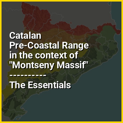
The Catalan Pre-Coastal Range (Catalan: Serralada Prelitoral Catalana) is a system of mountain ranges running parallel to the Mediterranean Sea coast in Catalonia. It is part of the Catalan Mediterranean System. Its main axis runs between the Catalan Transversal Range and the Serra de l'Espina, which connects with the Ports de Tortosa-Beseit, part of the Iberian System. The highest point is 1,706.7 m at the Montseny Massif.

↓ Menu

In this Dossier

Catalan Pre-Coastal Range in the context of Pre-Pyrenees

The Pre-Pyrenees are the foothills of the Pyrenees.

↑ Return to Menu

Catalan Pre-Coastal Range in the context of Catalan Central Depression

The Catalan Central Depression (Catalan: Depressió Central Catalana) is a natural depression between the Pre-Pyrenees and the Catalan Pre-Coastal Range in Spain. It widens towards the west, linking with the Ebro Depression, Catalan: Depressió de l'Ebre, of which it could be considered an eastern extension. The Catalan Central Depression is about 180 km long with an average width of 50 km.

↑ Return to Menu

Catalan Pre-Coastal Range in the context of Catalan Transversal Range

The Catalan Transversal Range (Serralada Transversal) is a system of minor mountain ranges at the eastern end of the Pre-Pyrenees, between the Osona and Garrotxa comarques. The existence of the Catalan Transversal Range has made communications in the northern areas of Catalonia difficult in the past, especially between Northeastern Catalonia (Catalan Coastal Depression, with cities like Girona, Figueres and La Jonquera) and Western Catalonia (Catalan Mediterranean System; Lleida, Cervera and further west to Aragón), a problem that has been partly solved with the development of the Eix Transversal.

↑ Return to Menu

Catalan Pre-Coastal Range in the context of Catalan Coastal Range

The Catalan Coastal Range (Catalan: Serralada Litoral Catalana, IPA: [sərəˈlaðə lituˈɾal kətəˈlanə]) is a system of mountain ranges running parallel to the Mediterranean Sea coast in Catalonia, Spain. It is part of the Catalan Mediterranean System. Its main axis runs between the Foix River and the Roses Gulf and the average altitude is around 500 m. The highest point is 763 m at the Montnegre.

↑ Return to Menu

Catalan Pre-Coastal Range in the context of Catalan Coastal Depression

The Catalan Coastal Depression (Catalan: Depressió Litoral Catalana) is a natural depression between the Catalan Pre-Coastal Range and the Mediterranean Sea. It is part of the Catalan Mediterranean System.

↑ Return to Menu

Catalan Pre-Coastal Range in the context of Congost river

The Congost (Catalan pronunciation: [kuŋˈgost]) is a river basin of the Besòs river and owes its name to the narrow gorge through which it passes, largely through the Catalan pre-coastal mountain range in Spain.

↑ Return to Menu

Catalan Pre-Coastal Range in the context of Vallès

El Vallès (Catalan pronunciation: [əl bəˈʎɛs], or simply Vallès) is a historical county in Catalonia, Spain, located in the center of the Catalan Pre-Coastal Range. It is nowadays represented by two separate administrative divisions (comarques) which are part of the Barcelona Province: the Western Vallès, which has two capitals, Sabadell and Terrassa; and the Eastern Vallès, with Granollers as its capital.

The present division of Vallès has its historical roots in the legal districts of Granollers and Terrassa, established in 1834. However, the first time this subdivision was explicitly used as sanctioned by law was in 1936, with the official division of Catalonia in comarques. In 2015, four of the municipalities in Eastern Vallès became part of a newly created comarca: the Moianès. Some parts of the Vallès region belong to the metropolitan area of Barcelona and the Àmbit Metropolità de Barcelona(metropolitan region of Barcelona), and is nowadays connected with Barcelona with public transportations systems such as FGC's so-called Metro del Vallès.

↑ Return to Menu

Catalan Pre-Coastal Range in the context of Onyar

The Onyar (Catalan: [uˈɲa]; Spanish: Oñar [oˈɲaɾ] ; Undarius in Latin) is a Spanish river in Girona, Catalonia that begins at the Guilleries massif at the apex of the Catalan Transversal Range and the Pre-Coastal Range. It joins the Ter at the city of Girona, and crosses the city from south to north, separating the city into the old part (on the right side) and the more modern part (on the left side).

During its course through the city, the Onyar river is joined by the waters coming from the Monar or Conda irrigation channel (which in turn comes from the Ter river), a channel that used to irrigate the orchards in the "Mercadal" area. As it journeys further north, the river converges with the Güell and the Galligans rivers near the crossing with the railway. Finally, it merges into the Ter river near the Pedret neighborhood.

↑ Return to Menu

Catalan Pre-Coastal Range in the context of Coll de Balaguer

The Coll de Balaguer is a mountain pass in Catalonia, Spain. It is located at the point where the Catalan Pre-Coastal Range reaches the sea, in L'Almadrava, within the Vandellòs i l'Hospitalet de l'Infant municipality, Baix Camp.

Despite its scant altitude this pass has been an important communication line between the Terres de l'Ebre region and the Camp de Tarragona since ancient times. Nowadays highways AP-7, N-340, as well as the RENFE Barcelona-Valencia railway line go through the Coll de Balaguer pass.

↑ Return to Menu