Cantino planisphere in the context of "Portuguese maritime exploration"

Play Trivia Questions online!

or

Skip to study material about Cantino planisphere in the context of "Portuguese maritime exploration"


⭐ Core Definition: Cantino planisphere

The Cantino planisphere or Cantino world map is a manuscript Portuguese world map preserved at the Biblioteca Estense in Modena, Italy. It is named after Alberto Cantino, an agent for the Duke of Ferrara, who successfully smuggled it from Portugal to Italy in 1502. It measures 220 x 105 cm.

The planisphere is the earliest surviving map showing Portuguese geographic discoveries in the east and west and is particularly notable for portraying a fragmentary record of the Brazilian coast, which the Portuguese explorer Pedro Álvares Cabral explored in 1500, the southern coast of Greenland, studied in the late 1490s, and the African coast of the Atlantic and Indian Oceans with remarkable accuracy and detail.

↓ Menu

👉 Cantino planisphere in the context of Portuguese maritime exploration

Portuguese maritime explorations resulted in numerous territories and maritime routes recorded by the Portuguese on journeys during the 15th and 16th centuries. Portuguese sailors were at the vanguard of European exploration, chronicling and mapping the coasts of Africa and Asia, then known as the East Indies, Canada and Brazil (the West Indies), in what became known as the Age of Discovery.

Methodical expeditions started in 1419 along the coast of West Africa under the sponsorship of prince Henry the Navigator, whence Bartolomeu Dias reached the Cape of Good Hope and entered the Indian Ocean in 1488. Ten years later, in 1498, Vasco da Gama led the first fleet around Africa to the Indian subcontinent, arriving in Calicut and starting a maritime route from Portugal to India. Portuguese explorations then proceeded to southeast Asia, where they reached Japan in 1542, forty-four years after their first arrival in India. In 1500, the Portuguese nobleman Pedro Álvares Cabral became the first European to discover Brazil.

↓ Explore More Topics
In this Dossier

Cantino planisphere in the context of Mauritius

Mauritius, officially the Republic of Mauritius, is an island country in the Indian Ocean, about 2,000 kilometres (1,100 nautical miles) off the southeastern coast of East Africa, east of Madagascar. It includes the main island (also called Mauritius), as well as Rodrigues, Agaléga, St. Brandon (Cargados Carajos shoals) and the Chagos Archipelagos. The islands of Mauritius and Rodrigues, along with nearby Réunion (a French overseas department), are part of the Mascarene Islands. The main island of Mauritius, where the population is concentrated, hosts the capital and largest city, Port Louis. The country spans 2,040 square kilometres (790 sq mi) and has an exclusive economic zone covering approximately 2,000,000 square kilometres (580,000 square nautical miles).

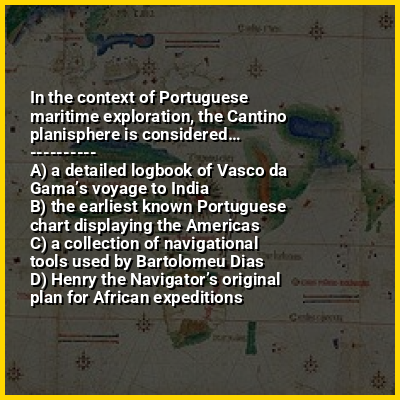
The 1502 Portuguese Cantino planisphere has led some historians to speculate that Arab sailors were the first to discover the uninhabited island around 975, naming it Dina Arobi. Called Ilha do Cirne or Ilha do Cerne on early Portuguese maps, the island was visited by Portuguese sailors in 1507. A Dutch fleet, under the command of Admiral Van Warwyck, landed at what is now the Grand Port District and took possession of the island in 1598, renaming it after Maurice, Prince of Orange. Short-lived Dutch attempts at permanent settlement took place over a century aimed at exploiting the local ebony forests, establishing sugar and arrack production using cane plant cuttings from Java together with over three hundred Malagasy slaves, all in vain. When French colonisation began in 1715, the island was renamed "Isle de France". In 1810, the United Kingdom seized the island and under the Treaty of Paris, France ceded Mauritius and its dependencies to the United Kingdom. The British colony of Mauritius now included Rodrigues, Agaléga, St. Brandon, the Chagos Archipelago, and, until 1906, the Seychelles. Mauritius and France dispute sovereignty over the island of Tromelin, the treaty failing to mention it specifically. Mauritius became the British Empire's main sugar-producing colony and remained a primarily sugar-dominated plantation-based colony until independence, in 1968. In 1992, the country abolished the monarchy, replacing it with the president.

↑ Return to Menu

Cantino planisphere in the context of Evolution of the Portuguese Empire

This article is a comprehensive list of all former possessions of Portugal.

↑ Return to Menu