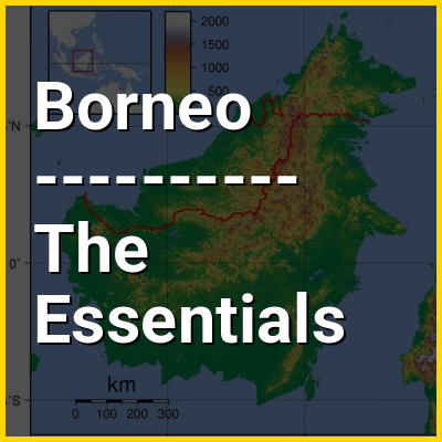
Borneo in the context of Endemism


Borneo in the context of Endemism

Borneo Study page number 1 of 9

Play TriviaQuestions Online!

or

Skip to study material about Borneo in the context of "Endemism"


⭐ Core Definition: Borneo

Borneo (/ˈbɔːrni/) is the third-largest island in the world, with an area of 748,168 km (288,869 sq mi), and population of 23,053,723 (2020 national censuses). Situated at the geographic centre of Maritime Southeast Asia, it is one of the Greater Sunda Islands, located north of Java, west of Sulawesi, and east of Sumatra. The island is crossed by the equator, which divides it roughly in half. In Indonesia, the island is also known as Kalimantan, which is also the name of the Indonesian region located on the island.

The geology of Borneo was formed beginning in the Mesozoic. It formed part of Sundaland, a region connected to mainland Asia, until it became isolated by sea level rise at the end of the last ice age. With seven unique ecoregions, including large expanses of some of the oldest tropical rainforests in the world, Borneo is rich in biodiversity and endemic species.

↓ Menu
HINT:

In this Dossier

Borneo in the context of Indonesia

Indonesia, officially the Republic of Indonesia, is a country in Southeast Asia and Oceania, between the Indian and Pacific oceans. Comprising over 17,000 islands, including Sumatra, Java, Sulawesi, and parts of Borneo and New Guinea, Indonesia is the world's largest archipelagic state and the 14th-largest country by area, at 1,904,569 square kilometres (735,358 square miles). With over 280 million people, Indonesia is the world's fourth-most-populous country and the most populous Muslim-majority country. Java, the world's most populous island, is home to more than half of the country's population.

Indonesia operates as a presidential republic with an elected legislature and consists of 38 provinces, nine of which have special autonomous status. Jakarta, the largest city, is the world's second-most-populous urban area. Indonesia shares land borders with Papua New Guinea, Timor-Leste, and East Malaysia, as well as maritime borders with Singapore, Peninsular Malaysia, Vietnam, Thailand, the Philippines, Australia, Palau, and India. Despite its large population and densely populated regions, Indonesia has vast areas of wilderness that support one of the world's highest levels of biodiversity.

View the full Wikipedia page for Indonesia
↑ Return to Menu

Borneo in the context of South China Sea

The South China Sea is a marginal sea of the Western Pacific Ocean. It is bounded in the north by South China, in the west by the Indochinese Peninsula, in the east by the islands of Taiwan and northwestern Philippines (mainly Luzon, Mindoro, and Palawan), and in the south by Borneo, eastern Sumatra, and the Bangka Belitung Islands, encompassing an area of around 3,500,000 km (1,400,000 sq mi). It communicates with the East China Sea via the Taiwan Strait, the Philippine Sea via the Luzon Strait, the Sulu Sea via the straits around Palawan, the Java Sea via the Karimata and Bangka Straits, and directly with the Gulf of Thailand. Additionally, the Gulf of Tonkin is part of the South China Sea.

$3.4 trillion of the world's $16 trillion maritime shipping passed through the South China Sea in 2016. Oil and natural gas reserves have been found in the area. The Western Central Pacific accounted for 14% of the world's commercial fishing in 2010.

View the full Wikipedia page for South China Sea
↑ Return to Menu

Borneo in the context of Riau Islands

The Riau Islands (Indonesian: Kepulauan Riau; Jawi: كڤولاوان رياو) is a province of Indonesia consisting of a group of islands located in the western part of the country. It was established in 2002 after being separated from the neighboring Riau Province. The capital of the province is Tanjung Pinang, while the largest city is Batam. It shares a maritime border with Riau and Jambi to the west, Bangka Belitung Islands to the south, Singapore to the northeast, Malaysia and West Kalimantan to the east, and Vietnam and Cambodia to the north. It comprises a total of 2,408 islands (1,798 having names) scattered between Sumatra, Malay Peninsula, and Borneo including the Riau Archipelago. Situated on one of the world's busiest shipping lanes along the Malacca Strait and the Natuna Sea (South China Sea), the province shares water borders with neighboring countries such as Singapore, Malaysia, and Brunei. The Riau Islands also have relatively large potential mineral resources and energy, as well as marine resources.

The Riau Islands have played a significant role in the maritime history and civilization of the Nusantara region. Between the 7th and 13th centuries, the area was influenced by the powerful Srivijaya Empire, a major maritime kingdom that controlled trade routes along the Malacca Strait. Evidence of Srivijaya's influence in the Riau Islands can be seen from the discovery of the Pasir Panjang Inscription [id] in Karimun Regency, which shows the existence of religious practices through Buddha's footprints, indicating early settlement and the spread of Buddhism long before the arrival of Islam.

View the full Wikipedia page for Riau Islands
↑ Return to Menu

Borneo in the context of Malaysia

Malaysia is a country in Southeast Asia. A federal constitutional monarchy, it consists of 13 states and three federal territories, separated by the South China Sea into two regions: Peninsular Malaysia on the Indochinese Peninsula and East Malaysia on the island of Borneo. Peninsular Malaysia shares land and maritime borders with Thailand, as well as maritime borders with Singapore, Vietnam, and Indonesia; East Malaysia shares land borders with Brunei and Indonesia, and maritime borders with the Philippines and Vietnam. Kuala Lumpur is the country's national capital, largest city, and the seat of the legislative branch of the federal government, while Putrajaya is the federal administrative capital, representing the seat of both the executive branch (the Cabinet, federal ministries, and federal agencies) and the judicial branch of the federal government. With a population of over 34 million, it is the world's 42nd-most populous country.

The country has its origins in the Malay kingdoms, which, from the 18th century on, became subject to the British Empire, along with the British Straits Settlements protectorate. During World War II, British Malaya, along with other nearby British and American colonies, was occupied by the Empire of Japan. Following three years of occupation, Peninsular Malaysia was briefly unified as the Malayan Union in 1946 until 1948 when it was restructured as the Federation of Malaya. The country achieved independence on 31 August 1957. On 16 September 1963, independent Malaya united with the then British crown colonies of North Borneo, Sarawak, and Singapore to become Malaysia. In August 1965, Singapore was expelled from the federation and became a separate, independent country.

View the full Wikipedia page for Malaysia
↑ Return to Menu

Borneo in the context of Straits Settlements

The Straits Settlements (Malay: Negeri-Negeri Selat) were a group of British territories located in Southeast Asia. Originally established in 1826 as part of the territories controlled by the British East India Company, the Straits Settlements came under control of the British Raj in 1858 and then under direct British control as a Crown colony in 1867. In 1946, following the end of World War II and the Japanese occupation, the colony was dissolved as part of Britain's reorganisation of its Southeast Asian dependencies in the area.

The Straits Settlements originally consisted of the four individual settlements of Penang, Singapore, Malacca and Dinding. Christmas Island and the Cocos (Keeling) Islands were added in 1886. The island of Labuan, off the coast of Borneo, was also incorporated into the colony with effect from 1 January 1907, becoming a separate settlement within it in 1912. Most of the territories now form part of Malaysia, from which Singapore separated in 1965. The Cocos (Keeling) Islands and Christmas Island were transferred from Singapore to Australian control in 1955 and 1958, respectively. Their administrations were combined in 1996 to form the Australian Indian Ocean Territories.

View the full Wikipedia page for Straits Settlements
↑ Return to Menu

Borneo in the context of Crown Colony of North Borneo

The Crown Colony of North Borneo was a Crown colony on the island of Borneo established in 1946 shortly after the dissolution of the British Military Administration. The Crown Colony of Labuan joined the new Crown colony during its formation. It was succeeded as the state of Sabah through the formation of the Federation of Malaysia on 16 September 1963.

View the full Wikipedia page for Crown Colony of North Borneo
↑ Return to Menu

Borneo in the context of Crown Colony of Sarawak

The Crown Colony of Sarawak was a British Crown colony on the island of Borneo, established in 1946, shortly after the dissolution of the British Military Administration. It was succeeded as the state of Sarawak through the formation of the Federation of Malaysia on 16 September 1963.

View the full Wikipedia page for Crown Colony of Sarawak
↑ Return to Menu

Borneo in the context of Brunei

Brunei, officially Brunei Darussalam, formally known as State of Brunei, is a country in Southeast Asia, situated on the northern coast of the island of Borneo. Apart from its coastline on the South China Sea, it is completely surrounded by the Malaysian state of Sarawak, with its territory bifurcated by the Sarawak district of Limbang. Brunei is the only sovereign state entirely on Borneo; the remainder of the island is divided between its multi-landmass neighbours of Malaysia and Indonesia. As of 2025, the country had a population of 466,330, of whom approximately 64,409 resided in the capital and largest city of Bandar Seri Begawan. Its official language is Malay, and Sunni Islam is the state religion of the country, although other religions are nominally tolerated. The government of Brunei is an absolute monarchy ruled by the Sultan, and it implements a fusion of English common law and jurisprudence inspired by Islam, including sharia.

At the Sultanate of Brunei's peak during the reign of Sultan Bolkiah (1485–1528), the state is claimed to have had control over the most of Borneo, including modern-day Sarawak and Sabah, as well as the Sulu archipelago and the islands off the northwestern tip of Borneo. There are also claims to its historical control over Seludong, in which Southeast Asian scholars believe the name of the location in question is actually in reference to Mount Selurong, in Indonesia, or Serudong River in eastern Sabah. The maritime state of Brunei was visited by the surviving crew of the Magellan Expedition in 1521, and in 1578 it fought against Spain in the Castilian War.

View the full Wikipedia page for Brunei
↑ Return to Menu

Borneo in the context of East Indies

The East Indies (or simply the Indies) is a term used in historical narratives of the Age of Discovery. The Indies broadly referred to various lands in the East or the Eastern Hemisphere, particularly the islands and mainlands found in and around the Indian Ocean by Portuguese explorers, soon after the Cape Route was discovered. In a narrow sense, the term was used to refer to the Malay Archipelago, which today comprises the Philippine Archipelago, Indonesian Archipelago, Borneo, and New Guinea. Historically, the term was used in the Age of Discovery to refer to the coasts of the landmasses comprising the Indian subcontinent and the Indochinese Peninsula along with the Malay Archipelago.

View the full Wikipedia page for East Indies
↑ Return to Menu

Borneo in the context of Cloud

In meteorology, a cloud is an aerosol consisting of a visible mass of miniature liquid droplets, ice crystals, or other particles, suspended in the atmosphere of a planetary body or similar space. Water or various other chemicals may comprise the droplets and crystals. On Earth, clouds are formed as a result of saturation of the air when it is cooled to its dew point, or when it gains sufficient moisture, usually in the form of water vapor, from an adjacent source to raise the dew point to the ambient temperature.

Clouds are seen in the Earth's homosphere, which includes the troposphere, stratosphere, and mesosphere.Nephology is the science of clouds, which is undertaken in the cloud physics branch of meteorology. The World Meteorological Organization uses two methods of naming clouds in their respective layers of the homosphere, Latin and common name.

View the full Wikipedia page for Cloud
↑ Return to Menu

Borneo in the context of Greater Sunda Islands

The Greater Sunda Islands (Indonesian and Malay: Kepulauan Sunda Besar) are four tropical islands situated within the Indonesian Archipelago, in the Pacific Ocean. The islands, Borneo, Java, Sulawesi and Sumatra, are internationally recognised for their ecological diversity and rich culture. Together with the Lesser Sunda Islands to their southeast, they comprise the archipelago known as the Sunda Islands.

Mainly part of Indonesia, each island is diverse in its ethnicity, culture and biological attributes. The islands have a long and rich history which has shaped their cultural backgrounds.

View the full Wikipedia page for Greater Sunda Islands
↑ Return to Menu

Borneo in the context of Java Sea

The Java Sea (Indonesian: Laut Jawa, Javanese: Segara Jawa) is an extensive shallow sea on the Sunda Shelf, between the Indonesian islands of Borneo to the north, Java to the south, Sumatra to the west, and Sulawesi to the east. Karimata Strait to its northwest links it to the South China Sea. Although generally considered to be a part of the western Pacific Ocean, the Java Sea is occasionally considered to be a part of the Indian Ocean.

View the full Wikipedia page for Java Sea
↑ Return to Menu

Borneo in the context of Tropical forest

Tropical forests are forested ecoregions with tropical climates – that is, land areas approximately bounded by the tropics of Cancer and Capricorn, but possibly affected by other factors such as prevailing winds.

Some tropical forest types are difficult to categorize. While forests in temperate areas are readily categorized on the basis of tree canopy density, such schemes do not work well in tropical forests. There is no single scheme that defines what a forest is, in tropical regions or elsewhere. Because of these difficulties, information on the extent of tropical forests varies between sources. However, tropical forests are extensive, making up just under half the world's forests. The tropical domain has the largest proportion of the world's forests (45 percent), followed by the boreal, temperate and subtropical domains.

View the full Wikipedia page for Tropical forest
↑ Return to Menu

Borneo in the context of Orangutan

Orangutans are great apes native to the rainforests of Indonesia and Malaysia. They are now found only in parts of Borneo and Sumatra, but during the Pleistocene they ranged throughout Southeast Asia and South China. Classified in the genus Pongo, orangutans were originally considered to be one species. In 1996, they were divided into two species: the Bornean orangutan (P. pygmaeus, with three subspecies) and the Sumatran orangutan (P. abelii); a third species, the Tapanuli orangutan (P. tapanuliensis), was identified definitively in 2017. The orangutans are the only surviving members of the subfamily Ponginae, which diverged genetically from the other hominids (gorillas, chimpanzees, and humans) between 19.3 and 15.7 million years ago.

The most arboreal of the great apes, orangutans spend most of their time in trees. They have proportionally long arms and short legs, and have reddish-brown hair covering their bodies. Adult males weigh about 75 kg (165 lb), while females weigh about 37 kg (82 lb). Dominant adult males develop distinctive cheek pads or flanges and make long calls that attract females and intimidate rivals; younger subordinate males do not and more resemble adult females. Orangutans are the most solitary of the great apes: social bonds occur primarily between mothers and their dependent offspring. Fruit is the most important component of an orangutan's diet, but they will also eat vegetation, bark, honey, insects and bird eggs. They can live over 30 years, both in the wild and in captivity.

View the full Wikipedia page for Orangutan
↑ Return to Menu

Borneo in the context of Bornean orangutan

The Bornean orangutan (Pongo pygmaeus) is an orangutan species endemic to the island of Borneo. It belongs to the only genus of great apes native to Asia and is the largest of the three Pongo species. It has a coarse, reddish coat and up to 1.5 m (4 ft 11 in) long arms. It is sexually dimorphic — males are larger than females and develop large cheek pads (flanges), for example.

The Bornean orangutan inhabits Borneo lowland rain forests and Borneo montane rain forests up to an elevation of 1,500 m (4,900 ft). Its diet includes fruits, seeds, flowers, bird eggs, sap and vines. It is highly intelligent, displaying tool use and distinct cultural patterns. It is critically endangered, with deforestation, palm oil plantations, and hunting posing a serious threat to its survival.

View the full Wikipedia page for Bornean orangutan
↑ Return to Menu

Borneo in the context of Mount Kinabalu

Mount Kinabalu (Dusun: Gayo Ngaran or Nulu Nabalu, Malay: Gunung Kinabalu) is the highest mountain in Malaysia and Maritime Southeast Asia, it is located on the Island of Borneo in Sabah. With a height of 4,098 metres (13,445 ft), it is the third-highest peak of an island on Earth, the 28th highest peak in Southeast Asia, and 20th most prominent mountain in the world. The mountain is located in Ranau district, West Coast Division of Sabah, Malaysia. It is protected as Kinabalu Park, a World Heritage Site.

In 1997, a re-survey using satellite technology was conducted. It established Mount Kinabalu had a summit (known as Low's Peak) height of 4,095 m (13,435 ft) above sea level, some 6 m (20 ft) less than the hitherto published figure of 4,101 m (13,455 ft).

View the full Wikipedia page for Mount Kinabalu
↑ Return to Menu

Borneo in the context of Sulawesi

Sulawesi (/ˌsləˈwsi/ SOO-lə-WAY-see, Indonesian: [ˌsulaˈwesi]), also known as Celebes (/ˈsɛlɪbz, səˈlbz/ SEL-ib-eez, sə-LEE-beez), is an island in Indonesia. One of the four Greater Sunda Islands, and the world's 11th-largest island, it is situated east of Borneo, west of the Maluku Islands, and south of Mindanao and the Sulu Archipelago. Within Indonesia, only Sumatra, Borneo, and Papua are larger in territory, and only Java and Sumatra are more populous.

The landmass of Sulawesi includes four peninsulas: the northern Minahasa Peninsula, the East Peninsula, the South Peninsula, and the Southeast Peninsula. Three gulfs separate these peninsulas: the Gulf of Tomini between the northern Minahasa and East peninsulas, the Tolo Gulf between the East and Southeast peninsulas, and the Gulf of Boni between the South and Southeast peninsulas. The Strait of Makassar runs along the western side of the island and separates the island from Borneo.

View the full Wikipedia page for Sulawesi
↑ Return to Menu

Borneo in the context of East Malaysia

East Malaysia (Malay: Malaysia Timur), or the Borneo States, also known as Malaysian Borneo, is the part of Malaysia on and near the island of Borneo, the world's third-largest island. East Malaysia comprises the states of Sabah, Sarawak, and the Federal Territory of Labuan. The small independent nation of Brunei comprises two enclaves in Sarawak. To the south and southeast is the Indonesian portion of Borneo, Kalimantan. East Malaysia lies to the east of Peninsular Malaysia (also known as the States of Malaya), the part of the country on the Malay Peninsula. The two are separated by the South China Sea.

East Malaysia is less populated and has fewer developed settlements than West Malaysia. While West Malaysia contains the country's major cities (Kuala Lumpur, Johor Bahru, and George Town), East Malaysia is larger and much more abundant in natural resources, particularly oil and gas reserves. In the pan-regional style, city status is reserved for only a few settlements, including Kuching, Kota Kinabalu and Miri. Various other significant settlements are classified as towns, including many with over 100,000 residents. East Malaysia includes a significant portion of the biodiverse Borneo lowland rain forests and Borneo montane rain forests.

View the full Wikipedia page for East Malaysia
↑ Return to Menu

Borneo in the context of Peninsular Malaysia

Peninsular Malaysia, historically known as Peninsular Malaya or simply Malaya prior to 1963, and also known as West Malaysia and the Malaysian Peninsula, is the southern part of the Malay Peninsula in Mainland Southeast Asia along with the nearby islands that are part of Malaysia. Its area totals approximately 131,956 km (50,948 sq mi). It makes up nearly 40% of the total area of Malaysia; the other 60% is on the island of Borneo, also known as East Malaysia.

The present-day land border with Thailand to the north originates from the Anglo–Siamese Treaty of 1909, while a maritime border with Singapore to the south was established following the independence of Singapore in 1965. To the west, across the Strait of Malacca, lies the island of Sumatra, and to the east, across the South China Sea, lie the Natuna Islands, both part of Indonesia. At its southern tip, across the Strait of Johor, lies the island country of Singapore. Most of Peninsular Malaysia's interior is forested, mountainous and rural, while the majority of the population and economic activity are concentrated along the coastal western half, where the country's major urban centres are located.

View the full Wikipedia page for Peninsular Malaysia
↑ Return to Menu