Biobío River in the context of Loa River


Biobío River in the context of Loa River

⭐ Core Definition: Biobío River

The Biobío River (also known as Bío Bío or Bio-Bio) is the second largest river in Chile. It originates at Icalma and Galletué lakes in the Andes and flows 380 kilometres (236 mi) to the Gulf of Arauco (in Spanish) on the Pacific Ocean.

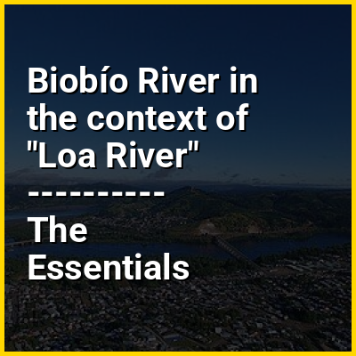
The major tributaries of the river are the Malleco and the Laja. The river is Chile's second-longest river (the longest being the Loa River) and the Biobío basin is Chile's third largest watershed, after the Loa and Baker basins. The river is also the widest river in Chile, with an average width of 1 kilometre (0.6 mi). In the Metropolitan area of Concepción, four bridges cross the river: Biobío Railroad Bridge (1889), Juan Pablo II Bridge (1973), Llacolén Bridge (2000) and Bicentennial Bridge (2010).

↓ Menu
HINT:

In this Dossier

Biobío River in the context of Pedro de Valdivia

Pedro Gutiérrez de Valdivia or Valdiva (Spanish pronunciation: [ˈpeðɾo ðe βalˈdiβja]; April 17, 1497 – December 25, 1553) was a Spanish conquistador and the first Governor of Colonial Chile. After having served with the Spanish army in Italy and Flanders, he was sent to South America in 1535, where he served as a soldier under the Pizarro brothers in Peru, gradually rising in power.

In 1540, Valdivia led an expedition of 150 Spaniards and 1,000 Peruvian Indians into Chile, where he defeated a large force of indigenous warriors and founded Santiago in 1541. He extended Spanish rule south to the Biobío River in 1546, fought again in Peru (1546–1548), and returned to Chile as Royal Governor in 1549. In 1550, he expanded Spanish rule further south into Araucanía, where he founded the city of Concepción and the eponymous city of Valdivia. He was captured and killed by Mapuche Indians during the Arauco War in 1553.

View the full Wikipedia page for Pedro de Valdivia
↑ Return to Menu

Biobío River in the context of Southern Chile

Southern Chile is an informal geographic term for any place south of the capital city, Santiago, or south of Biobío River, the mouth of which is Concepción, about 300 kilometres (200 mi) south of Santiago. Generally cities like Temuco are considered to be located in the south despite being relatively close to the geographical center of Chile. This is mainly because mainland Chile ended in La Frontera until the occupation of Araucanía (1861–1883). Similarly, the Southern Chile wine region is close to the geographic center of the country, encompassing wine-growing areas in the Bío Bío Region and Araucanía Region.

Southern Chile may also refer to the Zona Sur region between Biobío and Chacao Channel, which is often also called the Chilean Lake District. It may also refer to the Zona Austral, also called the Extreme South.

View the full Wikipedia page for Southern Chile
↑ Return to Menu

Biobío River in the context of Galletué Lake

Galletué Lake, also spelled as Gualletué Lake, is located in the Andes of the La Araucanía Region of southern Chile. It is surrounded by mountains on three sides. Issuing from the lake on its eastern side is one of the two sources of the Biobío River, the other being nearby Icalma Lake. The lake is in the ecoregion of the Valdivian Temperate Rain Forest. The monkey-puzzle tree (Araucaria araucana), locally called "pehuen", is the most distinctive of the tree species in the forest.

View the full Wikipedia page for Galletué Lake
↑ Return to Menu

Biobío River in the context of Malleco River

The Malleco River is a river in Malleco Province, La Araucanía Region, central Chile. It rises in the western slopes of the Andes, within the Tolhuaca National Park and near Tolhuaca Volcano. After passing by Tolhuaca, it drops into a 50 meter waterfall before continuing towards the Pacific. The river is a major tributary to the Vergara River, which is a tributary of the Biobío River. The Malleco Viaduct, built in 1890 and at the time the highest railroad bridge in the world, is the main landmark of the river and a candidate as a UNESCO World Heritage Site.

View the full Wikipedia page for Malleco River
↑ Return to Menu

Biobío River in the context of Juan Pablo II Bridge

The John Paul II Bridge (Spanish: Puente Juan Pablo II), also known as the New Bridge (Spanish: Puente Nuevo), is a bridge in Chile connecting Concepción and Talcahuano with San Pedro de la Paz, through the Biobío River. Since completion in 1974 it has remained the longest bridge in the country. It was significantly damaged in the 8.8 magnitude February 27, 2010 Chile earthquake.

View the full Wikipedia page for Juan Pablo II Bridge
↑ Return to Menu

Biobío River in the context of Lemucaguin

Lemucaguin a native of Andalicán was the successor to Turcupichun as toqui of the Moluche Butalmapu north of the Biobío River in 1558. He organized a detachment of arquebusiers from weapons captured in the Battle of Marihueñu. He continued the war against García Hurtado de Mendoza after the executions of Caupolican and Turcupichun. Establishing pucaras at Quiapo and other locations to block Spanish access to the Arauco region. He was the first toqui to use firearms and artillery in the Battle of Quiapo However he was killed in this battle and was replaced by Illangulién. The later historian, Juan Ignacio Molina, calls the toqui that led at Quiapo Caupolicán the younger, son the executed toqui Caupolican

View the full Wikipedia page for Lemucaguin
↑ Return to Menu