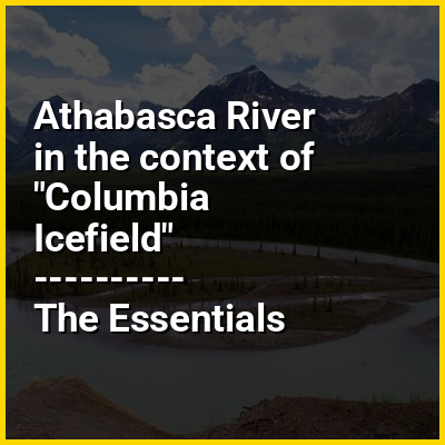
The Athabasca River (French: Rivière Athabasca) in Alberta, Canada, originates at the Columbia Icefield in Jasper National Park and flows more than 1,231 km (765 mi) before emptying into Lake Athabasca. Much of the land along its banks is protected in national and provincial parks, and the river is designated a Canadian heritage river for its historical and cultural importance. The scenic Athabasca Falls is located about 30 km (19 mi) upstream from Jasper.
HINT:
In this Dossier
- ⭐ Core Definition: Athabasca River
- Athabasca River in the context of Mount Edith Cavell
- Athabasca River in the context of Jasper, Alberta
- Athabasca River in the context of History of petroleum
- Athabasca River in the context of Wood Buffalo National Park
- Athabasca River in the context of Peace River
- Athabasca River in the context of Astoria River
Athabasca River in the context of Mount Edith Cavell
Mount Edith Cavell is a mountain in the Athabasca River and Astoria River valleys of Jasper National Park, and the most prominent peak entirely within Alberta.
The mountain was named in 1916 for Edith Cavell, a British nurse executed by the Germans during World War I for having helped Allied soldiers escape from occupied Belgium to the Netherlands, in violation of German military law. It was previously known as Mount Fitzhugh.
View the full Wikipedia page for Mount Edith CavellAthabasca River in the context of Jasper, Alberta
Jasper is a specialized municipality and townsite in western Alberta within the Canadian Rockies. The townsite is in the Athabasca River valley and is the commercial centre of Jasper National Park.
View the full Wikipedia page for Jasper, AlbertaAthabasca River in the context of History of petroleum
While the local use of oil goes back many centuries, the modern petroleum industry along with its outputs and modern applications are of a recent origin. Petroleum's status as a key component of politics, society, and technology has its roots in the coal and kerosene industry of the late nineteenth century. One of the earliest instances of this is the refining of paraffin from crude oil. Abraham Gesner developed a process to refine a liquid fuel (which he would later call kerosene) from coal, bitumen and oil shale; it burned more cleanly and was cheaper than whale oil. James Young in 1847 noticed a natural petroleum seepage when he distilled a light thin oil suitable for use as lamp oil, at the same time obtaining a thicker oil suitable for lubricating machinery. The world's first refineries and modern oil wells were established in the mid-nineteenth century. While petroleum industries developed in several countries during the nineteenth century, the two giants were the United States and the Russian Empire, specifically that part of it that today forms the territory of independent Azerbaijan. Together, these two countries produced 97% of the world's oil over the course of the nineteenth century.
The use of the internal combustion engine for automobiles and trucks in the turn of the twentieth century was a critical factor in the explosive growth of the industry in the United States, Europe, Middle East and later the rest of the world. When diesel fuel replaced steam engines in warships, control of oil supplies became a factor in military strategy—and played a key role in World War II. After the dominance of coal waned in the mid-1950s, oil received significant media coverage and its importance on modern economies increased greatly, being a major factor in several energy crises.
View the full Wikipedia page for History of petroleumAthabasca River in the context of Wood Buffalo National Park
Wood Buffalo National Park is the largest national park of Canada at 44,741 km (17,275 sq mi). It is in northeastern Alberta and the southern Northwest Territories. Larger in area than Switzerland, it is the second-largest national park in the world. The park was established in 1922 to protect the world's largest herd of free-roaming wood bison. They became hybridized after the introduction of plains bison. The population is currently estimated at 3,000. It is one of two known nesting sites of whooping cranes.
The park ranges in elevation from 183 m (600 ft) at the Little Buffalo River to 945 m (3,100 ft) in the Caribou Mountains. The park headquarters is in Fort Smith, with a smaller satellite office in Fort Chipewyan, Alberta. The park contains one of the world's largest fresh-water deltas, the Peace-Athabasca Delta, formed by the Peace, Athabasca and Birch rivers.
View the full Wikipedia page for Wood Buffalo National ParkAthabasca River in the context of Peace River
The Peace River (French: rivière de la Paix) is a 1,923-kilometre-long (1,195 mi) river in Canada that originates in the Rocky Mountains of northern British Columbia and flows to the northeast through northern Alberta. The Peace River joins the Athabasca River in the Peace-Athabasca Delta to form the Slave River, a tributary of the Mackenzie River. The Finlay River, the main headwater of the Peace River, is regarded as the ultimate source of the Mackenzie River. The combined Finlay–Peace–Slave–Mackenzie river system is the 13th longest river system in the world.
View the full Wikipedia page for Peace RiverAthabasca River in the context of Astoria River
The Astoria River is a short river in Jasper National Park, Alberta, Canada. It is an early tributary of the Athabasca River.
The Astoria forms in the Tonquin Valley, collecting meltwater from the Fraser Glacier, The Ramparts, Mount Erebus, Mount Clitheroe, and Oldhorn Mountain.
View the full Wikipedia page for Astoria River